
June 8, 2016: Llanfachraeth to Holyhead
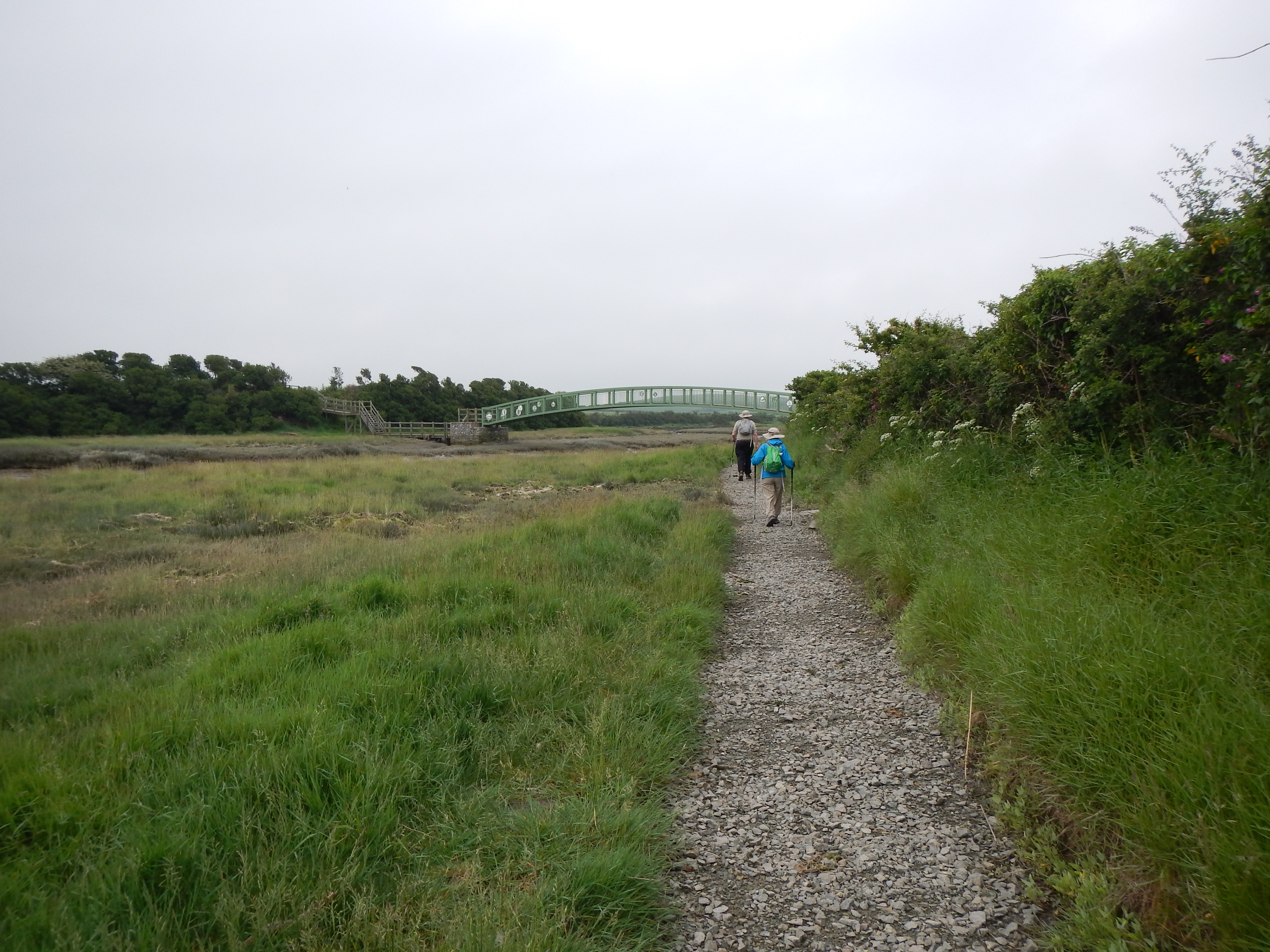
After deciding on a shorter day we chose the final section into Holyhead itself. After leaving Llanfachraeth we used this bridge to cross the Afon Alaw.
As we ate our breakfast in the dining room of the Woburn Hill Hotel on a bright Wednesday morning it was time to reflect on the strategy we would now adopt in the face of the necessary conclusion – there was no way we could complete all five stages of this year’s walk as planned. Walking directly out the front door and heading for Church Bay did not seem practical since this stage is listed as 10.5 miles in the guidebook but, given our recent experiences with the deficiency of such measurements, no doubt many more. The coastal territory needed to complete such a maneuver would have been challenging at the best of times but its extreme remoteness meant that a phone signal was unlikely and this would be problematic if we needed an early halt.
I was also reconsidering my decision to use tomorrow, the last day of our trip, to complete the final stretch from Llanfachraeth to Holyhead, listed at seven miles or so, in time to make our 1:58 train back to London. This now seemed a naively overoptimistic target – especially since I could not get the promise of a taxi ride back to Llanfachraeth from our Holyhead b&b at the start of this stage before 9:00. (You compete with the school run at such an hour.) So, as Naomi munched her poached egg and I my scrambled – with egg-phobic Adrian making do with bacon and beans – we had decided to walk this last stage today – when there would be plenty of time – and leave the whole section from Camaes to Llanfachraeth for another time.
So, after settling the bill for our drinks, meals and packed lunches, we awaited our trusty BWJ taxi, which picked us and our bags up at 9:30. The bags would be ferried forward to Holyhead and, on the way, we would be dropped off in the parking lot of the Holland Hotel in Llanfachraeth.
While I waited on a corner opposite the luridly yellow post office stores Naomi and Adrian went inside this establishment for some additional supplies and by 9:50 we were off – following a track back in the direction of the coast. The section we were about to enter is accompanied by a complex set of guidebook instructions but, since we had not walked into Llanfachreath, there was some concern over picking up this path now. I had been studying my Explorer map for the western part of Anglesey and I was confident that two nearby bridges should do the trick and so they did – the second a large green metal bridge taking us over the Afron Alaw. We were back on course.
Walking conditions were unusual – for a heavy mist made it impossible to see anything clearly beyond two hundred yards and this was quite eerie. Still the footpath here was well-marked and easy to follow over rough grass paths and even some duckboard as we continued toward the coast itself, with the Alaw estuary, at low tide, on our right. I was still wearing only a t-shirt and this was perhaps not enough cover – for it was chilly in all the murk.
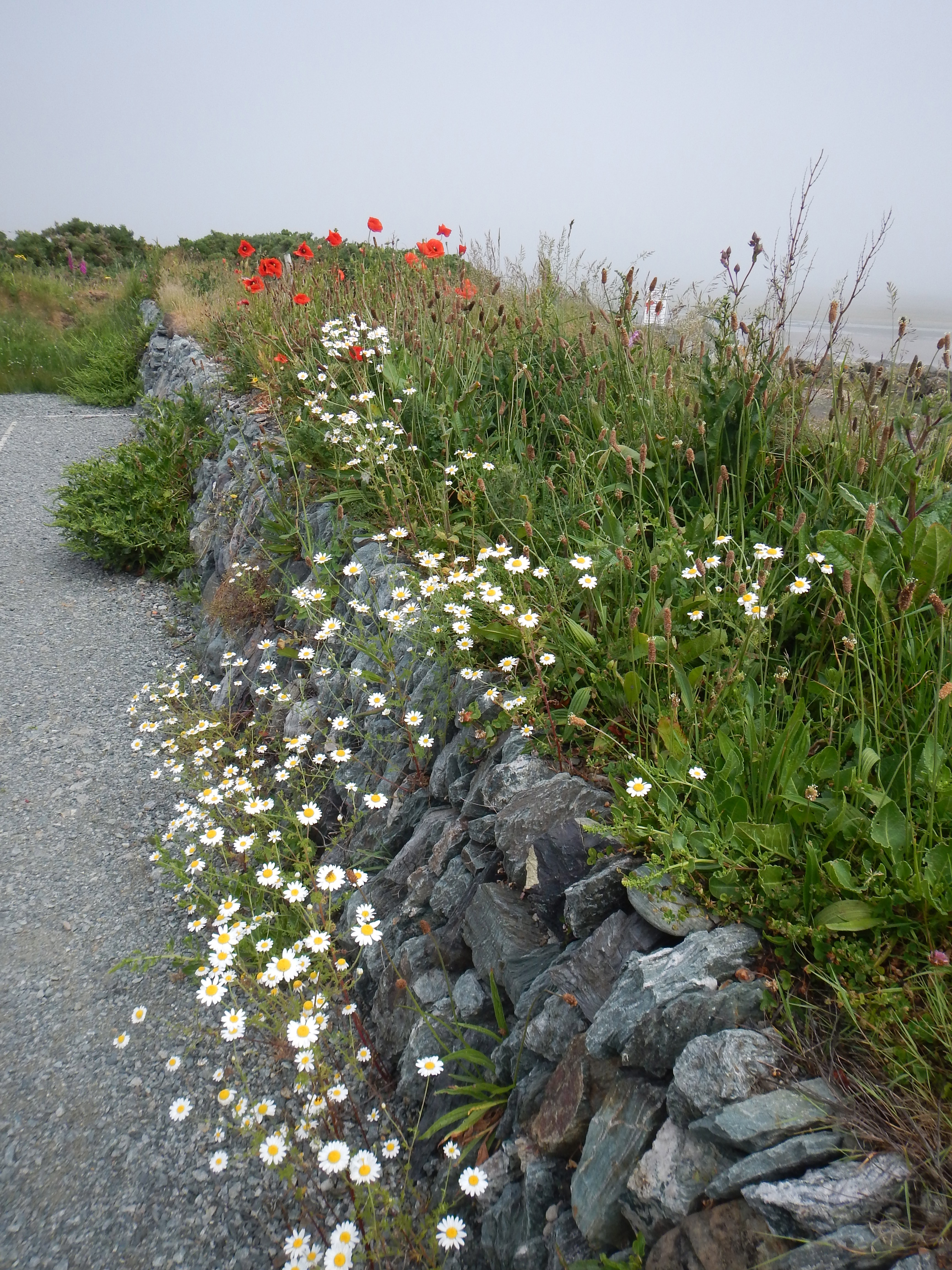
Wildflowers near Penrhyn Beach Farm.
We walked along hedgerows and fences and across fields for quite a while – with no sight of the coast as yet in evidence. Still it was pleasant enough out here and I was often called upon to identify local flowers. These included foxglove (including a white specimen perched among it magenta cousins) and, as we at last reached Penrhyn Bach Farm, some wonderful red poppies. Shortly after passing the farm we at last reached Gorad Beach and began a short stretch along the shore.
Curiously this strand, though so identified in the guidebook, is not named on the OS map and there was another anomaly just ahead. There is a high tide alternative around the village on our left and, though tides were not a problem at this hour, I held out the hope that there might be some form of refreshment here. So we climbed some steps and pressed forward into suburbia, turning left on a road to reach the main highway where we turned right. I was disappointed in my quest for there seemed to be nothing more than bus halts and a telephone kiosk here. (But where is here? The village, even on the large-scale OS map and in the guidebook as well, was nameless.)
Roofers and other workmen blocked the pavement hereabouts and we often had to dodge into the oncoming traffic as we made our way south. I had to call Adrian back when he overshot the entrance to the Newlands Park Estate – which is mentioned in our text – and we turned right to wind through suburbia in search of the original route. A waymarked Anglesey Coastal Path sign beckoned us into fields – which we were invited to cross in the direction of buildings on the main road.
In fact, as the mist thinned, we would see a gap in the distance and so we began our crossing. We had company. A large herd of curious cows began to follow us closely and sometimes they ran ahead of us as though they would show us the way. It was a bit disconcerting to have these huge animals in such proximity and they were no good at pathfinding anyway – for as we neared the highway our exit was blocked by a low stone wall and a padlocked iron gate. We hunted around for a more useful exit and eventually Adrian lead us uphill behind some houses where he discovered a waymark post promising relief. (How difficult would it have been to invite walkers to stay close to the right-hand hedge in their crossing of this field?)
After a few more twists and turns we at last reached the A5 at an auto repair shop and here we sat down for a brief rest and some water. The way forward was somewhat problematic since some signs pointed to the left (perhaps promising a quick return to Four-Mile Bridge) but we were certain that we needed to turn right along a famous Telford project, the lengthy Stanley Embankment. (There was a sign advertising Pete’s Burgers in 800 meters.) I lead the way along this mighty bridge, whose pavement was littered with junk. We passed half a dozen middle-aged men whose chief activity seemed to be keeping an eye on their fishing rods, which were anchored over the lip of the embankment. At one point we had the unusual sight of the sea pouring into a chasm on our right.
When we had completed our crossing I suggested we look for the re-sited tollhouse, which as “Coffee Cups” now served as a teahouse at the entrance to Penrhos Coastal Park. This was soon discovered on our left and we sat down in a shady spot out front while Naomi and I had a cuppa and Adrian drank a can of ginger beer. Then, much refreshed, we passed through the parking lot (Pete’s Burgers turned out to be a man in a van) and began our search for a likely looking shaded bench – where we might eat our packed lunches. Most of the mist had burned off by now and it was quite warm in the direct sunlight.
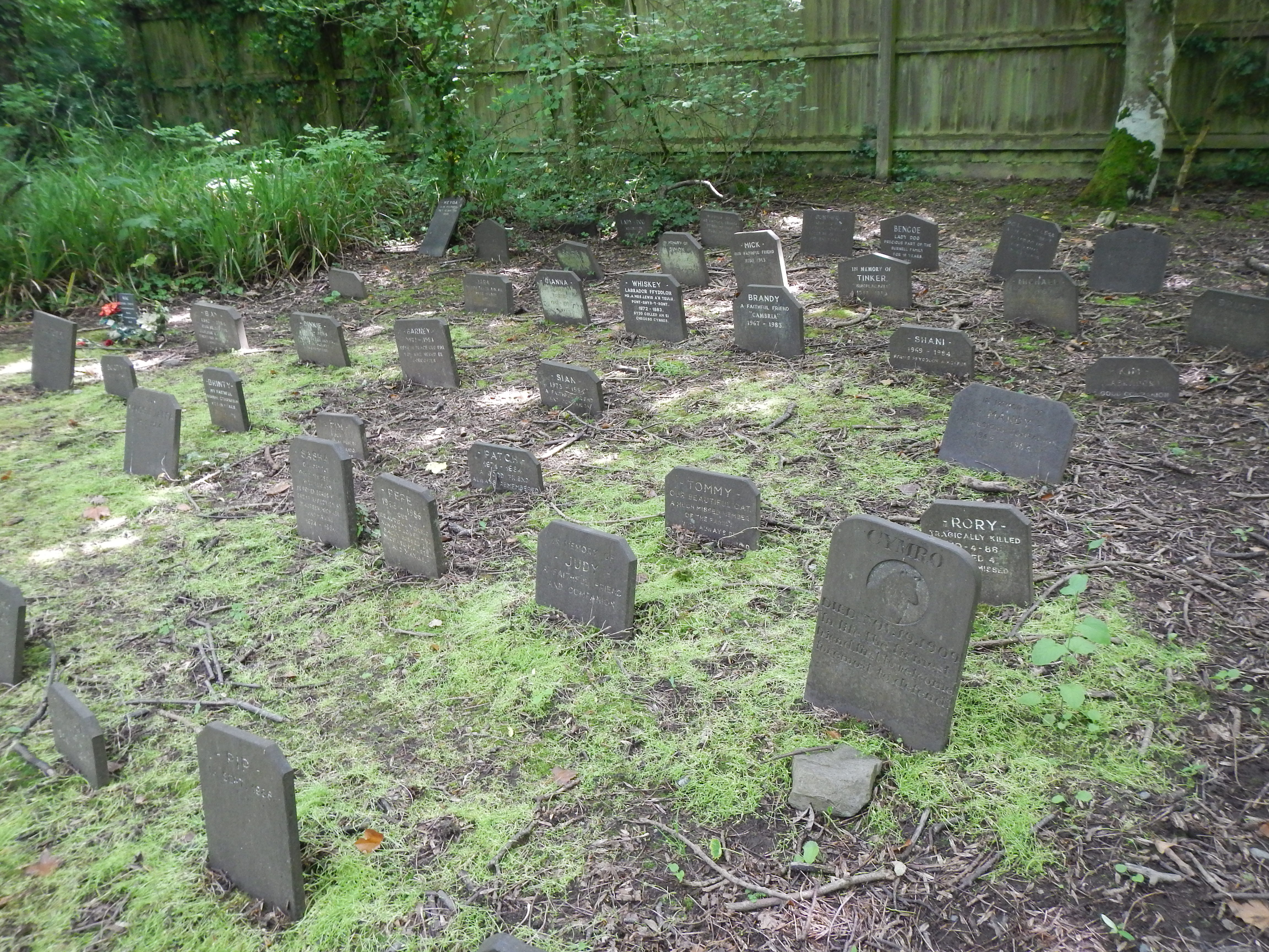
Pet Cemetery in Penrhos Coastal Park.
The route circuited Beddmararch House on a delightful woodland path and, after passing a large but melancholy pets’ graveyard, returned us to the coast – where our sought-after bench faced the sea. Naomi and I had ordered the egg-salad sandwich today (how about a little salt and pepper?) and we had a nice relaxing repast as wet dogs came by for a visit and an enterprising seagull bobbed up and down on the waves, waiting for a handout.
We resumed our woodland walk – with rhododendrons resplendent on our left – and took the long cut up a headland on our right. This was a wonderful spot with a huge meadow peppered with little white daisies and yellow buttercups. Returning to the main path we passed behind a sandy cove and began a long section with fields on our left and hedgerows on our right. (A huge industrial chimney dominated the scene here as well.) Ahead of us was the car park of Penrhos Beach and the nearby aluminium works and when we reached the former we sat down for another rest on a low stone wall. Dogs were active in chasing down their balls and Frisbees here.
From a study of the map I could see another inviting shortcut from this spot but Adrian was insistent on following the final stages of the coast path itself so, utilizing a tarmacked road to get us started, we began another circuit of another headland – with housing on our left at the back of huge grassy playing fields. Pumping station and factory walls followed as the route made it as far as Turkeyshore Road. (I have to say that in all this industrial squalor the Anglesey Coastal Path ends with a decided whimper.) We had only a short distance of road walking needed to bring us out at a roundabout where both train station and ferry terminal beckoned across the street.
Here also we discovered the Edinburgh Castle pub and so we decided to seek some liquid refreshment. I had a gin and tonic, with the bar lady darting back to make sure she had added a slice of lemon to this concoction. Then we made our way through the stations and crossed the modern Celtic Gateway footbridge into Holyhead itself. Since we had started our walk here two years earlier the place was familiar and we were soon trudging steeply uphill in search of our b&b, one used on our first visit as well. One of Mrs. Lipman’s daughters admitted us to Yr Hendre shortly after 4:00 and we had a nice rest for the next two hours. (We had walked, so our apps told us, 10.5 miles today.)
At 6:30 we dropped down to the coast in order to revisit the Boathouse Hotel, where we had enjoyed dinner two years ago. I had a seafood platter and two scoops of ice cream and we tried in vain to get a signal on my mobile phone. I needed to let the taxi company know when to pick us up on the morrow but the signal kept failing. On the way back to our table I did notice a coin-operated telephone and this technologically outdated form of communication succeeded where its more modern cousin could not.
We did have several hours to kill on the following morning – which was punctuated by the sound of fog horns – and after breakfast we walked over to the Maritime Museum for an interesting hour – though I could have done without the predatory docents descending on you every time you paused before an exhibit. We had something to drink in the adjacent café and continued on into town, revisiting St. Cybi’s Church, which is the official starting point for the walk. Here I noted a plaque which celebrated the opening of the route by a Secretary of State for Wales on June 9, 2006 – we had arrived on the tenth anniversary of this event!
Now there was one final ascent of the hill in the hot sun as we arrived at our b&b just before 12:30, when our taxi came to take us and our bags down to the train station. We used a table in the W.H. Smith café as we ate our sandwiches and crisps and watched Eurotrash coming off the ferry. We were allowed to hunt for our reserved seats on the 1:58 some half an hour before departure time and so we were well-ensconced in an empty carriage as the other passengers streamed in. These included a father with his teenage son and four or five boys who never grew up as they opened can after can of beer, guffawing mindlessly for the whole three and a half hour journey. Later, putting it all together, it became obvious that all these people were on their way to Bordeaux for the Wales-Slovakia match in the European championship.
We found our way into the basement of Euston Station and were soon on the way home – delayed by all the traffic from the England-Sri Lanka test match at Lord’s. How good it was to get home (and enjoy the return of little Otto two hours later). We had all enjoyed this Welsh outing very much.
The 2016 journey was now concluded but there were still two stages that needed to be completed the following year.
To see how we accomplished the first of these you need: