
May 27, 2015: Llyn-Rhos-ddu to Lanfairpwll

The famous steppingstones over the Afon Braint.
A sunny morning greeted us as we descended to our tasty breakfast on the second day of our walk. As usual I tried to stick to scrambled eggs on toast at such moments – with only the occasional sausage or bacon rasher thrown in. Yogurt was also a favorite but I did not join the others in the muesli – Adrian is, of course, egg-phobic so he needed to find other things to satisfy his palate. He continued to seek out local produce whenever possible on this trip, though I did learn that our economist had a number of other culinary aversions – oranges, liver and carrots among them.
At 9:30 a taxi arranged by Celtic Trails arrived to pick us up. It would take our bags on to our next b&b in Beaumaris and drop us off in the parking lot of Lynn Rhos-ddu, where I had finished my fourth day of walking last July. In fact Naomi and Adrian had already walked the next stage and it will show what good sports they were when I reveal that they were now willing to re-walk it with me. (I needed to rest up for a final day on the trail in 2014 and that is why they had walked without me.) To add to their credit I do remember that they had complained last year that the stage was long and full of problems, though they had walked it on a really warm day. No one would call it that today – I think I saw the sun only once and we walked under lowering gray skies, often with a chilly wind blowing up from the Menai Strait on our right.
Our cab now moved off. We re-arranged our daypacks on a bench near the unusual marram grass sculpture and at 9:50 we were ready to move off. An access road brought us to a road junction and we walked forward along the pavement of a busy road. But after 300 meters or so we were directed to a farm road on our right and followed this for half a mile or so; I was now eager to see the state of the first problem that Naomi and Adrian had reported from their previous experience with this terrain. I am referring, of course, to the impediment provided by the Afon Braint, a river that must be crossed at this point if a long detour is to be avoided. There are, indeed, stepping stones across the river – but Naomi, still remembering last year’s episode, was beginning to fret over the wide steps she would have to take to make progress across these solid mounds. In the event she was assisted by Adrian, who went first and I was right behind and the tide was low anyway at this moment and the menace was soon conquered.
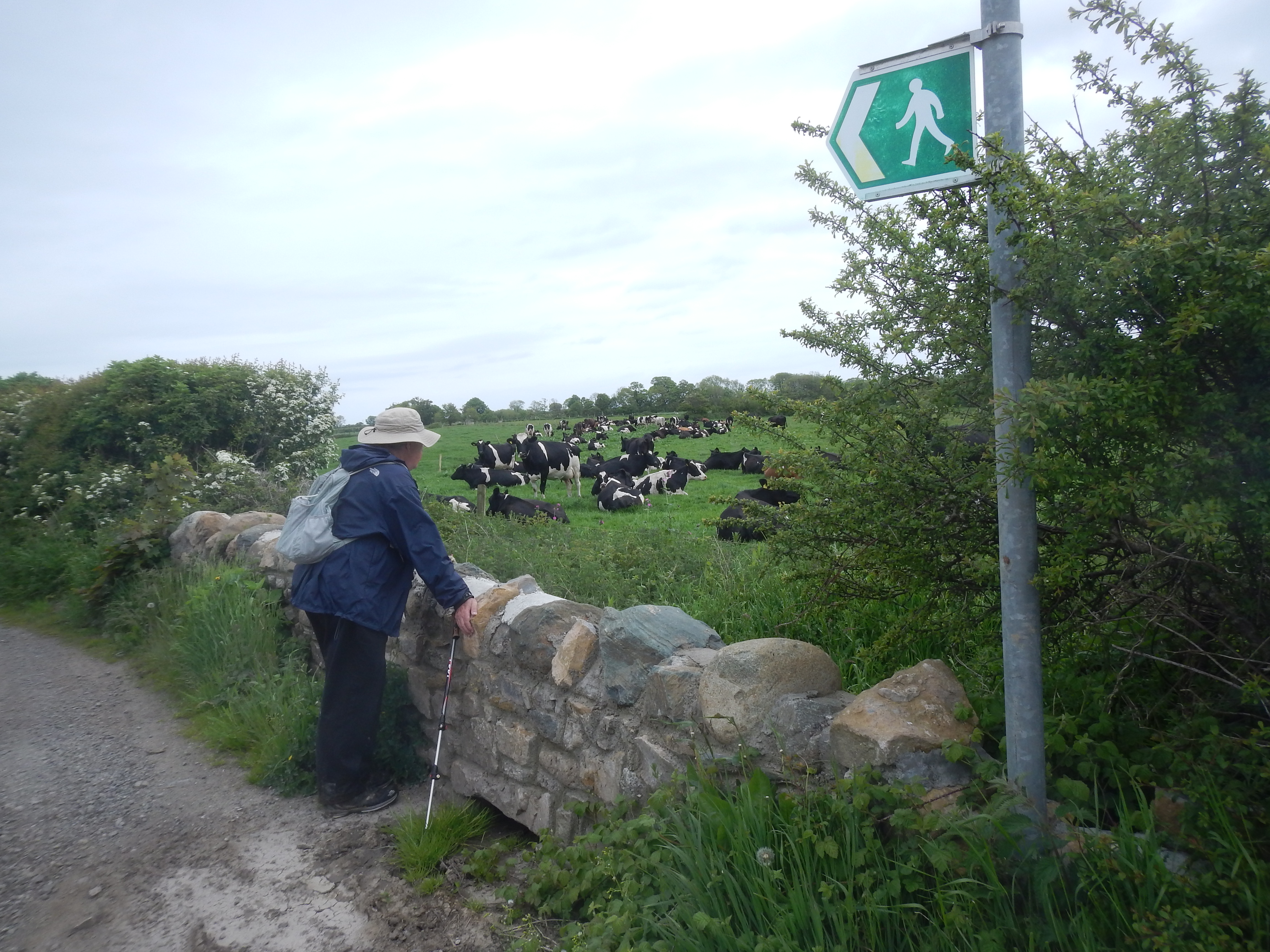
In pastoral country north of the Afon Braint Adrian pauses to check out the local bovines.
On the other side we turned our back on the Strait for some time, following grassy paths along the riverbank as we gradually shifted to a northerly direction, marching through field after field with the aid of gates and stiles. There was the occasional farm here as well and private houses too (all very useful in measuring our progress) and we used the access drives of such structures, as at Cae Llechu, to advance our project. Occasionally Naomi complained that the fields lacked drama but I enjoyed them very much. A new array of wildflowers, not seen in July, were constantly at our feet and, in particular, spectacular displays of bluebells gave constant delight.
A lane led us to the house of Tan Twr and several others were used to approach two fields, spaces that allowed us access at last to the shore. Shore walking would be a problem on a number of occasions on this trip, either because the sand was too loose, the rocks too large or the seaweed too slimy, but here, after a dance on pebbles, we soon had use of a road at Tal y Foel Pier. This is a part of the route that once contained the Mermaid Tavern but Naomi and Adrian had discovered its demise last year and knew that if we wanted sustenance we would have to turn off the route to penetrate the precincts of the Anglesey Sea Zoo.
It was well past the noon hour by now and so we pushed our way through the crowds of visitors, including lots of kids on their half-term holiday, and pushed on past the miniature motor boats and the mini-golf course and entered the equally crowded bistro at the back. Here we ordered sandwiches and had a nice rest among the perpetual hubbub. Then, shortly after 1:00, we went next door to visit the showroom of the sea salt factory and after a brief visit we were ready to begin our afternoon’s stroll.
We continued to walk in a mostly northerly direction, using lanes and even returning for a very brief spell on the shingle as well. Adrian pointed out through the increasingly murky atmosphere that we were almost opposite Caernarvon Castle, on the opposite side of the strait here – and I tried to take a picture or two with my zoom lens. More field walking followed but about an hour after leaving the Sea Zoo we arrived at the ruins of Llanidan Church and here there was no mistake – it was beginning to rain!
Naomi helped me don all of my rain gear – it helps to have someone to lean up against when I put my rain trousers on – but she and Adrian had been wearing theirs from the outset because it had been so chilly. In order to avoid more encounters with the foot-wrenching shingle Adrian now chose to follow a high-tide inland alternative as we climbed a hill and used lanes to head in a northwesterly direction. I did have guidebook instructions and the Explorer map hanging from my neck but I yielded all the decision making to my brother-in-law today; rain made it even harder to concentrate on such route-finding puzzles.
At Meini Gwnyion we reached a farm that offered a continuation along a grassy track; more farm country followed as our route made several twist and turns, eventually joined by the coastal alternative as well. At a crossroads we turned left to climb up to the main road and its whizzing traffic. A year ago a tired Naomi and Adrian had decided to brave the cars by walking against the traffic all the way to Llanfairpwll from this spot. Today Adrian was determined to follow the guidebook instructions and cross the road in order to take a quiet lane to Pont y Craig, which would also give him access, on the right, to the Bryn Cellu Ddu Burial Chamber. Naomi and I were too weary to undertake any additional sightseeing at this point and so he sent us ahead – sure that he would catch up with us long before we returned to the main road.
We didn’t get very far for we ran out of path and though a footpath sign offered encouragement to those heading in the opposite direction it was not clear how to continue. Of course I did have instructions in my map case but we decided to wait for our companion to catch up with us – standing in the still steady rain as we did so. When Adrian arrived he led us on a half-right ascent of a grassy field – there had been no hint of this turn-off on the ground. Footing was very difficult and at one point I fell forward on my face – though I was not hurt in any way. At last we reached a kind of summit and sloped off, without much evidence of any path until a track finally led us back to the main road.
This burial chamber alternative had been one of those path building exercises designed to take walkers off the highway and, like so many of these well-meaning gestures, hardly worth the effort. We had now returned to a portion of the roadway where walkers had been provided with their own path (or duckboard) separated from the traffic by a hedgerow. (I needed this separation if I was successful in getting in a clandestine pee.) It wasn’t the most edifying of stretches and it was not easy to measure our progress, which had us shifting to the other side of the road at some point. We were heading for a rendezvous at the Llanfairpwll train station so we chugged up hill and wearily turned left for a final assault on the halt. It was 5:40 and I believed Naomi when she said we had walked 13.5 miles.
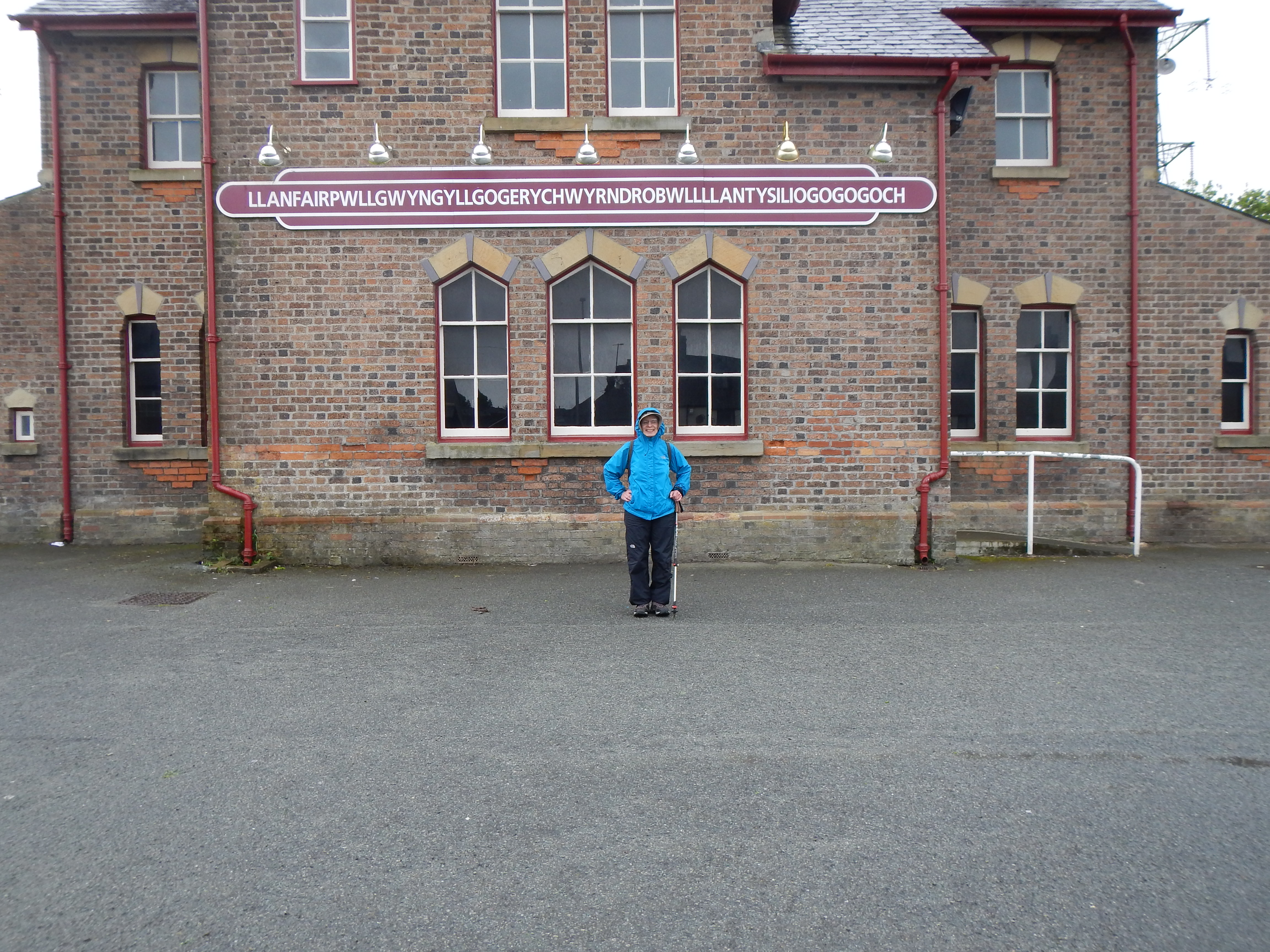
Walking over for the day, Naomi poses beneath the sign for the local train station, one for a village with the longest place-name in British geography.
She and I had our pictures taken beneath the sign on the station building, the one featuring the full version of the longest place-name on the U.K. map – Llanfairpwllgwyngyllgogerychwyrndrobwyllllantysiliogogogoch – which, as we know, translates as “St. Mary’s church in the hollow of white hazel near a rapid whirlpool and the church of St. Tysilio near the red cave.” Unfortunately the building was locked and not a single bench had been provided for train users outside so we wandered over to a shop facing the parking lot that had some tables out front. It would have been nice to go inside but they were just closing and, at any rate, the rain was coming to an end.
I used my mobile phone to summon a pre-arranged taxi from Beaumaris and after twenty minutes we were aboard, re-tracing much of the walking route completed on the last day of our adventure in 2014. (There were now no coastal path gaps left to this point in any of our walking records.) We had a new Beaumaris b&b on Victoria Street, very centrally located, and after yielding our wet boots we were shown to comfortable rooms on the first floor. Our hosts, Carol and Jeff, went through the dinner options in town and on this night we chose a new Italian restaurant, Tredici, on the high street. I think we were all very tired. I had a double gin and tonic and we shared some antipasti and selected our pasta dishes. I was well satisfied with my efforts on this day but also very tired and by 9:30 I was sawing wood.
For the route from Llanfairpwll to Beaumaris, which we had walked the previous year, you need:
Day 5: Llanfairpwll to Beaumaris
To continue with our 2015 journey you need: