
June 12, 2009: Machynlleth to Cemmaes Road
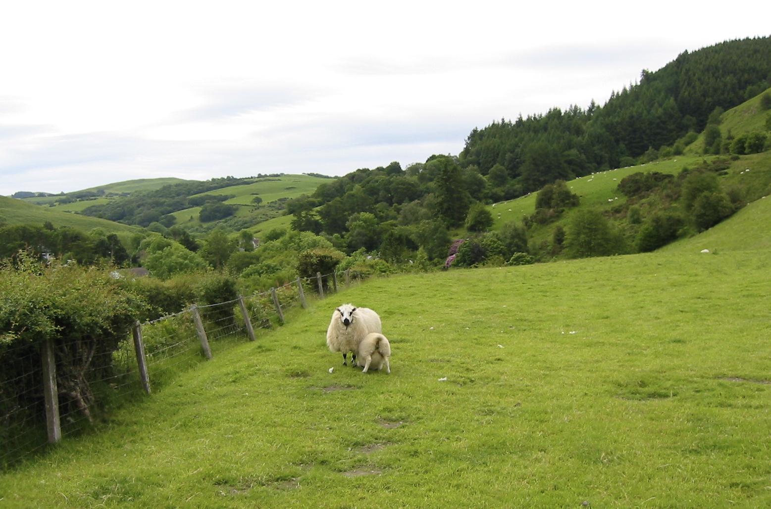
Nursing sheep on the road to Forge
Our day began at about 7:00 when we rose to complete our packing and fetch our sandwiches from the Spar shop. Breakfast was at 8:00 – for I wanted another early start on a day with a nine-mile itinerary – followed by our return trip to London – and we were thus ready to depart by 8:45. The Morgans seemed genuinely sad to see us go. Angela surprised me a bit when she wished me a nice journey back to England.
Dave once again served as chauffeur, recapitulating the route he has driven yesterday afternoon from Machynlleth. Today skies were overcast and there was a grey cast to the countryside but, in the event, rain would not be a factor in our progress. When we pulled up opposite the Parliament building I crossed the street so that Margie could use my camera to take a picture of me standing in front of the ancient site; it was the only time I would appear in any of the shots taken on this trip. The ladies used the parking lot loos, Dave drove off, and we were now ready to begin the last walk of the expedition at 9:28 – departing along Maengwyn Street. We were heading east – now the dominant direction of the route after nine days of northwest.
There was a good deal of road walking in the first mile – another point of objection for Tosh – but there wasn’t too much traffic and we could make steady progress as we turned south-east on the road to Forge, crossing a golf course. Each of us was active with our cameras during this stretch and Margie went off-route somewhat in order to be able to get a shot of a sheep munching on a golf green. There were a number of attractive houses with resplendent gardens in Forge. After passing through the town we turned left on a lane, following a progression that declined from road, to lane, to track and finally to path.
There was no traffic on any of these surfaces as we headed north, climbing gently. As we switched to east again we neared a farmstead at Pen-rhos-bach and here there were some curious cows and one adorable all-grey calf. Gates and stiles bore the characteristic GW symbols and telegraph poles served as waymarks as we thrashed our way through a number of overgrown fields. Eventually we were able to reach a farm road where we turned left. Only a short distance to the north was a delightful spot on the outskirts of Penegoes village where a restored 17th Century mill, now a b&b, provided the setting for more burgeoning gardens – including a patch of red hot pokers.
We turned right when we reached the A489 and walked the length of the traffic-beset village, turning off on a lane where a Mini bore the legend “True Brit Not German Shit.” The lane became a track as it passed the entrances to several farms and our first substantial climb of the day was underway. Cheering us along was the appearance of the sun at this point and we were also much engaged by the sight of a farmer on a three-wheeled motorbike herding his sheep with the help of three sheepdogs. Tosh had a chance to talk to the fellow, who had once been on an exchange in America sponsored by the Future Farmers (he had even been in her native Iowa). He pulled up at one of our gates after his chores were over (all three dogs jumping onto the platform behind him) and paused so we could take a picture.
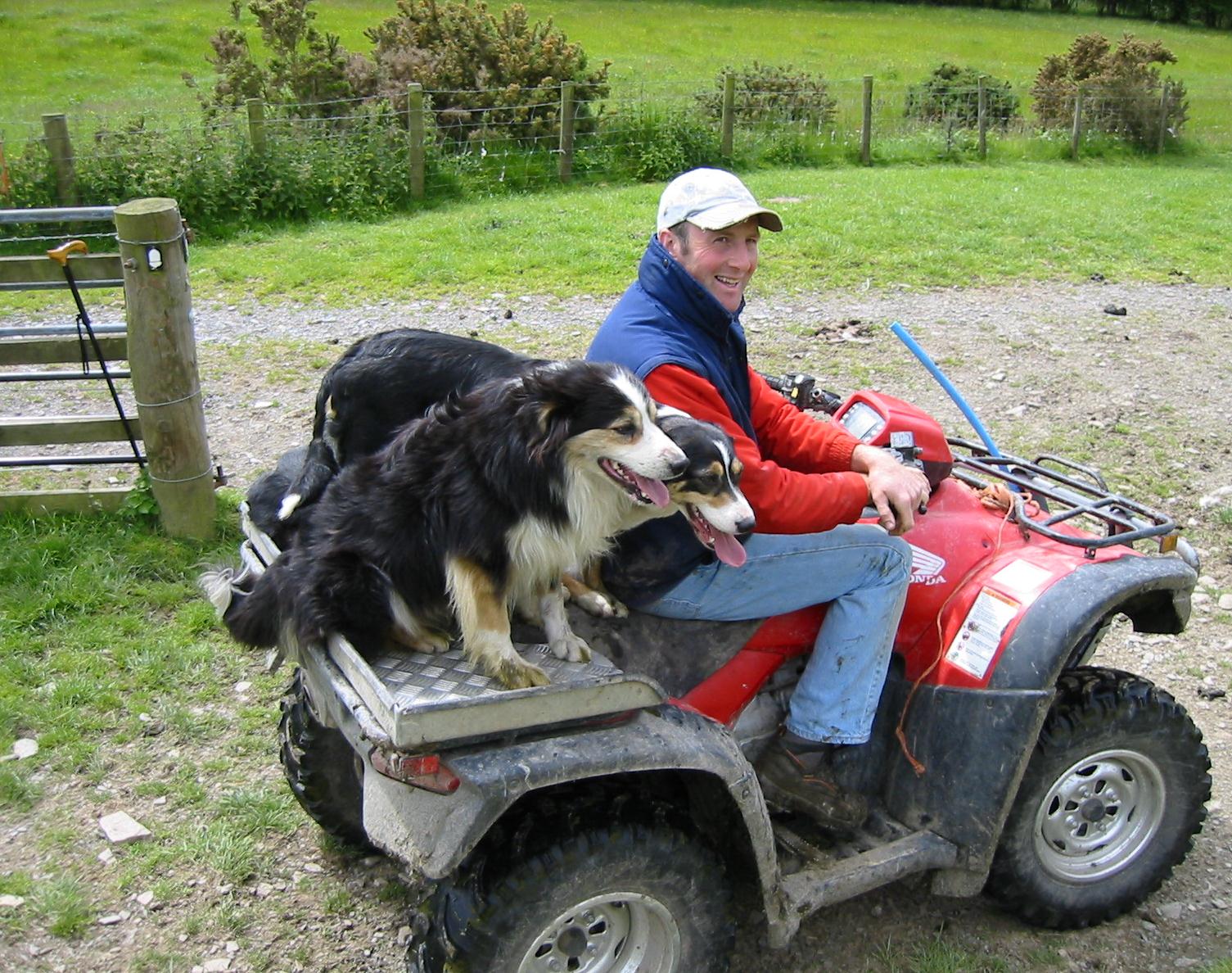
Farmer and sheepdogs on the road to Penegoes
The way forward was now very steeply uphill in a northerly direction as we inched along a fence in the grass. The ascent also featured use of a ladder stile to get over two fences; Tosh said she had never seen one before but, of course, there had been many of these in our expeditions in the past. Often accompanied with a fence on our right, we continued forward through bracken and gorse, rounding the summit of Bryn Wg well above us, and keeping a close eye open for waymarks and finger posts. Once again the views north to the Dyfi Valley were magnificent. After passing the four-mile mark we began to descend, however, and, amid lush greenery, we made our way down along lanes to another of those former mill sites, this one at Yr Hen Felin (also a b&b) before crossing the millstream and climbing up to the village of Abercegir.
This was a place of considerable charm, though there wasn’t much to it and we had soon turned left, then right to climb above it on a lane. Here I discovered a convenient bench and so I was able to suggest (even before much nagging) that this might make a good lunch spot. Tosh disdained the bench, choosing to sit on the grass, but Margie and I used it. A chap came out from a cottage to ask us to keep the noise down. I had noticed that the boot of his car was open and it now transpired that someone (presumably the baby) was asleep in the car. I ate my chicken mayo baguette and drank some of my Zero Dr. Pepper but, once again, we did not linger for long. On all but one of the days of this trip our pace was dominated by the need to make contact with our driver(s) at a specific time; today’s 4:00 rendezvous was particularly critical because we would then be whisked off to a 4:37 train at Caersws.
We soon left our lane for a track that begin a long circuit of Rhos y Silio – but almost immediately I had to call the ladies back because they had penetrated the next farmyard and I had spotted a stile that put us onto a broken route around this spot. Thereafter it was not always easy to continue forward through gate and hedges, but soon we were swinging steeply uphill to the right and searching for a gate in a stone wall. This we found, and we began heading steeply uphill again in open territory where evidence of a path was often hard to come by. A few more gates were available as waymarks and we were able to use a rising track as well but as we neared the summit it became harder and harder to match the description on the ground with that in the text. Margie was often out front here and then Tosh – and I was not always confident that they were making the right choices.
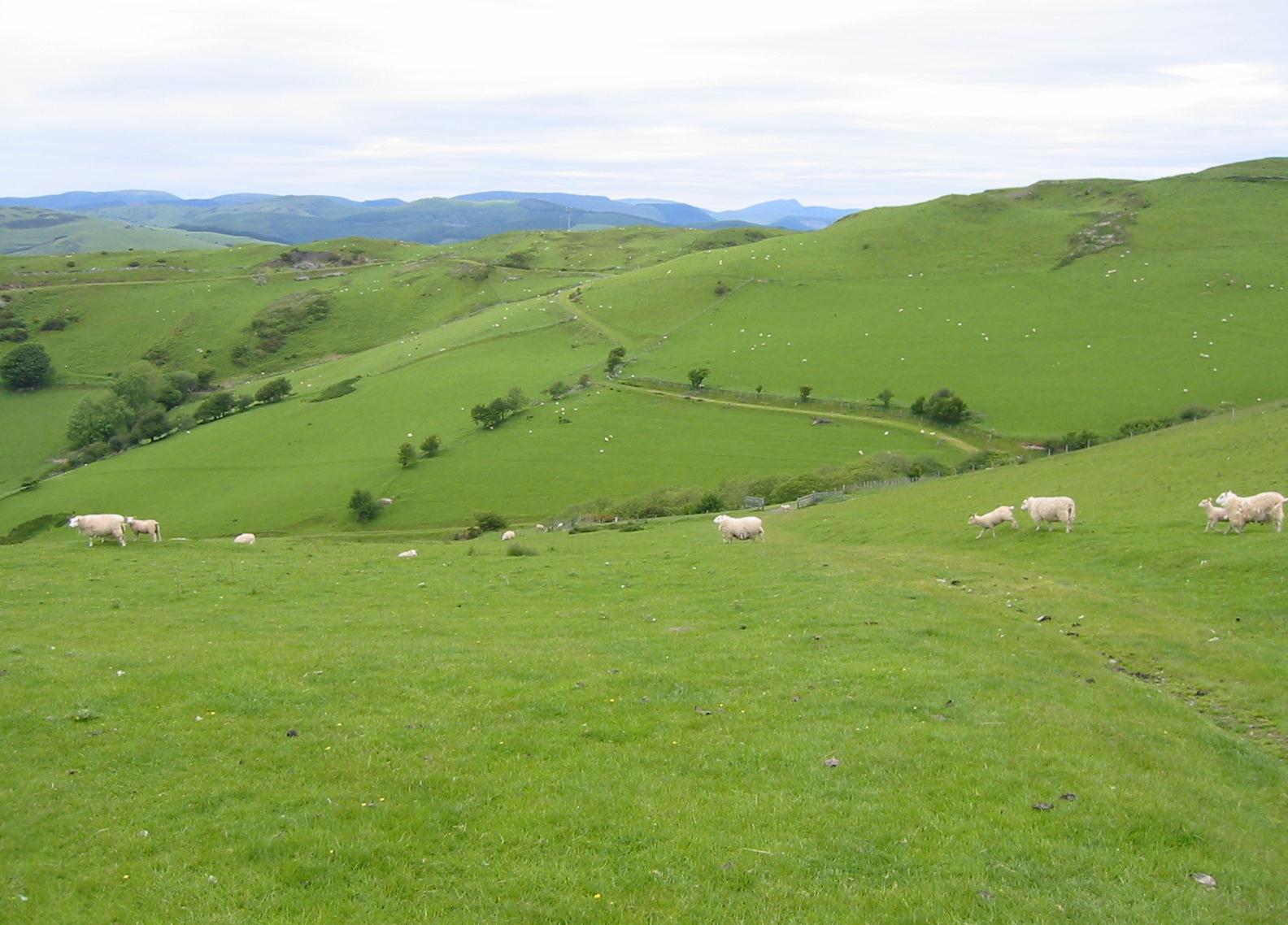
Green track along Ffridd Esgair-yr-onen
We passed through an old hedge line and this put us onto a winding track on the north side of the ridge, with more magnificent views of the valley on our left. I agree with David Perrott that the surface we seemed to be following was a delightful, carpeted green road – but waymarks were all but absent up here and anticipated landmarks were missing altogether. When the track petered out we were faced with a mystery. Tosh was sitting on a log that had a red arrow painted on it (but this had not been used as a symbol for GW walkers before this moment). I followed a thin trod in the grass up to the end of the ridge above us, but we could find no useful way forward. We were lost.
I got out my compass, noting that we were heading almost due north, and with the help of the OS sheet itself, I soon became pretty confident that the territory below us represented the confluence of water, railway track and roadway symbolizing our destination, the village of Cemmaes Road. But how to get there – if one could no longer rely on the surfaces provided by the missing GW – was problematic. The nice thing was that Tosh and Margie, far from panicking at this moment, considered it all an adventure and so, in good spirit, we decided to head downhill in a northerly direction in an act of impulsive improvisation. Almost immediately the grassy path I had been using disappeared and we were on our own on the bare, sheep-filled hillside.
We continued to drop, searching out gaps in the fences in order to make progress. Ahead of us, in the valley bottom, I could see a major highway and this became our goal. All went well until we neared a line of scrub that was etched in long strands of barbed wire. By this time I could see a farm track below us as well and I hoped that this would lead us back to civilization – if only we could make it that far. Fortunately a tree had fallen across the barbed wire at one point and we were each able to scramble onto an exposed limb in order to make our crossing. Is this what they mean by the right to roam?
On the other side of the fence we had to whack our way through the bracken and other undergrowth of a steep hillside as we dropped down at last to the farm road. Once again I was happy to have the support of my stick but the ladies seemed to do very well without such assistance. I paused for a pee and then pulled out the global positioning unit that Tosh had given me last year. It took forever to get a signal and when it did I didn’t find the numbers on offer to be of much use in figuring out where we were. It even began to rain a little but this soon came to an end as we pondered our next move.
The farm road was heading west (which I suspected was the wrong direction) but it was also going downhill and so we continued to use it; after a while it reversed directions and began its descent to the highway I had spotted from on high. What direction to take when we at last reached this place was still a problem and so I suggested to Tosh that we needed to see if a speeding car would stop so that we could ask its driver to tell us just exactly where we were.
It is a bit of an irony, that, so close to our destination, I should have gotten lost today, for today, of all days, was my 400th day on a British footpath – and I had also gotten lost a mile after starting out on day one of this series, on the Pennine Way in 1974! Now I expected Tosh to put up a thumb but instead that intrepid lady simply waved her arms hysterically at the first approaching vehicle and a little old Welsh lady in a small blue sedan pulled over immediately. She got out of her car and I asked her if she knew the way we should go to reach Cemmaes Road. She seemed amused by my query– for the town in question was less than a mile ahead if we continued in an easterly direction!
She was heading there herself and I toyed with the idea of having her give one of us a lift – so that there would be no problems if Dave arrived here early, but her car was filled with baby seats and shopping so this wasn’t a possibility. Well, if she was right, we could easily make our rendezvous – it was only 3:00 or so – and so we began a spirited stretch of road walking on the busy A489. Before long it was obvious that she was right, we were walking in Cemmaes Road itself and there she was again standing in front of the post office and drinking from a juice carton with a straw.
Next door was the Dovey Valley Hotel and we used a side door to penetrate the quiet presence of its bar, soon rousing the attention of an ancient gentleman who agreed that he was open. Tosh was ushered off to the indoor loos while I drank half a lager, then another. Tosh returned to quiz the old gentleman about his history in this down-at-heels place – he had been born here and now objected to anyone taking pictures in the bar. Tosh used her mobile phone to call David, who was fifteen minutes away, letting him know exactly where we had ended up. If it had not been for our unscheduled shortcut we would never have had any bar time today, so I was quite chuffed – even though I downsized our distance for the day from nine miles to eight. (The GW makes an eastern swing and enters the town from the east; we had done so from the west. In later days I used Google Maps’ satellite view to see exactly where our feet had taken us – though I could still not figure out where we had gone wrong up top.)
After a few minutes I went outside the use the covered urinal and when I emerged David was just pulling up in the parking lot. He had brought with him a number of forgotten objects including some stones and a feather abandoned in Tosh’s room. (He also brought a sponge from my shower but it had been there upon my arrival.)
In the boot were our packs and, shoving my map case, the OS map, the guidebook, my whistle and compass, the gp unit and all the other odds and ends into my knapsack, I now added this object to the pile. Even before 4:00 we were off, amid occasional drizzles, on our drive to Caersws.
We had about twenty minutes to wait for our train as David helped us with our luggage. He wouldn’t take a tip; indeed it was he who supplied Margie with a pile of papers, each having to do with his ownership of the Moxie registration plate – since she knew some Moxie cultists back in the States. We were cheered by the lowering of the crossbars over the nearby street, and our train soon appeared on time. There was no problem with seating this time and we were even able to shift seat directions in Shrewsbury, where the train reverses itself.
The Railtrack website had suggested a tortuous return schedule, with changes in Wolverhampton and Stafford, but everyone on the ground suggested that a change at Birmingham New Street would be quite sufficient. Margie had some cryptic crosswords with her and we worked on these, finishing one before Birmingham and one after. Our train was a bit late because it had to wait for two others to pass it at Rugby, but at 8:30 we arrived back in Euston after a most successful outing. I said goodbye to my walking companions, who were heading for the underground, and went downstairs to wait for a cab. There was still light in the sky when I reached home at 9:00. At 10:30 Hanna delivered my Fritz after his evening walk and we both went to bed almost immediately.
To continue with the next stage of our walk you need: