
May 30, 2012: Sporle to Harpley

Castle Acre: priory ruins and church tower
At breakfast we met two other guests, members of the law faculty of the University of Michigan – and naturally there had to be some desultory conversation in which life in Ann Arbor was compared with that in East Lansing. Mr. Shead asked us to bring our packs downstairs this morning – he would deliver them to our next b&b as part of his medical expedition – he expected to have the cast removed from his leg today and, in hope, he had remembered to bring his long unused other shoe. We met him a second time when, after receiving our packed lunches, we had walked up the street to the town market in Sporle village itself.
Tosh was delighted to find this place – since she could start the day with her favorite newspapers – but her search for a comb was fruitless; they had sold their comb. I stood out in front of the shop studying my maps in the pale sunlight. It was 9:15. Our return to the Peddars Way from this spot, on the Bunker’s Hill road, was the most straightforward of all such journeys and in less than a mile we had accomplished the task.
We headed north, with farm territory again dominating on our left, the sun became ever brighter and I was soon wearing only a t-shirt again. At Great Palgrave, near the site of a medieval manor, we reached tarmac and, indeed, much of the day would be accomplished on metaled surfaces – though, as here, there were sometimes parallel grassy paths in the verge. I was out in front as we descended to the A1065 and I had to wait for the rest of our party on the other side, where we climbed again on tarmac – soon obtaining views of Castle Acre, with its priory ruins and its church tower.
The route now descended into the valley of the River Nar, crossing another road and reaching Church Farm before turning right to parallel the river itself. Just at this corner I observed an unusual sight in the nearby barn – two chaps were making adjustments to a splendid antique Rolls Royce; we all paused to admire this vehicle. Then, with the ruins of the Cluniac priory on our left, we approached the river where the ford was marked as unsuitable for motor vehicles but a nice bridge had been provided for pedestrians. There was a bench at this lovely spot and we had a bit of a rest before continuing on back streets into Castle Acre itself. I ducked through a hedge to take more pictures of the priory ruins.
Castle Acre is one of the few towns actually on the line of the Peddars Way and it was busy with activity and the vehicles of tourists. Much of it also had the ring of antiquity about it and at the top of the town we passed through the Bailey Gate and onto Stocks Green. We turned right here and had a brief look at the castle ruins before retreating in search of refreshment. Mr. Shead had recommended the Churchgate tearoom and we headed here – the town had two pubs (one for sale) but it was a bit early for us and Tosh had her heart set on a piece of cake. I had a Diet Coke and got up several times to take photos (the flowering wisteria on the walls of the café, the nearby church). Then we passed the open pub (ignoring the invitation to visit the back yard bunnies) and followed the road around to use its pavements in our favorite north-by-northwest direction.
We now had a long two and a half mile stretch of substantial uphill walking. After a while we were offered another off-road path behind the roadside hedge – but this put us directly in the bright sunshine and so it was hard work much of the time. Open fields dominated the scene on our left and wildflowers bloomed at our feet. We stepped over the carcass of a recently felled bunny and, indeed, we walked past a number of dead game birds as well – no wonder there were lots of feathers lying around for Tosh to add to her baseball cap.
Once we were offered a switch to a path paralleling the road on the east side but by this time I was fed up with the uneven surface and decided I could make faster progress on the road itself – there was very little traffic. I was searching for a spot on the western side of the road, where shadows from the hedge might provide a comfortable place for our lunch spot – and at last I found it. It was well past 1:00 by now.
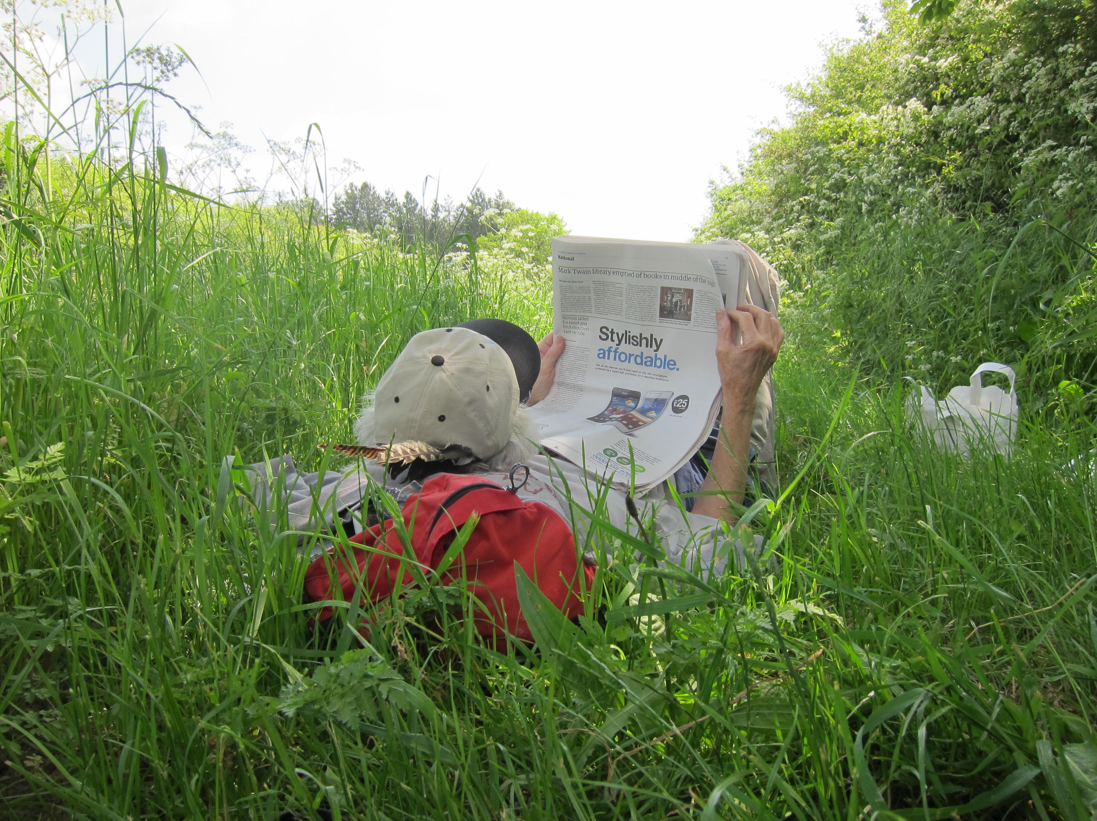
Tosh relaxes at lunch.
We sat down in the shadows and tucked in – as insects continued to make a meal of me. Tosh was lying on her back reading her newspapers when, after a rest of half an hour or so, I crawled to my feet (never an easy process these days) and continued uphill in the hot sun. Eventually the road reached a kind of summit and twisted to the right at a place called Shepherd’s Bush. There was an old OS triangulation pillar here; we had reached an altitude of 302 feet – which must count as a mountain in Norfolk.
Although our surfaces changed, grassy and earthen tracks having replaced tarmac, our direction did not and we plodded on for a further three miles – pausing every now and then to take on more liquid or examine a condominium for pigs on our right. We were now on the lookout for an important turnoff since, once again, we would have to seek our accommodation in a village to the northeast.
The critical point was Clark’s Farm, though it was no longer obvious on the ground that the barns on our left bore this designation. The OS map did identify an adjacent cottage – which was clearly marked, and so I sat down to study my map as I prepared for our departure from the Peddars Way. I was pretty tired by this time (and when I leaned down to pull something from my daypack I felt quite lightheaded) but we still had a mile and a half or so to go to reach our b&b in Harpley.
Our trip organizers had provided a brief summary of the way forward but I found it too brief and so (that night) I wrote my own. This is how to do it – “At Cockyhoop Cottage look for a footpath sign inviting you to leave the Peddars Way in an easterly direction. Follow a faint and overgrown path, initially with a wire fence to your left. It will swing around to the northeast, passing beneath a tongue of woodland, and eventually cross a small road. Continue forward up a steep hill on a wide track. At the top this will be joined by a lane coming from the left and you now continue with it to the right. The track will swing to the left and rise to become the start of a lane heading in an easterly direction. Follow this to the village ahead, passing a school and crossing Harpley’s main street. Continue on Church Lane, past the church itself, as far as Back Lane – where you turn right. Meadow House will be on your left, near the 30 mph sign.” I can add that I was a bit nervous at the outset of this journey, since the initial footpath was so rutted and overgrown. The road crossing was litter-strewn and the hill climb seemed to go on forever. Harpley itself looked quite interesting and Meadow House quite comfortable – after we had pressed a button that opened its gates electronically. It was 5:30.
Mrs. Amanda Case was our hostess and she showed us our rooms. I selected one facing the back garden – which backed onto immense fields stretching to the east. I had my shower and another brief nap and, a reservation having been made in our name, we left the house at about 7:00 to head back into town and the Rose & Crown. Mrs. Case was entertaining her grandchildren and there were also two large dogs, a Labrador and an Alsatian. The walk past the church seemed to take forever, in our tired condition, but I did take some more pictures of the church as we walked by. We turned to the left when we reached the village’s main street and passed a number of antique buildings before entering the doors of the pub.
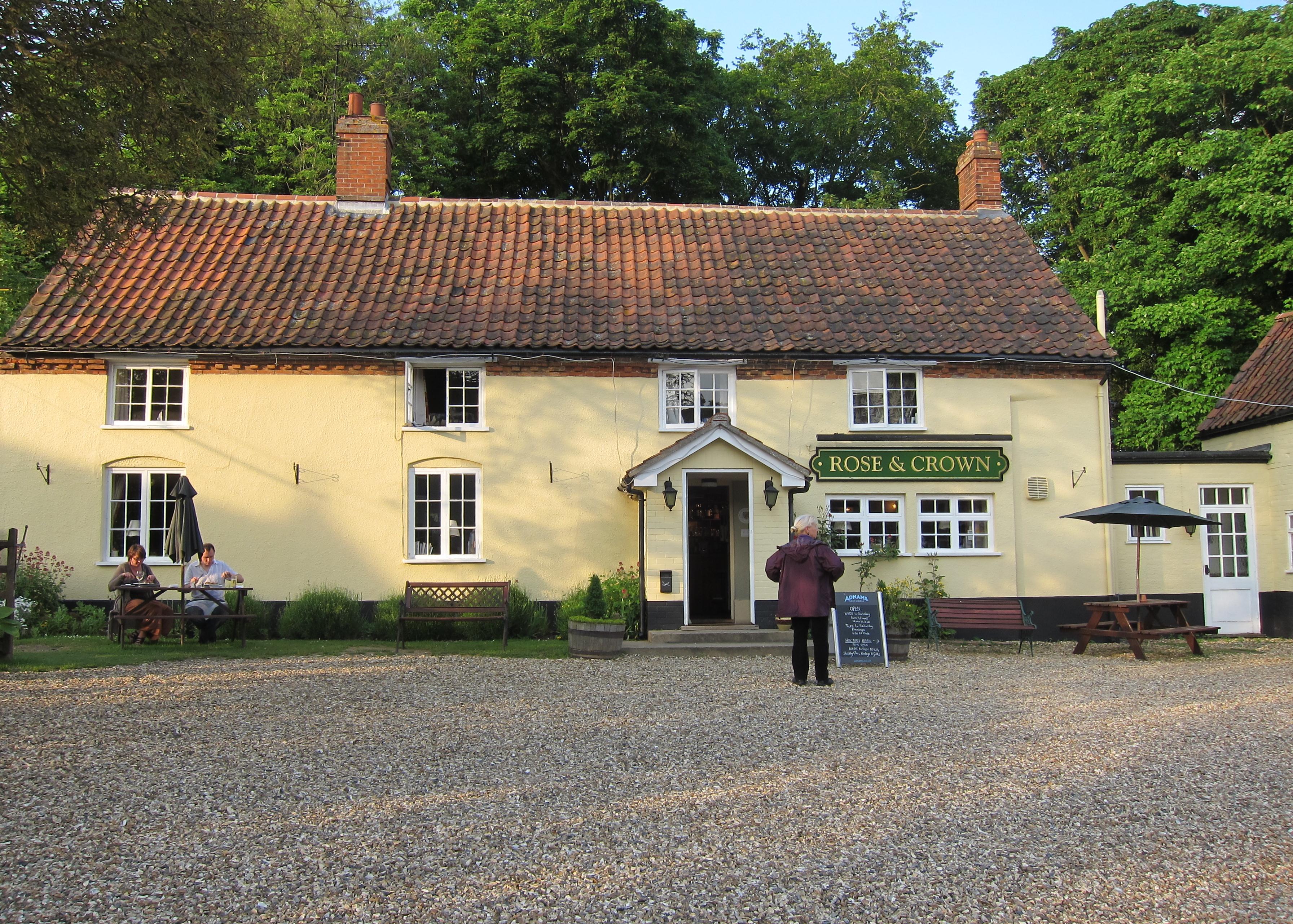
Marge approaches the Rose & Crown, Harpley.
We had a nice relaxing time of it here. I had the battered cod and chips and drank two gin and tonics. Again I tried to select some extra liquid from behind the bar for the morrow and then we walked on Church Lane again – in deepest dusk. I didn’t last too long as I pored over my articles – tired after another twelve and a half mile day.
To continue with the next stage of our walk you need: