
August 2, 2009: Camp to Anascaul

Along the track between Camp and Inch
I was far more restrained in my salt intake at breakfast on Sunday, August 2, restricting myself today (and on most mornings hereafter) to dry cereal, scrambled eggs and toast – even Gavan settled for eggs and sausage most days. I spent time completing the removal of more dirt from my rain pants. This object (and its upper counterpart) would have to be in use almost from the start today – for it was grey and threatening outside. When we brought our bags downstairs we discovered that the kindly Mrs. Daly had stuffed paper into Gavan’s boots; I had done the same to my own the night before.
It was 9:30 when we made our departure from Finglas House, and the village was far quieter this morning than last night – indeed though there had been a rush for 6:30 mass yesterday, the church seemed deserted now, even though it was a Sunday morning. Our route took us back up the same hill that we had descended yesterday but the gradients were easy and I was soon tapping along happily, the extra noise occasioned by the absence of the rubber tip from my stricken cane. On our left there were many views of an agricultural valley but the hills above us were shrouded in rain-bearing mist.
Wildflowers blossomed everywhere, or were they wild? Two garden plants, it soon became obvious, had long ago escaped their home base to colonize every lane on the peninsula. These were the fuchsia, grown to monstrous size in an endless series of bushes, and the orange day lily. With real wildflowers adding their yellow or purple colors I must say that the lanes were lovely indeed. We soon reached the directional posts of yesterday afternoon and continued forward, moving mostly south this morning, as we began a crossing of a kind of isthmus that would lead us from the north to the south coasts of the peninsula.
Gavan was again carrying the map and the guidebook and so I just followed along. With the book arriving only a few days before our departure I would have to say that I often knew next-to-nothing about what to expect on this expedition, relying on Gavan, who is now not only fastidious in following guidebook instructions but adept at map reading as well. He also did a good job of announcing the milestones I had recorded as they popped up on the OS map.
For a while – a light rain now falling steadily – we continued forward on tarmac, then on dirt roads that crossed a kind of high plateau. On the descent we approached a conifer plantation (trees being a real rarity on the Dingle Way) and here we met up with a Belgian couple (also resident at Finglas House the previous night) who were drinking tea and smoking cigarettes. He asked us about our plans, complained about the road walking, and translated our comments for his partner. He was balding and bespectacled and looked like he had just translated a particularly difficult chapter on semiotics. She wore blue jeans and carried two walking poles – though these were hardly needed today.
They passed us again (as did some other walkers) as we crossed the plantation– when the rain was falling quite heavily – and I suggested to Gavan that we take refuge under some of the trees. Here he distributed some cranberry encrusted granola bars. After a while we continued forward, soon reaching tarmac again and crossing the Emlagh River on a bridge.
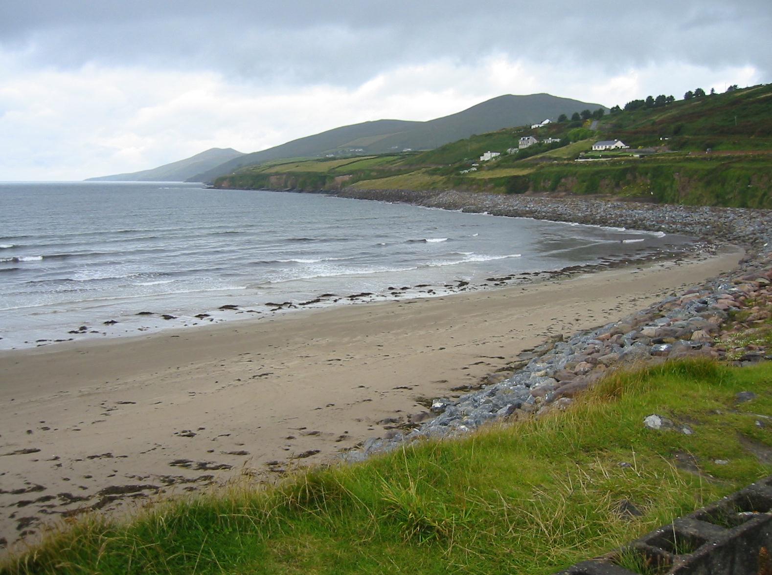
Gavan objected to the instruction that we “continue up to the left on a gravel track” since the guidebook failed to mention that you have to turn right off the road first in order to do this. I objected to having to make another ascent, since we were supposed to be dropping down to Inch Strand. Sure enough things quickly leveled off and we used some rough boreens to drop down into civilization, the houses above Inch itself. Views of the Iveragh Peninsula were now available, even in the grey light, and we could see the McGillicuddy Reeks rising to considerable height across the water. Gavan, who had been in this area several times before (though never on foot), could also point out other interesting projections and islands. He could point them out but I often failed to focus on what he was talking about because of the limited visibility.
We began a steep descent on tarmac to the coastal highway, where we turned left in search of refreshment. It was just going 1:00 and we had walked seven miles. The refreshment was provided by Sammy’s, a large oasis that included a store and a restaurant. It wasn’t easy to reach it, with all the tourists and their cars; there was even an antique car rally gong on in the neighborhood. A cheery waitress showed us to a table, where we ordered some warm food and cold beer. The waitress, asked if the weather was depressing custom, replied that customers may have been fewer on the ground – but that they stayed longer and spent more.
Inch strand
We were able to get out of our wet outer clothes here and when we resumed our walk, after an hour or so, the rain had lifted. Gavan had really wanted to walk along the beach at this point; he settled for a little longer on the coastal highway before we found a roadway that would bring us back up to the Dingle Way. We were soon using a flower-guarded boreen to make our way ever upward, at last reaching a road that headed due west steeply down into our next point of accommodation, the village of Anascaul. This could be seen in great detail from our vantage point but it seemed to take a long time to reach it (my feet and legs protesting against the steepness of the descent).
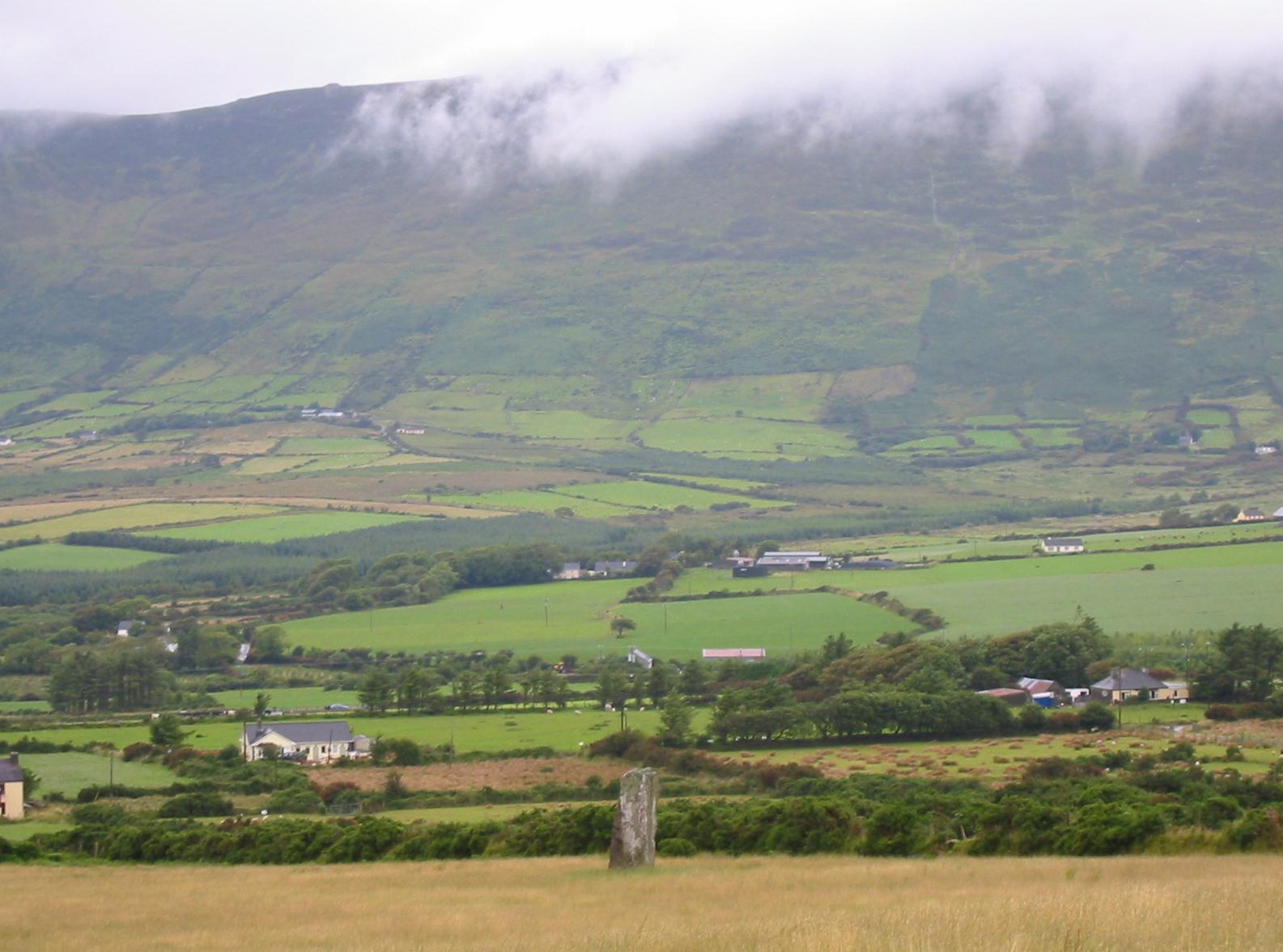
A standing stone on the road to Anascaul
We arrived in a village of considerable interest and charm at 5:00, again having completed eleven miles. A sharp right put us onto the town’s main street and only a few doors away we found the Old Anchor Guesthouse and Restaurant. We were welcomed by our Polish hostess and we sat down on the bottom step to remove our boots. We had a nice room facing the main street and, after our showers, we headed off to the find the pub. Kerry was due to play the team from Dublin in Gaelic football on Monday and tribal passions were clearly on the rise hereabouts.
Anascaul has a number of pubs but only one of note, the South Pole Inn, an establishment founded by the famous Tom Crean, an heroic survivor of Shackleton’s ill-fated Antarctic expedition of 1914-1916. We located this bright blue mecca only a short distance down our street and while Gavan went inside I took some photos outside. An Irishman on his way out asked if I wanted him to take a photo of me standing in front of the pub sign. I declined and his friend said, “Just as well, he only wanted to steal your camera.” Inside, the place was tightly packed, a combination of locals and day-trippers. I found a little stool near the fireplace but Gavan had to stand for a while as I drank a gin and tonic and he a pint of Guinness. The pub was full of wonderful photos of the expedition including one of Tom holding an armful of Husky puppies. Meanwhile a naughty black kitten kept penetrating the pub and local girls kept fishing it from under the tables and putting it back outside. We had to fight our way through the mob when it was time for us to honor our dinner reservation at the Old Anchor.
Again we both had the salmon and it was quite tasty. The Belgians tried to get a table here too, but they were told to come back later (they ate at the South Pole). The restaurant also served as the local pizzeria and several takeout orders were prepared, though no one ordered either the black or the white pudding, which were among the toppings on offer. Our meal was again pre-paid but I did have to come up with two Euros for a can of Diet Coke.
It was still light when we went upstairs to bed. Gavan had been complaining of a cold, but he seemed fine now; his nose was certainly unblocked or he could not have complained so vociferously about my Deep Heat.
To continue with the next stage our walk you need: