
August 4, 2009: Dingle To Slea Head Farm
Over the sands of Ventry Harbour
The sun was shining for once as Gavan and I got ready for day four of our Dingle Way walk. We finally made contact with the elusive Claire at breakfast but this was a fleeting contact at best since she was attending to her little girl, cooking in the kitchen, and serving the food to breakfasters – all at the same time. Gavan did not ask for his taxi money back.
We left at 9:35 and I took quite a few pictures on my way out of town – since the poor weather had rather restricted opportunities the day before. One of these was a shot of a private house opposite the motel – one painted a lurid shade of red. We walked up to a roundabout on the west side of town, one reconnecting with the Way itself, and headed west on tarmac for the next few miles. At a place called Milestone a large standing stone also earned a shot.
The westerly trod, with only gentle permutations in altitude, was very similar to the start of yesterday’s route to Minard Castle, though there was a bit more traffic and one memorable obstruction – a large herd of black and white cows. These animals were blocking the road as two teenage girls attempted to get them moved from one field to another while an angry bull, hidden behind a leafy hedgerow, bellowed in disappointment. Another surprise followed as Dingle Way signs, including some with unhelpful instructions in Gaelic, bade us to leave our route on the right. A “Pilgrim’s Route” was nearby, according to the map, and I wondered if we weren’t being offered an alternative to more road walking at this point, but, after a brief conference with my companion, we decided to ignore this diversion completely. A few minutes later we were beginning our descent to the beach at Ventry.
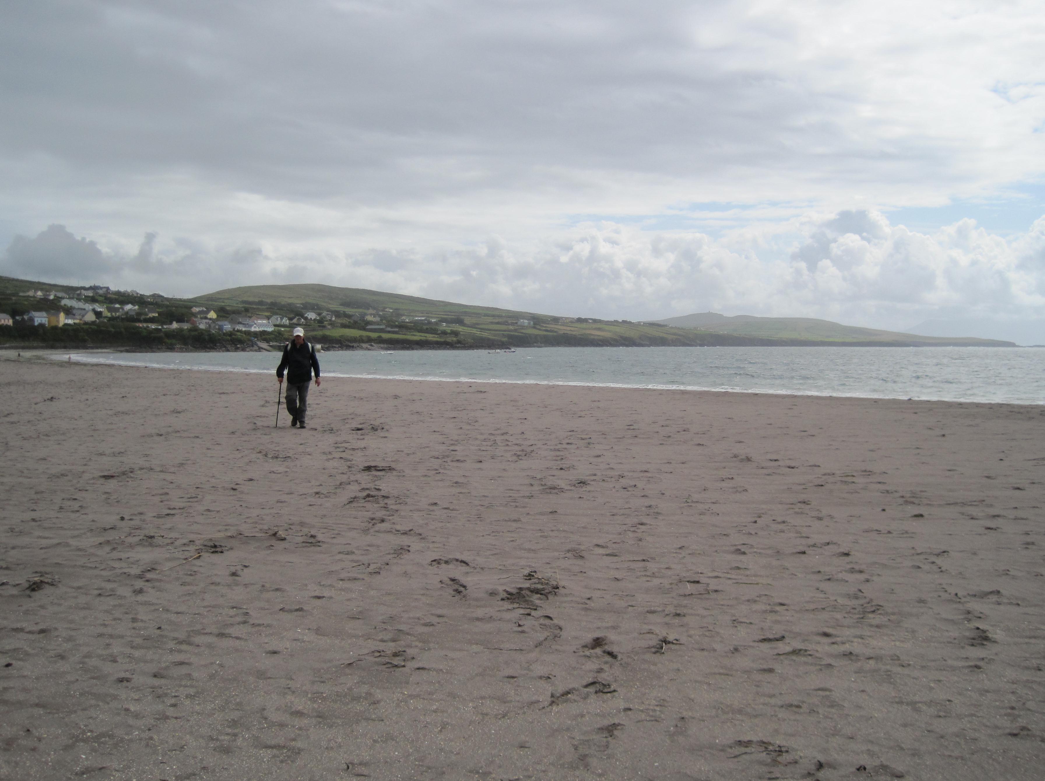
I think the local inn was actually open, though it was only a little past 11:00, and too early for us, and so we dropped down to the beach, which was busy with vacationing visitors, and began an hour-long stretch on the sands as we headed in a mostly southerly direction. Beach walking can be a lot of fun but unless you have a firm section to walk on it can also be very strenuous. Today we tended to stay at some distance from the waves, walking along the back of the beach where directional posts kept urging us forward.
Gavan was taking pictures of jellyfish, barnacles and a number of riders who were wading into the sea with their horses. There were also lots of dogs about, which was curious: in England they would have been banned from beaches at this time of year – though permitted on the footpaths. In Ireland the reverse often seemed to be true – we crossed many a stretch of territory with “No Dogs” signs. The skies darkened a bit as we neared the end of the beach and there was the briefest of showers. I sat on a sand dune and changed into my raingear and then we sat down in the sand and ate our lunch while a family, opposite, searched the kelp pools for signs of cockles or mussels.
In bright sunlight we now headed inland among the reeds, looking for a bridge that would take us across a river. Both Gavan and I had by this time experienced a problem unique to such a treeless environment: where to go when you needed to pee. I looked around in every direction and performed my act in the open air. Three more bridges were required to get us through this marshy territory; the bridges were essentially narrow troughs and, after all the rain, they were full of water. You had to straddle the edges of the trough and inch your way forward – if you didn’t want to put your feet in the water. I had the additional problem of what to do with my cane when both hands were needed for the top rail; eventually I pushed it before me along this rail and in this fashion we left the beach behind us and reached a substantial collection of houses on the main coastal road, the R559.
Here we expected to begin a parallel inland route above the highway but Dingle Way signs urged us to keep to the roadway itself as we headed west. Gavan was convinced that some churlish farmer had blocked the right of way but we decided in this case to obey the signs – though I knew that Gavan would not be appreciating this road-walking diversion. There was a lot of traffic, including some giant tourist buses and a number of cyclists. The latter were pushing their bikes as the road began a steep rise. After a few minutes of walking into the bright sun (I got a deep tan on this day) a sign, at about the eight-mile mark, finally signalled an escape from the traffic.
The next few miles were strenuous ones – muddy tracks (presumably preferred by wrongheaded Belgians), grassy boreens, stony pathways – but the views, particularly to the south, were wonderful. I had to take off my rain jacket in the hot sun and this left me with no easy access to my camera since I was still wearing my rain paints and these have no pockets. (Gavan soon carried my camera in his pocket.) Sea birds glided above us and sheep croaked at our feet.
There was also a lot of elevation to gain as we rose far above the highway. Once we crossed a stream, gingerly, while a waterfall thundered away on our right on its descent from Mt. Eagle. We also walked past a farmstead and encountered the first of a number of “clochains,” stone beehive enclosures whose purpose is still being debated: human habitation, shelter for animals? Many seemed to be in remarkably good states of preservation.
It was not easy knowing exactly how far we had come in this territory but eventually we rounded a corner, the direction shifting from west to north and a great view of the western coast appeared before us, with Coumeenoole Bay below. In this way we knew that we had reached the tip of Slea Head and that we could begin a steep descent back down to the highway and our night’s accommodation.
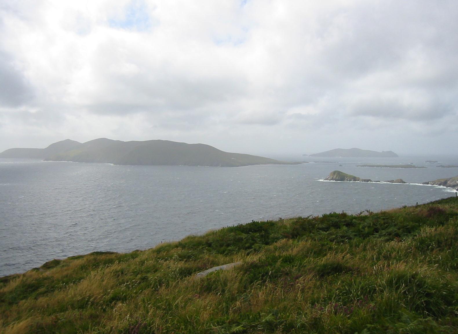
Our first view of the Blasket Islands
There were some guys with camping gear and fancy camera equipment up here and they took a picture of us side by side. Then, very gingerly, I tiptoed down the track, far more slowly than my companion. We paused to have a debate about which house might be the one we sought but, since Celtic Trails had supplied photos of all of the b&bs, Gavan was able to identify Slea Head Farm from its drainpipe.
There were a lot of tourists at a pottery on the main highway; there is a café here too but it closes its kitchen at an unhelpful 4:30. Just a few steps on the R559 brought us even with the entryway we were seeking and here I could see our hostess, Caitlin (Kathleen) Firtéar mowing her back lawn. We made our way down here at 4:45; we had walked eleven and a half miles. Kathleen’s baby grandson, with his blonde curls flashing, was using his scooter and his toys on the back driveway. (Kathleen’s daughter taught Irish language classes in Dublin.)
We took off our boots and climbed to our room on the first floor – with wonderful views of the Bay and Great Blasket Island itself (you could even see abandoned buildings with the naked eye). I had a bit of a rest while Gavan went out to take more pictures of the local ruins and the crashing waves and to play with the resident Golden Retriever, Molly. This sweet pink-nosed animal patrolled a low stone wall nearby. She quickly forgave me when I accidentally stepped on her toe. Slea Head Farm is the westernmost farm in Europe – making Molly the westernmost dog!
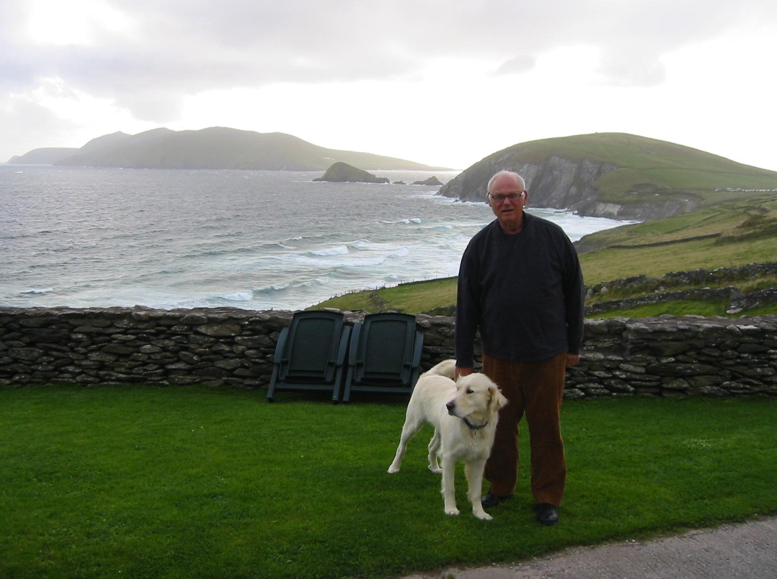
With Molly at Slea Head Farm
Soon there arose the question of our evening meal; none was of offer here, the local café was closed, and so taxis are laid on for walkers like ourselves and one was scheduled to arrive for us shortly after 7:00. We decided to head for Ballyferriter, some five miles away, though Gavan was a bit disappointed that I would now see some of tomorrow’s striking territory today. He soon cheered up in chatter with the cabbie, who was based in Dingle. Indeed Gavan blossomed in these conversations (as with all our landladies), never forgetting to mention that he had been born in Dundalk and that I was 72 or 73 – neither of which was correct. The cabbie said that he knew a young lady who had sworn to dance on Peig Sayer’s nearby grave – after failing a literature exam based on the famous autobiography.
I must say the views were outstanding, dominated as they were by the famous Three Sisters, steep peaks on our left. We chose to get out opposite the Tigh Ui Chathain pub and John, our driver, said he would try to get back for us as soon after 9:00 as possible. I asked the barman if he had a table but he said he was all full up at the moment and Gavan also went across the street to another establishment that was equally busy. We decided to stay put and gradually improved our seating until there was room to put a meal down in front of us. I had a curry and we enjoyed our beer. Locals were becoming the worse for wear at the bar but everyone seemed to be in a good mood after Kerry’s thrashing of Dublin.
John arrived about 9:20 and we reversed our direction, arriving back at Slea Head Farm as the light was fading from the western skies. Once again it was straight to bed.
To continue with the next stage our walk you need: