
July 29, 2005: Moor Park to Borehamwood
A day of golf course crossings begins with this one at Sandy Lodge.
Over five weeks had passed since the Lees and I had returned from our June walk in Lakeland – and I was anxious to hit the trail once again. We had been working on the Vanguard Way in Sussex but because I had a social engagement on the evening of the chosen day (many others having been rejected because of heat, interruptions to the travel system or the Lees’ double booking) it was decided to attempt another day on the London Outer Orbital Path.
This is why I left the house shortly before 8:00 in search of the Maida Vale tube stop. My plan had been to take the Bakerloo line north to Kenton and walk over to the nearest Metropolitan line station, but this early departure meant that I would have had to pay two fares with such a strategy (instead of no fare at all, had I left an hour later) and so I headed down to Baker Street where I climbed back up to the Metropolitan Line platform, having only a few minutes to wait for a Watford train.
I used this time to buy a Diet Coke and a cheese and ham croissant, which I consumed as we sped north – after having discovered that I don’t do that well on the trail on an empty stomach. I read my Metro and munched away as we headed north and at exactly 9:00, our agreed time, I got off at Moor Park– where the Lees were poring over their papers in the platform waiting room. The early start, I hoped, would not only allow for a late afternoon return to London but assist us in reaching a noontime pub at just the right hour.
We thus began our twelve mile jaunt by using an underpass to reach the front of the station, exiting through the turnstiles, turning around immediately – and walking back through the same underpass to exit on the east side of the tracks. Moor Park had been our first north of the river ending point for a LOOP day – but that had been some time ago and I can’t say that the stretch of woodland we now passed through on earthen paths seemed that familiar. Tosh kept yawning amid complaints that she was not used to getting up so early. Sensing open territory to come, I paused for a pee and then we were out in the morning sunshine on a beautiful summer’s day. There were high clouds about (though none of these produced anything like the threatened showers) and temperatures were mild. A gentle breeze cooled us down whenever we got too warm.
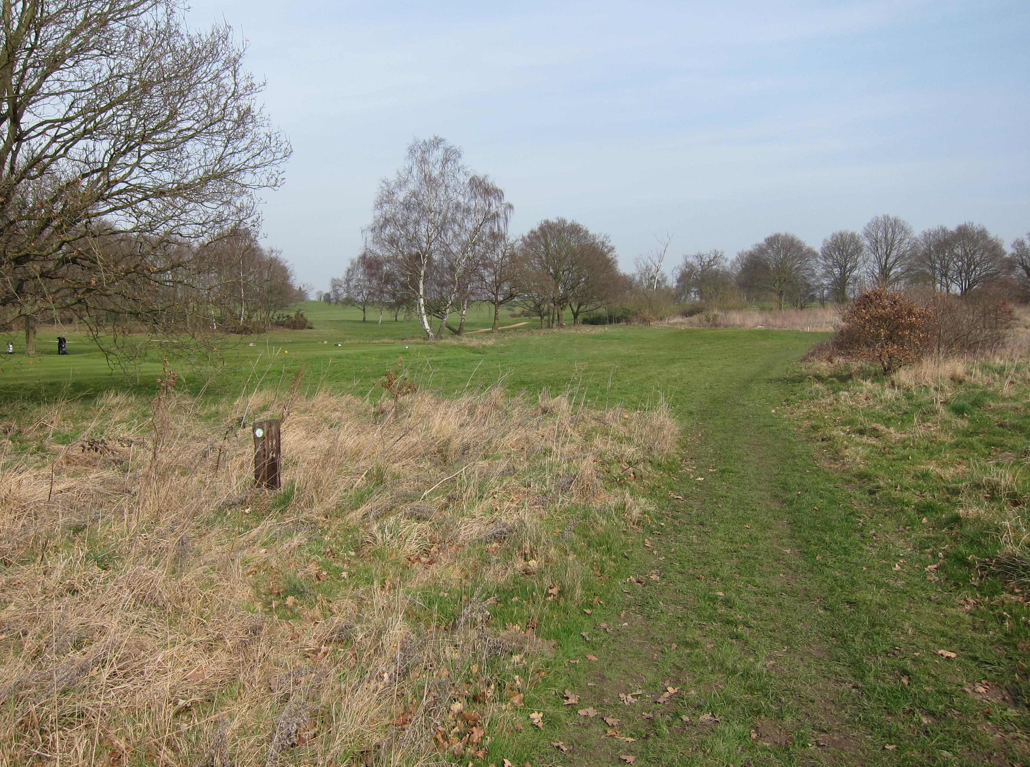
At a metal barrier, still near the railway line, we turned to the east, following paths in high grass along the back of a line of houses, gradually turning northeast, passing under power lines and entering the precincts of the Sandy Lodge Golf Course. We reached a crossing track and looked for a series of promised yellow signs to help us across the course but these proved to be brown posts with faint yellow lettering (“Footpath”) and useful arrows. It took us a few holes to encounter the first golfers and we stopped a few times so as not to break their concentration – and tiptoed past their tee shots on other occasions. I told Harold, at the one-mile mark, that he had now completed 2400 miles on British footpaths.
We left the course at Sandy Lodge Lane, where views to the north gave us a fine prospect of the Colne Valley. We turned east and walked a short distance to the A4125, the Hampermill Lane. This main road was very busy and it took us a while to get across. Almost hidden in the foliage was the beginning on another path, which took us up to the right, where we emerged into open fields. You could tell that the rains, which had at last fallen earlier in the week, had been insufficient to turn these yellow surfaces green. We followed a line of trees on our left and these turned right and came to an end at a point where we had to guess a bit on how to precede toward a line of houses along a suburban street.
There were lots of people out walking their dogs but before I could ask any of them how to get to Ashburham Drive I spotted a fenced-in play area that was David Sharp’s next clue. We passed this on the left and headed for a gap between houses, reaching a gate next to a red dog waste bin. Tosh sniffed at this – since dogs had been provided a bin but not people – and threw a plastic bottle at the foot of this object, a very uncharacteristic gesture. If this had been Acton, Tosh would have been the one picking up such trash.
We turned right on the drive, reached a T-junction, turned left, and right again on a cul-de-sac of a street named Nairn Green. Here a ginger and white cat had made himself at home on the bonnet of a parked car. He jumped off as we approached, leaving paw prints all over the paintwork. We now entered Oxhey Woods, turning left and then right to climb a hill on wet paths. Near the top, where we spotted a black cat, I began to look for a turnoff marked by the presence of a sawn-off seat in a tree-trunk. This I couldn’t locate, but the right fork obviously lead down to a road on our right and we needed to go in the opposite direction so I took the left fork – after the Lees had passed a canteen around.
The path here was somewhat overgrown, with blackberry vines slashing away to right and left, and once I got scratched in the face. I complained about this to my trailing companions and was surprised when a lone gentleman, who had come up behind me, responded, “If the mud doesn’t get you, the trees will.” Fortunately the sighting of a house ahead confirmed our position and we had soon reached a lane. I would say that the pattern of the walk today featured a long series of mostly wooded sections bisected by the appearance of paved roads. You crossed the road, as we did now, and immediately entered the next section.
This was a short one, as we turned from east to southeast, crossed a busy road at a traffic island, and continued down some steps into our next stretch of woodland. When we reached a clearing Tosh announced that she had to have a food break and so we sat down on some fallen logs in a very pleasant spot and the Lees ate some sandwiches. It was 10:30. Tosh seemed to remember that she had studied the food chain in Oxhey Woods during her career as a science student.
LOOP signs had just begun to make an appearance and I was joking that their presence robbed the route-finding enterprise of some of its adventure when they ceased altogether and in Nanscot Wood I found no convenient turn off at a point where our forestry track turned right. I had my wish – we were lost. We followed the track to the right for just a bit, but I knew this was taking us west when we needed to go east. The OS map in Sharp’s book showed that we needed to be adjacent to an open space and I could see this below us (another golf course) and so I found a path down to the woodland edge and here we did turn east. Still it took about ten minutes for me to be able to say that we were back on route for sure.
With houses on our left we continued ahead, out in the open again, up to a fence and a kissing gate where we were supposed to turn south. Curiously, an old man was struggling to climb the fence here; it took him a long time to do it and I was afraid he would come crashing down – but no sooner had he righted himself than he spotted us at the stile and realized that he needn’t have climbed the fence at all. We were soon in the precincts of Pinnerwood farm, where Tosh was miffed that a tractor was removing a fallen log rather than letting it survive as the rotting home of country insects. We dodged a second tractor and emerged at the flowery farm cottage, then we used concrete driveways to reach the lovely Pinnerwood House – an 18th Century moated farmhouse that was once the home of Edward Bulwer Lytton. It was lovely, but its pond was mostly dried up in these parched times.
Still on concrete we turned a corner and went forward to a stile that put us into fields again. We had a hedge on our left for a short distance and then we picked up a second hedge heading south; a stile and footbridge allowed us to change hedge sides and soon we were rounding a corner with the houses of Hatch End on our right and open fields on our left.
Woodland was ahead of us and eventually, to our pain, we climbed a stile into it. The footpath was almost choked with the tendrils of scratchy vines and nettles and it was a struggle to battle forward. I lost track of the Lees as I battled the foliage – Tosh having stopped to put on the protection of another shirt. After a minute or so of struggle I reached an open place in the woods and here (too little, too late) there was actually a LOOP sign – the first in some time.
I waited for the Lees to catch up and headed north in a narrow choked defile with hedge and fence on the left side, the backyard fences of housing on the right. The jungle battle began again but at one point we discovered that a fencepost on our left had been knocked down and this permitted us to enter a grassy field on the other side of the hedge – where northerly progress was much easier. The problem with such a strategy is that you know you don’t belong here and you can’t be certain that you will be able to rejoin your original route when the field comes to an end. Sure enough there was a row of barbed wire that we needed to hop over here, but this wasn’t too difficult and we were soon reunited with our path – which now headed across open country itself.
Our guidepost in this case was an electricity pylon, which we passed on our way to an overgrown kissing gate onto Little Oxhey Lane. We turned right on the footway of this road and, passing over a railway line, continued forward on the north side pavement past more suburban housing and up the B4542 to a busy T-junction –where a traffic island helped us find a safe passage over the main road. I never saw a sign pointing forward “To Grimsdyke,” but the rising track seemed to be heading in the right direction and soon we were approaching our third golf course. Tosh had been agitating for definitive information on the distance to our noontime pub and now, turning a page in the guidebook, I was able to predict an arrival in some thirty minutes.
After entering the golf course we marched over a green and headed uphill along a hedgerow, aiming for a cottage above us. Beyond this structure we used its access lane – but just before arriving at our next road we reached a plinth marking the presence of Grim’s Dyke, an ancient earthwork. This was also the signal for a turnoff onto a path paralleling a road; we passed a pond and a telecom establishment and continued past more ponds as we rose gradually to join the dyke itself. One of these ponds retained a melancholy atmosphere as the spot where W.S. Gilbert drowned in 1911 – during his residency at the nearby Grimsdyke House.
I must say there were many paths to choose from here and I was quite happy that the LOOP signs had returned in abundance. They made it easy to relax and enjoy a truly lovely pineland ascent, the dyke on our left; here we were reminded strongly of stretches along Offa’s Dyke Path. Our travels in the Harrow Weald (we often had views of distant Harrow with its church spire to the south) lead us out to the Old Redding road opposite a car park. Here we turned east, passing the entrance to a hotel that offered summer performances of a number of Gilbert and Sullivan operettas, and soon thereafter we reached our pub. It was just past 12:30.
I had told the Lees that we would be encountering one of the strangest pub names in our long travels – for this pub was named The Case is Altered. Licensing decisions by local officials are presumed to lie behind this name, which is claimed by more than one establishment, but Sharp says this pub favors an explanation that parallels the way in which the Infanta de Castile became Elephant & Castle, that is that that the original name of the pub was Casa Alta. (There is a Spanish connection in the pub sign, which features soldiers of the Peninsular War.)
We now selected a table and Harold and I had pints of lager, well I had a pint and a half, while Tosh had a pint and a half of bitter shandy. The barman told Tosh that he had a soccer scholarship to Furman in South Carolina. We placed our food orders and sat down at a table next to the bar counter and here we endured another long wait, the better part of an hour, for our food to arrive. We needed a rest and I suppose a view of all those bums lined up for their drinks was as good a prospect as many we have had elsewhere, but we were ravenous by the time our food came. Harold and I had fish and chips, Tosh the stilton ploughmans. “I suppose coffee is out of the question,” Tosh said, knowing what the answer would be on an afternoon during which I was still trying to get home at a decent hour. I figured we had covered about six and half miles, with five and half still to go.
We left at 2:07 and crossed the road to follow a broad track heading north into woodland. Next we turned east and climbed some steps up to the A409. Opposite this spot was the beginning of an easy stretch on a concrete path through the Bentley Priory Open Space. Not much could be seen of the priory itself and a double perimeter fence to our left discouraged exploration – this had been the command headquarters for the Battle of Britain and the establishment was still Air Force property. There were quite a few people and their dogs about.
We turned north after some distance, a glimpse of a tower just visible on our left and the sound of the priory bells sounding the quarter hour. At Priory Drive we entered a very prosperous section of suburbia, with the Lees offering an architectural critique of each pile. Some of these efforts at mock elegance would, indeed, have looked better under a coating of ivy. A quick left turn brought us out to the A4140, where the traffic island mentioned by Sharp now seemed to be on the right rather than the left. We needed to cross this busy road in order to continue in an easterly direction along Warren Lane. A car park on our left beckoned us to take a path that paralleled the lane for a while, crossing it from north to south while a cricket match was in progress – and continuing in a southerly direction between two ponds.
There were a lot of LOOP signs around but I swear that one of them pointed to the right when we should have gone left. We were walking along the east side of the larger of the ponds, with fisher folk at work on the banks, but when our path turned right at the bottom of this body of water I knew we were heading in the wrong direction. I used the maps in the guidebook to reverse matters, heading east around houses and so discovering the advertised rugby pitches. We were on Stanmore Little Common now but a brief woodland stretch brought us by another pond (Sharp mentions two ponds here, but I saw only one) and so up to Warren Road again – here running north-south.
We soon reached a road junction and took the road on the right to arrive at the gates of a bone hospital. We were looking for a smaller gate on our left but it didn’t seem to materialize as we wandered down a private road with a series of discouraging signs warning us that the resident guard dogs bite. So we retraced our steps and I found, without benefit of gate, the path that was supposed to take us north through another narrow passage punctuated by hedge on the left and hospital fence on the right. This was also a journey of despair, though better than being bitten by dogs I suppose. I lost track of the Lees – though eventually they caught up and we at last escaped the jungle to reach a farm road heading north.
Tosh, in the first of a number of delaying tactics, stayed behind to use the privacy of the last woodland bush while I started downhill very slowly, Harold trailing me. I could see Tosh catching up eventually as I rounded a corner on a track heading for the M1 motorway and I turned off at a tall LOOP sign pointing north. Harold was still in view and he followed me but when we had crossed a hedgerow and climbed up a little hill there was no sign of Tosh!
Harold decided to backtrack, calling his wife’s name, but there was no response. Much to my surprise, however, I now spotted the lady marching toward me from the direction of the motorway, having already climbed up to our little hill. She blamed us for the separation (and, indeed, Harold took responsibility) but, as we defended our dereliction by citing the prominent LOOP sign she must have walked right by, an unrepentant Tosh responded, “I never look up; I just look at my feet.”
Reunited we now pressed forward through tall grass and then a short-cropped field in the direction of the Elstree Road, where we turned right, crossed under the motorway, did a semi-circle of the roundabout ahead of us and continued forward on pavement along Elstree Road. This highway twisted to the right around the southern end of the Aldenham Reservoir, then left up the other side. At the Fishery Inn we were invited to cross to the other side but with a blind corner in both directions this was not so easy a task and it took us quite a while.
We walked north on reservoir paths and past a sailing club. There seemed to be quite a bit of water, which was encouraging, but I didn’t have an answer for two young lads with a Husky in tow who asked me if I knew where the bailiff was. The guidebook suggests that the LOOP undertakes a short northeast detour here but at the end of this road there was just a fence. Harold spotted a LOOP sign on the opposite side of the fence so we climbed over and were again met by the lads, who wanted to know where we were headed. When I named our railway station they agreed that this was a long way away – which rather discouraged the footsore Tosh – but I told her that, to kids, anything more than five minutes is a long walk these days.
We crossed a road and continued in an easterly direction at the foot of a hill; above us on the right was the spire of Elstree Church. At the end of this stretch we reached the old Roman road of Watling Street – now paved as the A5183. We leapt across this highway and took Allum Lane for a short distance, crossing the lane to enter an open space with hedges and hills. Harold and I ducked behind the former for a last countryside pee but this inspired Tosh again and she sent us uphill (lots of warnings here about not straying from the right of way) – where we waited for her at a stile into another golf course.
It would have been difficult to have relied only on the guidebook text here – as I suspect there had been alterations to this man-made environment, but fortunately there were plenty of LOOP signs and so we made our way down to Allum Lane again and thus returned finally and definitively to civilization. We had by this time missed quite a few earlier connections but there are four trains an hour from the Elstree and Borehamwood Station, which we reached within ten minutes (at about 5:10) – with only about fifteen minutes to wait on platform one. I think we were all pretty tired; there had not been a single rest since leaving the pub.
Our travel passes were good even at this distance from London and we were soon speeding south on a Thameslink train, sitting opposite three beefy Polish workmen. I had devised a return strategy for the Lees, whose normal progress, like so many London journeys on this day, was impeded by line closures in the wake of the suicide bombings of July 7. They now tried out half a dozen alternate proposals before accepting my suggestion: stay on this train to Blackfriars and take the District Line west. I phoned Dorothy and reported my progress before getting off at about 5:40 at the Thameslink Kings Cross Station.
Here I returned to street level and headed west toward Kings Cross Station itself where I descended once again to take the Metropolitan Line back to Baker Street and the Bakerloo Line home. All this time I was glancing at the headlines in the Evening Standard – which other passengers were reading. The terrorist events of July 21 had been a constant topic on the trail and I now saw that two of the four would-be bombers had just been captured. This spurred me on to cover the distance from the tube stop to Morshead Road as quickly as possible – so that I could be home in time for the 6:30 news. I made it, learning that, indeed, all four of the bombers were now in custody. This news and the memory of a splendid outing in Hertfordshire made for a jolly meal at the Formosa Dining Rooms at 7:30.
To continue you need: