
March 8, 2007: Chigwell to Harold Wood
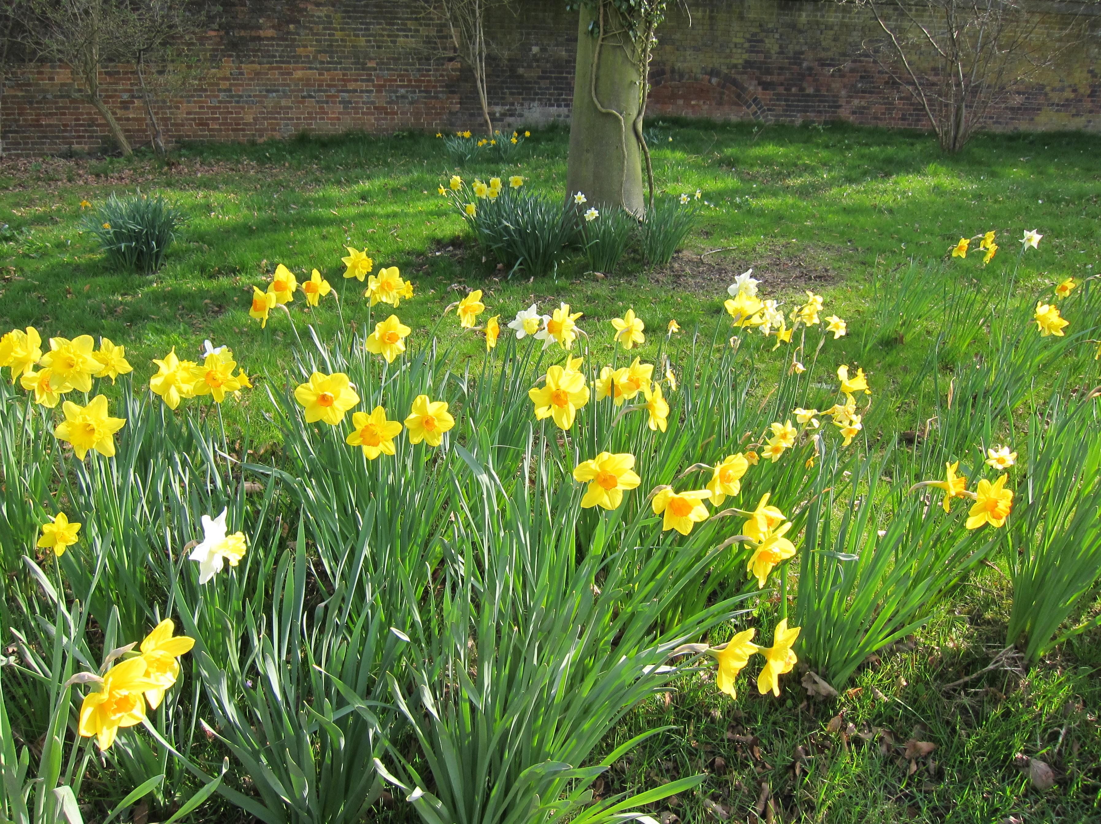
As winter gives way to spring the walker is rewarded by a sea of daffodils.
The walking season for 2007 began on a bright, sunny Thursday morning in March – when Tosh and I decided to walk the next-to-last day on the London Outer Orbital Path. Once again I had determined that the stage could be accomplished without our having to spend anything on transportation – if we jumped into the public transportation system at exactly 9:00, when our freedom passes would became operative. This will explain why I left the house at 8:50 (much to the distress of the whimpering dog) and marched over to the Maida Vale tube stop – where I bought a small Snickers and a Mr. Town peanut bar from the upstairs kiosk.
As usual, a crowd of pensioners lurked outside the gates, waiting for the clock to tick over (I ate my Mr. Town bar) before heading downstairs for a ride on the Bakerloo Line. I read an article on Uncle Tom’s Cabin and one on Jimmy Stewart as I changed to an Epping train on the Central Line at Oxford Circus. The Transport for London website, which mandated a change at Woodford, had promised me a journey of 56 minutes, but even though I had made excellent connections to this point, it was already 10:00 by the time I reached Woodford – and there was no mention of a Hainault train on the overhead screen. I tried to call Tosh, but my call went straight to voice mail. Fortunately she called me – she was waiting for a train at another station on the Hainault line and I could see that we would not have an early start.
In fact I could now see the train I wanted having a snooze on a siding and after fifteen minutes or so it decided to spring into action and I was able to ride the two stops needed to reach Chigwell – where we had broken off on an earlier stage of the London Outer Orbital Path two years ago. There was still no sign of Tosh when I reached this station so I strolled over to the opposite platform and waited a further five minutes. When Tosh arrived she reminded me that Auntie Barbara expends considerable effort in trying to instruct Colin on how to reach Chigwell in Mike Leigh’s Meantime.
It was 10:35 before we were able to leave the station with a right turn on the Chigwell High Road. We seemed to be making up for lost time with a corking charge up the hill on the pavements of this street – I knew I wanted to be sure to arrive in time for food at our mid-walk pub, some six miles distant. But my out-of-condition legs were already complaining.
There was a touch of melancholy in today’s outing for it was the first walk we had taken since the death of our long-time walking companion, Tosh’s Harold – in late October of the previous year. I had presented a thorough review of his career as a walker as part of my eulogy at a memorial service on December 3. Harold had walked every stage of the London Outer Orbital Path with us to this point, and he would be sorely missed on the last two stages and on every other walk that we took subsequently – including a projected outing on Glyndwr’s Way at the end of May.
After a few minutes we reached the hilltop where St. Mary’s Church and the local grammar school were located across the street. Sharp’s guidebook notes that the latter, founded in 1629 by the Archbishop of York, Samuel Harsnett, specified a need for faculty who would be “neither papist or puritan…no tippler, haunter of alehouses or puffer of tobacco, but apt to teach and severe in punishment.” Sharp implies that few of us could qualify today.
A footpath opposite the school admitted us to a field and onto a second road, which we crossed in search of a gate. We were heading mostly in an easterly direction, passing through a grove of trees and out into the open again. Around the corner we followed a field boundary uphill in the direction of a house on a hilltop. Tosh took off a layer when we reached a crossroads – I walked the entire day wearing only a green sweatshirt over a t-shirt.
From our elevated position we had wonderful views over a fertile Essex countryside and we now descended into a valley bottom on a track, turning from southeast to northeast as we reached Pudding Lane, an old green lane. Down below us there was a shallow lake not marked on any map, the consequence of lots or recent rain, and I told Tosh that this did not augur well for some of the surfaces we would have to travel over today. Footing was still okay and we again switched to a southeasterly direction on a track that reached the valley bottom and began to climb the hill opposite.
We were supposed to be looking for a half-left turnoff but I told Tosh not to take a path through crops, even though it was heading in the right direction – because we had not reached the end of the hedge on our left. Sure enough, when we did so, our path was obvious on the ground – the crops in question were still hugging the surface. Behind us there were also grand views.
Through a hedge line I found a narrow path up against some Essex Water Company establishment and we struggled forward to the entrance to this place where, taking a left turn and passing a large reservoir pool, we continued under evergreens as far as a stile. Several more stiles followed as we continued in a northeasterly fashion out to Chapel Lane in Chigwell Row and a brief return to civilization.
We had a brief look at the yellow-brick chapel behind us and crossed a road to enter the precincts of Hainault Forest, utilizing paved walkways past a children’s playground – with people out walking dogs as we made our way along the edge of the woodland on our right. To my surprise LOOP signs directed us into the woods themselves (the guidebook map suggests remaining outside these) and I decided to trust the signs, which soon had us heading in a southeasterly direction and out into the open as we neared the Romford Road. Some forestry workers were coming up toward us and one chap warned us that they were lopping limbs ahead and that we needed to keep to the left. The sight of men in trees was a familiar one to me – as this activity had been going on in Morshead Road all week, but at home we hadn’t any campfires going to burn up the tree wreckage, as they did here. Tosh said she hoped we weren’t seeing the origins of a new housing estate.
Just as we were about to dash over the road a lorry speeding toward us from the south honked its horn at us and three chaps gave us a thumbs-up sign. Why? On the opposite side a gate admitted us to a corner of Hainault Country Park but here there were no useful LOOP signs at all and I had to get out the compass to make sure I was at least heading in the right direction. Sharp mentions a faint path here and there seemed to be one heading in the right direction so we pushed open a gate and began to head downhill along the left side of an open field. There were no footpath signs but I seemed to be where I needed to be according to the OS map in Sharp’s book and so I persevered as far as a crossing track where I turned left.
A chap was out walking two dogs and I asked him if there wasn’t a lake at the bottom of the woods here. (Tosh again commented that I would never have asked for help in this fashion in my early days as a walker.) He confirmed this and suggested a pathway so we soon turned right again and I could at last see the waters of “The Lake” through the trees. Footing was often mucky here, but we persevered, even jumping over a stream at the bottom, and thus reached waterside. Here we turned northeast and walked on paths around the northern end of the duck-filled body of water before turning uphill. A little toddler in a pink playsuit was happily dancing about amid the Canadian geese but I could hear her mother saying, as baby grasped some entirely unsuitable object, “Put that down immediately!”
The map showed us heading in a northeasterly direction well below the roadway that we were now approaching – but I could see a refreshment kiosk and Tosh wanted a bit of a rest so we sat here for ten minutes while Tosh had a cup of coffee and ate an ice cream bar. Then we continued in the desired direction and I searched for a route that would leave the open space below us by climbing the opposite hillside in a northerly direction. To be in a better position to see any likely turnoffs I walked over wet and lumpy grass while Tosh followed on the road itself. When a line of cottages appeared on the latter I decided that we at least needed to reach them in order to see if a surfaced track could be discovered nearby – it could. We therefore turned left here and began our ascent, Tosh complaining about a rock in her shoe. About half way up the hill, with a golf course fence on our right, I spotted – at last – another LOOP sign.
At the top we were invited to enter the precincts of the golf course itself and to follow signs and yellow marks on trees to get us safely across the always hazardous confines of the plus-four fraternity. There was some initial uncertainty but I persevered in looking for yellow marks on trees (found a golf ball in the process) and thus we were able to enter a long finger of woodland (Mile Plantation). Under cover, as it were, we made a safe descent between fairways – though soon after a crossing track we emerged on the eastern side of our woodland and crossed some open territory in search of a stile. This admitted us to a green where golfers were just completing their putts. We paused a minute, then crossed a last fairway and escaped at the corner of the course into a field.
Moving forward to a boundary ditch, with views of Romford to the south, we switched to an easterly line along the same ditch in order to reach Foreberry Wood South and some welcome roadway. We turned right here to pass through the yard of Lower Park Farm, where we were greeted by some farm folk. We also spoke briefly to some horsewomen and to two chaps on bicycles – who were wisely rejecting a bridleway that now faced us. This stretch, described by Sharp as “often-muddy,” more than lived up to this description today, a swamp covered in water with only a hint of dry footholds on either side. On the right we had a barbed wire fence (I picked up a splinter clinging to a fence post) and on the left it was a battle with bushes that seemed to want to propel you into the gloop. My feet sank below the surface on more than one occasion as I battled along, Tosh following me at a distance in an equally desperate struggle. I could see dryer land ahead and so we persevered, at last reaching a corner of Havering Country Park. I could just see the cyclists, who had taken a long detour, disappearing into its shadows. This has been one of the very worst stretches of footpath encountered in all our years on the trail.
Our route required us to head uphill along the western boundary of the park, though at last we turned into it, still climbing, at last on firmer ground. Some lads had been playing football on one cleared field and we also saw some of our horsewomen – trying to escape from a field in which a “No Horses” sign was prominent. The highlight of this woodland was the presence of giant sequoia, Wellingtonia, which someone had planted as a stately avenue. For me it was a poignant memory of my California youth but I was glad we were getting close to Havering-atte-Bower and our noontime pub. I was parched, my legs ached, and a cough I had been participating in since a trip on the Nile was bringing up phlegm every other minute.
At last we returned to civilization and the B175 where we turned left, spotting immediately the Royal Oak pub on the left. I had phoned this place yesterday to ask about lunchtime hours – lunch ‘til 3:00 had been the answer – but I now noticed that a sign out front made that 2:30. It was just going 2:00 and we had walked six miles. There was just time to pause at a bus stop and scrape some of the layers of mud off our boots before reporting to the bar – where a helpful bar girl asked us what part of America we hailed from.
There was only one other group in the place and so there wasn’t much delay in getting our food orders seen to. I had the cod and chips and Tosh had an omelette and a jacket potato. I polished off a pint of lager while Tosh drank a pint of bitter shandy, her favorite tipple on such occasions. At one end of the establishment a giant TV screen was blaring out a re-run of Midsomer Murders, though no one was watching, not even the bar girl, who disappeared for long periods of time to look after our food – leaving a new customer to stand there like a dummy hoping for some service. (The rest of the staff was at the cash and carry, as we soon discovered when they started offloading their purchases.) I gave to Tosh a pashmina she had left at our house some months ago and we polished off every scrap of food. Tosh did have a cup of coffee – I got one of her After Eights – and after using the loos a few times we were ready to leave at 3:00. This was just as well because we still had five miles to go and I was afraid of losing daylight. “Have a nice day,” the bar girl said.
We crossed the B175 and squeezed past a garage to begin a long series of adventures in the mucky fields. The going was often very sloppy and the route a little quixotic. For instance we were kept near a fence as it crept uphill toward a curious round tower in the adjacent farmstead on the right – when we were actually aiming for an opening in a hedge downhill on our left. (Again I was able to get us squared away because I was following the yellow line on the OS map).
We found our crossing, topped a rise, and aimed for the left hand end of a tree-belt. Then more mucky field paths lead us by a lone oak and up to the woodland of Pyrgo Park. Every now and then I would spot a LOOP sign and would have to make sure its arrow was aligned with our expectations – Tosh often got well ahead of me by just plodding forward in a straight line. We climbed a hill and kept to the outside of the wood around two corners. Here we encountered a stile that lead up to a ridgeway track, one that promised some dry footing, though only for a brief interval. After leaving it we headed over open country again and along the northern edge of a small wood, Tench Pond Plantation. I was coughing all the time by now.
At the end we turned left along a hedgerow – this was another spot where we ended up walking two sides of a triangle instead of only one. Over on our right we could see the very impressive buildings of Widdrington Farm. After utilizing a small footbridge we followed field paths to the east, encountering two twitchers with binoculars – they were studying the hovering skylarks whose song was everywhere evident. At the end of this section we reached a lane, Paternoster Row, and turned south (our dominant direction from this point on). Tosh was a bit disconcerted to be walking on a paved roadway but I welcomed the solid footing and there was no traffic anyway. We said hello to some locals – Tosh congratulating one chap on his success with daffodils – which were everywhere resplendent today – and we continued forward to a point where our lane ran up to the forbidding gates of Widdrington Farm.
We were provided with our own track off to the left, though its tarmac now lay over the roadbed in jagged shards and the walking was not so easy. We walked downhill and then up again, escaping onto a continuation of Paternoster Row at a stile. Here we turned left and continued downhill to the busy Noak Hill Road. On the corner was the Bear pub and it would have been nice to have had a rest here but we were still worried about the fading daylight and so we persevered, crossing the road, turning left, and then right again into Tees Drive, a suburban street on the north side of Harold Hill.
I had to change pages here and I could at last see our goal on the OS map, though still two miles or so to the south. Some workmen parted on the pavement to let us by. “Ah the ramblers,” one of them said, “you look tired,” “We are,” I replied.
Much of the route we followed now paralleled the confines of Carter Brook, a stream that changes its name a number of times before reaching the Thames. Our initial experience, on the west bank, was not very encouraging – as the litter-strewn footpath was pitched at a steep angle, one likely to lead to an intimate acquaintanceship with the brook itself. Tosh, surveying the litter, said, “They need to get the Boy Scouts in here.” “Yes,” I replied, “so that we can tell them to stop dropping all this junk.”
We escaped the narrow wooded defile and climbed up to street level where a long strip of parkland, often with paved walkways, allowed us to keep in contact with the brook on the east bank. There were a number of crossing streets dividing sections of this greenery and at one of these another driver honked at us enthusiastically – “Honk if you think Ramblers are mad” being the operative theme today, I suppose.
Tosh was appalled by all the litter in these parks and outraged at the local authority for not doing a better clean-up job. She was clearly getting tired but she was usually ahead of me – just a remarkable performance when you realize that she is about five years older than I am. We had one difficult crossing to make, the A12 dual carriageway, but we waited for an appropriate spot to dash over to the divider and had no difficulty with the rest of it. We had one last section of woods now and each of us took advantage of some foliage for a last quiet pee. There were lots of kids about in large groups and one ten year-old with attitude asked me, “Why are you wearing boots?” I said, “Because I’ve just walked ten miles.” Honk if you think Ramblers are mad.
At last we left kids and parkland behind us and crossed Church Road to begin a suburban stroll westward toward the Harold Wood train station. Tosh said she had hoped that Harold Wood would turn out to be a lovely place but I don’t think she was gratified in this wish as we continued forward on Queen’s Park Road. I too thought of the gentle irony of our first walk without Harold ending up in Harold’s Wood (we even passed the King Harold pub near the end). We were now walking uphill to reach the entrance to the station and, after passing some portly teenage girls, we descended the steps to platform three. It was 5:15 and we had covered eleven miles. And eleven miles, it turned out, were all that were needed to push my total on British footpaths to an even 4000!
Tosh offered me her congratulations as we waited only five minutes or so for a Liverpool Street train. We were now too tired to read and it was indeed a struggle to unstiffen long enough for a walk through the crowded station to the underground, where we parted at last. I took the Metropolitan Line to Baker Street where I switched to the Bakerloo line, using the last few minutes before reaching Maida Vale to put on my rain jacket against the chill night air. I shuffled slowly homeward, reaching the flat at 6:45. Four thousand miles seemed to me to be an unusually large number and I was quite pleased to have reached this milestone – even if it did take me the better part of a third of a century.
To continue with the next stage of our walk you need:
Day 15: Harold Wood to Rainham via Coldharbour Point
Day walks from London:
If you are looking for additional London-based walking opportunities you may want to have a look at our experiences on the following routes:
A Chilterns Hundred
The Chiltern Way
The Green London Way
The Greensand Way
The London Countryway
The London Outer Orbital Path
The North Downs Way
The Ridgeway Path
The Saxon Shore Way
The South Downs Way
The Thames Path
The Vanguard Way
The Wealdway