
June 24, 1986: Pooley Bridge to Troutbeck
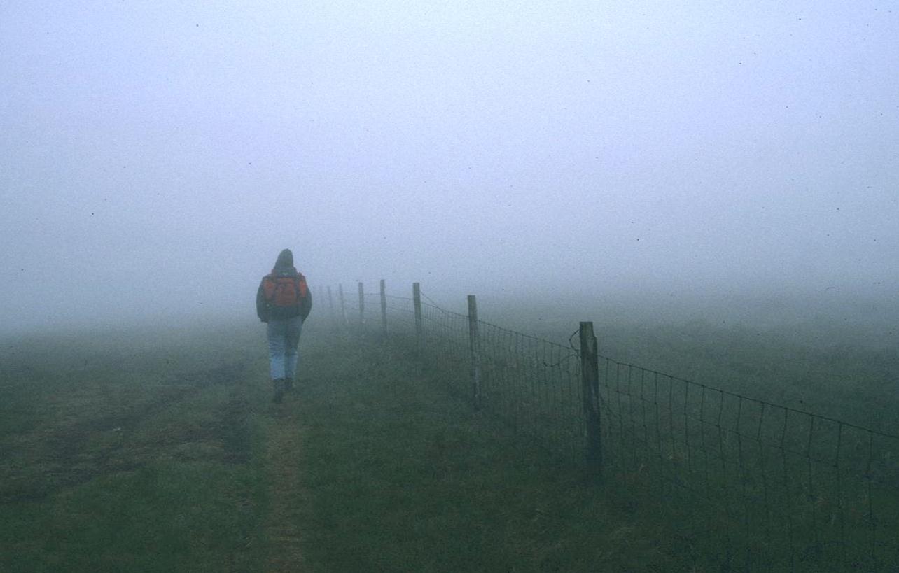
Tosh disappears into the mist on Red Crag.
I used a version of this photo as an illustration in my A Walker’s Alphabet.
When I looked outside early the next morning I saw only gray. Later glances confirmed this dismal prospect and by the time I was ready to go down to breakfast a drizzle had begun. I was greeted by the same forlorn faces that had stared accusingly at me two years ago – over breakfast at the Patterdale Hotel. Remembering that morning, Tosh now said, “Let’s see if he has thought up an alternative plan.” I had not – for a day on the buses or in cabs would have been very awkward from Pooley Bridge and, besides, I hadn’t quite given up on walking today. I was quite dispirited, however.
We had muesli and the Swiss Breakfast (English would have been an additional $4.50); the former featured a plate of cold meats, a soft-boiled egg, and croissants. The croissants had not arrived and toast was offered as a substitute. The egg also failed to materialize – a very odd meal indeed. While the Lees were finishing I grabbed my rain cape and dashed across the street to look at bus schedules. Then I called the Cumbria Weatherline and then the mountain weather forecast on a Windermere number. The latter promised a dull, often wet day, but also promised “moderate visibility at all levels.”
Encouraged by this fact and by the end of the rainfall I returned to the Swiss Chalet to share my information with the others and to urge that we begin our walk after all. We could always turn back if conditions were too awful and, no matter what the discomforts, they seemed less troublesome than the tedium of a day of spent waiting around. The Lees agreed, so we paid up, crammed our lunches into our packs, and, at 9:00, began our fifteen-mile trek to Troutbeck. This proved to be a day of great adventure for us – one memorialized twenty-five years later with the publication of A Walker’s Alphabet, my book on the joys and challenges of the long-distance footpaths of Great Britain.
Tosh had never done fifteen miles and she was full of misgivings over this stage – one I had invented in order to miss out on the steep descent to and re-ascent from Howtown recommended by Dunn. Perhaps her initial reluctance manifested itself in the long time it took us to get out of Pooley Bridge – with Tosh and Harold again pausing in front of every garden to admire the flowers, readjust a sock, or put on some more tape. I was alone in wearing my rain pants – this I did not because of rain, which was only a threat most of this day, but because I expected juicy surfaces underfoot. We found plenty of these.
I was counting crossing tracks as we re-climbed the lane over Moor Divock and I must have miscounted – turning onto the moorland on our right too soon. We hadn’t made much progress in a southerly direction when I saw my mistake; we had to re-cross a small beck and continue uphill – quite juicy indeed – until we had drawn parallel with the cairn on the Moor Divock road. From it there came a track heading south and we took it to the Cockpit Stone Circle, where a westerly track took off for a low level passage to Howtown.
We needed, however, to ascend in a southwesterly direction, up Barton Fell – with Dunn warning us that the desired track would be unclear at the outset. I wandered alone down the Howtown route, looking for a likely turnoff, found none, brought out the compass and, taking my bearing, left the comfort of a dry tail, climbed up the moorland a short distance and signaled to the others that we would begin our assault here. The Lees slogged up to join me. I pressed on in very wet conditions for many minutes, moving from right to left and back again in search of any sign of the Roman Way. I found it – that is we encountered a real track heading in the right direction, but it was not until we started to encounter the wooden fences over the advertised reservoirs that I felt sure I was on route. Tosh had been testing me with every detail – “Is this on the map?” When I could at last say yes, she seemed most relieved.
It was particularly fortunate that we now had a firm trail beneath our feet because after we had been walking for an hour and a half we were suddenly enveloped in mist. At first there was some moisture in the cloud and I put on my rain cape (always assisted on this trip by Harold), but after a while there was just mist and no wet. No one would call this moderate visibility, though occasionally the fog would lift and we could see Bonscale Pike or the valley of Swarthbeck Gill. The Standing Stone on the track was another good landmark.
The Lees paused every few minutes for a snack and we all had a slug of gin. Every now and then the temperature would suddenly rise, the sun would break through and the focus of the scene would shift from short to long again. Such moments had a tremendously heartening effect on three rather gloomy and anxious spirits. Because of the minor shifts in direction taken by the track I knew exactly where we were, but it still felt as though we were lost to the world. Finally, after a quite gradual five-mile ascent we reached the ruins of the chimney on the south side of Loadpot Hill. It was close to noon. We had a good rest here and ate some of our sandwiches. Or the others did. I marched around in the mist with my compass, looking for a continuation of the path.
This seemed to head due south (not the southeast of the OS map) – down to the flat col between Loadpot Hill and Wether Hill. We could see islands of exposed peat standing sentinel on our left, but conditions underfoot were excellent. We crossed the two summits of Wether Hill. Once I was almost garroted by the wind’s action on my camera strap, my compass string, and the long shoelace I had tied to my plastic map case.
On the other side of Wether Hill there were again tall peat islands, but the footing was good. Fortunately, given the mist, there seemed to be a very good track underfoot up here on the High Street route, and we also had a variety of walls, some stone, some wire, to accompany us for the next mile or so, over Red Crag and up much of High Raise. Once or twice we had eerie patches of clarity so that we could see down a ravine or up the track ahead – and I took some photos at such moments. Then the mist would sock us in again. It was at its worst on Rampsgill Head – where I lost track of any path amid the summit furniture of countless cairns.
I continued on, however, and came to a track along a deep declivity to our left side. This I took to be the route to Kidsty Pike, and I was correct – for by turning right on it I soon placed us at the junction with the Patterdale path – in the footsteps of my dog Bertie again.
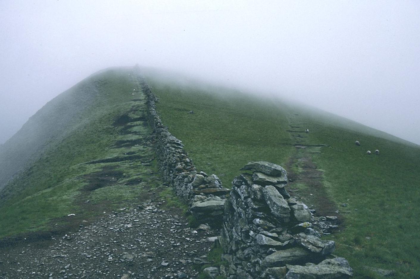
At the beginning of the High Street ascent
I was extremely relieved to have gotten us to this point, for, if necessary, I knew we could even follow a wall all the way over the top of High Street itself. But the mist was lifting a bit now and so we took the long trek southward on the Roman Way itself. After a few minutes we encountered another walker (our first), who was looking anxiously for five Oldham schoolboys who were missing at a rendezvous point on their Duke of Edinburgh gold award scheme. He was also looking for their “assessor” (whom he took to be Tosh!), though this turned out to be another gentleman – whom we found running down the track with his dogs a few minutes later. We continued over the crest and descended to the wall corner, where there was a little shelter from the wind. I had a Mars Bar and put on my jacket. It was quite cold. We were again interrupted with queries about the five missing boys.
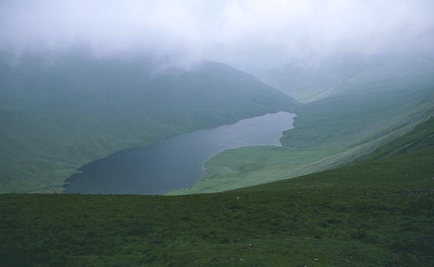
Hayeswater from the High Street trail
After we had seen the last of Hayeswater Reservoir and descended Thornthwaite Beacon it was time to look at last for a turnoff from the ridge track itself; we needed to find the start of a long steep “Scottish Rake” down to Hagg Beck. Kentmere Reservoir was clear on the left below us but we had been warned not to stay on the ridge too long. This sent me searching in the grass on the right side of our path rather too soon, but eventually, as a maze of tracks all seemed to converge on the ridge, our turnoff became clear and we began the slow, steep descent – with The Tongue as a landmark below and Hagg Beck, seemingly tilting uphill, waiting for us.
Tosh was the first down, I last. We rendezvoused at Blue Gill, where I ate an apple. When we began to walk along the track out of the valley I had to pause to cover a blister on one heel with more tape – the original patch had come loose in all the wet. It was warmer here than up top but it rained for a few minutes – the only true rain of the day. I put on my rain cape – Tosh still complaining that I had promised to get rid of it. “Yeah,” I agreed, “but I need new boots more. If I get a rain jacket I’ll need new rain pants to match and a new waterproof knapsack – we’re talking hundred of pounds here.” Eleven years later, with new pack and new boots, I was still using the offending cape.
The rain stopped by the time we reached Troutbeck Park and Ing Bridge. Visibility continued to improve as we wearily pushed on among the tourists and took the steep road up to Troutbeck’s Town Head. At the top was our hotel, the Queen’s Head. It was 6:30. We had made it!
We were shown to our rooms in the building next door – I had a palatial suite with two bedrooms, a bathroom, a sitting room, TV, kitchen, and even the boiler room – in which I placed my boots and socks. We agreed to go right back to the pub for a pint (American tourists were trying out the dart board and gawking at the four poster beds) and then we went to our respective bathrooms for a soak. One of my toes was bleeding and I had walked a most uncomfortable sore between my legs. We had another drink and then went to the Mayor’s Dining Hall, which was bathed in the stench of burned chip oil. The Lees had steak, I had plaice. I thanked my partners for trusting me not to get them irretrievably lost on such a day as this had been. We were all very happy to have done so well on a day of great adventure – none of the famous views, but the feeling of a job well done. In the many years of walking that followed I could honestly say that there was no day to rival this one for its demands on my route-finding skills nor one, therefore, that was concluded with such a feeling of satisfaction.
To continue with the next stage of our walk you need: