
March 23, 2005: Woldingham to Edenbridge
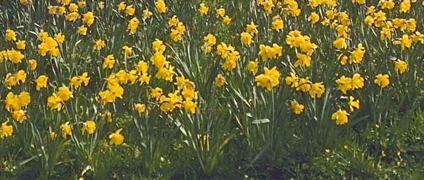
One of the great rewards of springtime walking
in Britain ¬– daffodils in bloom.
Just eight days after our previous outing on the LOOP I felt that the Lees and I could venture out of town again by completing the second stage of the Vanguard Way.
In order to take maximum advantage of our freedom passes and our senior rail cards I suggested that we each needed to be poised at our local tube station at exactly 9:00 – when our tube passes woukd become operative. Indeed I was about five minutes early at the Maida Vale station and used the extra time to buy two small bags of KP peanuts at the street level kiosk – thereafter positioning myself at the turnstiles so that I could pass through exactly as the clock struck 9:00. I dashed down the escalator steps and a train was just coming in. So, after a change at Oxford Circus, I was able to enter Victoria Station at 9:20.
The first Woldingham train that we could take after the 9:30 watershed (when our rail passes became valid) was at 9:53. I joined a long but fast-moving queue, with Harold a dozen or so bodies behind me. With all of our concessions a day return to Edenbridge cost only £3.10. By the time I had purchased my tickets Tosh was waiting for me with a cup of coffee – but I asked her to hold mine a bit longer while I used Dorothy’s new mobile phone to call the trainside taxi firm in Woldingham in order to request a car that could take us the two (mostly uphill) miles back to the Vanguard Way. It was hard making myself heard but the voice at the other end, after suggesting that an accident had closed their Woldingham office temporarily, nevertheless promised me a car for 10:25, our arrival time.
By the time I was off the phone Harold had emerged from the queue and we could already make a move toward gate 16. The turnstile didn’t want to take my newly purchased ticket (I should have used my freedom pass here) but a guard let me through and we selected seats in a snazzy new green car belonging to the Southern branch of the privatized rail system. I drank my coffee and we caught up on the latest gossip (mostly politics) and soon we detrained at the appointed hour.
There was no cab waiting and when, after ten minutes, I attempted to reach Catax (which seemed to have offices at many of the stations hereabouts) I couldn’t get a signal on my mobile. I could see the boarded up office of this firm as I headed into a BT call box, but their line was now busy. After fifteen minutes of waiting around I spotted a van with a cab symbol heading down the hill and I gave a wave. The cabbie (not the one we were expecting) backed into the station and I showed him on the OS map where we wanted to go. We were there in five minutes and were able to begin the day’s march only a quarter of an hour late – I still entertained high hopes of making it to a pub at the halfway mark before they stopped serving lunch and this still seemed possible in spite of the late start. It was a day that had called for a lot of fine-tuning in the planning and now a good deal of improvisation as well.
At 10:50 we were at last ready to push off and this meant a stint on a steeply rising track that climbed Botley Hill. I lead off (and indeed was usually in the lead today) enjoying the challenge of the assault on a wonderful spring morning with splendid views in all directions under blue, sunny skies cooled by a light breeze – with temperatures in the low 60’s. In a little over a week I had been able to shed scarf, gloves, wool hat and leather jacket in favor of my maroon sweatshirt, a baseball cap and a pair of cords.
Near the top of our climb we met two women and a dog heading downhill. The summit represented the highest point on the Vanguard Way so I suppose it is not surprising that a microwave relay station was off to our left – as well as several farmsteads over on the right. We emerged at last on a ridge top road next to Flint House and had a drink of water once we had dodged the traffic to get across.
I was charting our progress on the old OS sheet 187 in my map case and following the text of Colin Saunders’ guidebook as well – but I was surprised that our route began a steep descent on a half-right angle down to the North Downs Way, and not a half-left one. The views of the valley scene before us were spectacular, spoiled only by that gash of modernity in full spate, the M25 at the bottom of the hill. There was a bench with a view that took in this motorized lunacy. I snuck into a nearby copse and had a pee.
Then it was left (east) along the NDW, which I had walked over twenty years earlier – when the M25 was still a building project. Our route rolled up and down in a gentle fashion and we climbed several stiles before reaching a fieldside stretch on a slimy surface – where much of the path appeared to have been ploughed out. I saw a parallel route just inside Titsey Wood on our left and suggested we might find easier footing on a real path. Unfortunately, just as I was about to head into the woods I felt quite lightheaded again and said I would have to sit down on a log. The condition recurred on two other occasions this morning and I blamed myself for starting out without any food at all today, let alone energy-producing carbohydrates. Tosh chose an adjacent log (which snapped as she sat down) and we had a very brief rest before starting off again. I opened one of my packages of nuts and ate these as we moved east.
We descended at the end of this stretch, climbing down to a sunken road, saying goodbye to the NDW, and heading south to Pitchfont Farm. At a meeting of roadways there was some ambiguity over how to proceed across Titsey Park but an assertive blue Vanguard Way waymark was positioned at the head of a mucky track heading southeast and so we took this, moving ever closer to the motorway without encountering any of the landmarks mentioned in Saunders’ text. Eventually we crept beneath the motorway and reached the B269. But there were no VW signs here at all – and I was forced to conclude that we had missed a turnoff!
To right our ship we had to head north on the road, passing beneath the motorway again and persevering until I could see footpath signs that identified the missing VW coming in on the left side. The Lees were trailing in some puzzlement but they seemed to relax a bit when we reached a water company building and a stile with a VW marker. Here we followed a wire fence and, when it ended, made our way up to the margins of the motorway, using tractor trods to navigate the uneven surfaces of a nascent crop. I was a bit cross about this misadventure, always worrying about the hours of food service at our halfway pub, but when the Lees caught up with me, just after we had climbed up to a roadway over the M25, we agreed that, at 12:30, we still had over an hour to go.
Our way forward for many miles was almost due south, starting with a track which descended toward Broomlands Farm, where I had to wait for the Lees again and then uphill (there was again a lot more up and down on today’s stage than I had expected) with a huge sand pit quarry on our right. When things leveled off our road, now metaled, swung to the right and reached a junction with the busy A25 at Moorhouse Bank. I was able to assure the Lees, who again got out the canteen, that we had only a mile to go.
We used a bridle path to make a brief descent, crossing two fields and heading for a distant stile into the woods. Here we were directed uphill with quite a few helpful blue arrows at tricky junctions. (The VW seemed to alternate between blue and yellow signs, though signage was very inconsistent and often missing when you really needed it.) Near the end of this woodland stretch we met an elderly couple heading downhill. Tosh mentioned her need for the pub and she was told she had only to follow her nose.
We emerged at a corner of the village of Limpsfield Chart and, with the common on our left, continued forward to reach a road junction carrying the Greensand Way. To the right we could see a mass of parked cars, symbolic of the presence of the long sought Carpenters Arms. It was 1:35. I used a stick to scrape clay from my boots and Tosh and I had an ancient argument. “Suppose we should ask them if they want us to remove our boots?” the lady said. “Don’t even put the idea into their heads! They’ll then have to answer yes. Besides do you really want to go to the loo in your stockinged feet?” “Well,” she admitted, “I think you’ve persuaded me.”
In the event no one said anything about boots in this comfortable establishment where I chose a window table and we ordered our drinks and studied the chalkboard. The Lees had sandwiches and I had the jumbo cod and chips – quite good but jumbo only in Lilliput land. The place was not busy and the staff were very competent – when the Lees asked for coffee it was poured immediately. The upshot of all this efficiency was that I could see we were easily going to finish before the 2:30 departure time I had suggested as our next time target. There was time to visit the loos and to converse with the ancient pub lady (this was her third establishment) and to make our farewells at 2:20. I was aiming for a 5:08 train and I now felt quite confident.
We continued south, past the St. Andrew’s church and across the B269. In delightful stockbroker belt country we took a roadway steeply down the hill in the direction of Trevereux Manor at the bottom. Views were again excellent – with lots of trees in pink blossom and, at our feet, a variety of wildflowers in yellow – daffodils, primroses, even what appeared to be yellow violets (if that isn’t a contradiction in terms).
At the bottom we took a stile opposite Trevereux Cottages and walked south on grass past a large pond on our left. A dollhouse-sized Greek temple occupied an artificial island on this body of water, with a real swan, almost as large, guarding the drawbridge. We passed a second pond and headed across a large expanse of greensward, aiming for a break in a distant hedge. This concealed a ditch carrying the Kent Brook and marked the boundary between Surrey, which we were leaving behind and Kent, which we now entered,
We continued forward with a fence on our right, climbing a stile at the end to curve around to a road at Hurst Farm. Here we followed the road around to the left and entered an entranceway to Old Dairy Farm, where a tractor with tusks was just lofting two giant sacks – which the fascinated Lees identified as nitrate fertilizer. I found a stile and we followed another fence to an upper corner where a second stile put us into another field. The Lees were still mesmerized by the nitrate sacks that were soon being decanted for use by a second tractor.
We were entering a section of the Vanguard Way that Saunders warns walkers about, the route having been realigned and older descriptions no longer being accurate. Having discovered the author’s email in one of my Ramblers Associations publications I had entered into some correspondence with him since our first walk on the VW and he had sent me some route updates. Nevertheless we were about to endure one of those puzzling stages where the text didn’t seem to have an exact parallel in the red dash marks of the OS map. Almost immediately we went wrong.
You can either put this down to my inability to follow orders or the inconsistency of VW waymarkers but having had a number of yellow discs recently I expected one to be on a stile just forty meters along our next fence line. When none was offered I continued forward to a much more inviting stile straight ahead of us – and the consequence was that we descended our next hill too far to the right.
Matters weren’t helped when I discovered a pond at the bottom (a real pond but not the one advertized) and felt for a brief moment that I had made the right move. When the next set of instructions didn’t compute, however, I ordered a partial retreat, having decided that we were on the wrong side of Guildables Wood and that a track along its northern perimeter should be taken to move us eastward. This strategy worked and we rejoined the VW (now waymarked) at the wood’s northeast corner. Bunny rabbits were scurrying in all directions.
We headed south along the east side of the wood, noting that the sun had pretty much disappeared and that it was a bit chillier in the grey (the Lees were taking their coats off and on all day). After clearing the wood we continued south along the edge of two fields and turned right along a fence for 50 meters – where a stile invited a crossing.
Here too there was some ambiguity. Saunders mentions local footpath 591 and encourages walkers to enter an enclosed trackway once over the stile. But he doesn’t say you have to turn right to do this (there was an enclosed footpath heading west here but at the bottom of the hill I could see an enclosed trackway heading south). There were no useful VW markers so I chose the southerly option and we continued forward in increasingly poor walking conditions over some broken down stiles and up the hill to Hilders Farm and so out to a road. There had been a number of 591 signs about – but my guess is that we should have headed west not south at the point of puzzlement.
A chap was cleaning the banks of a huge pond belonging to the farmstead and he certainly didn’t seem surprised to see us. We turned west now and walked into the village of Troy Town, turning south after a road junction to cross a railway line – definitively back on the VW but about to leave it for the day since it turned right here – and we had to head for our train station in Edenbridge by turning left.
For a while we sat on a bench overlooking this junction and then, as Tosh wanted a last loo stop, I found a footpath into some woods next to a factory and we all made a brief visit to some foliage. I could tell we would have no difficulty in making our train but this did not make the road journey any more pleasant since there was no footway along a road that turned from east to south and passed under our railway line. Cars whizzed by a great speed and we were happy to encounter pavement as we at last reached suburbia.
I was navigating by OS map alone now and I had to figure out which road to take east to reach Edenbridge Town Station. (This is a community that has two stations on different lines; the one just called Edenbridge Station is, confusingly, in Marlpit Hill, farther north, but the one we were heading for would make it easier for us to rejoin the VW next time). At any rate I guessed right, we made a left turn along a terrace of houses dated 1905 and had soon reached the B2026. But, as we made a perilous dogleg to the north, we discovered that the recently re-engineered junction here made no concessions to pedestrians whatsoever. Nevertheless we persevered and were soon heading east on our last street of the day, the closed station lying at the end. We had added an extra mile with our wanderings today, bringing the mileage total to eleven.
We walked around the building and found that we were on the right platform. It was 4:53 and we had only a fifteen-minute wait. I was a bit stiff and the Achilles tendon on my right foot was a bit sore but the exercise today had been very pleasurable. When our train arrived (another new green Southern train) I saw that we were about to enter a first class carriage, dived therefore into the next compartment and the doors almost closed on the trailing Lees. An announcement suggested that they could change at Oxted for Victoria but when Tosh and Harold did this a few minutes later they found that they would have to wait so long for this train that they got back on with me, still seated, and rode as far as East Croydon, where we at last parted.
At Oxted we were joined across the aisle by four teen-aged girls (sixteen or seventeen, I would guess) who provided us with great entertainment as they consumed a feast that included a giant pizza, chocolate chip cookies and some fruit (they couldn’t quite figure out if it was a nectarine or a plum). Their topics included school, fashion, sex and a gig they were going to at Ally Pally. They also provided imitations of school personalities.
They detrained, as did I, at the end of the line, London Bridge, shortly after 6:00. Again the machine wouldn’t take my ticket (again I should have used just my freedom pass; the train tickets, after all, were to and from zone six). A guard let me through and I headed for the Northern Line, intending to ride two stops and pick up the Bakerloo Line at Elephant and Castle – where I would be certain to have a seat for the rest of my journey. (I could have used the Jubilee to Baker Street too).
I had an unusual journey through the bowels of London Bridge, passing through a delicatessen and along tunnels with exposed wiring before squeezing onto a Northern Line cattle car. My Bakerloo Line journey was much more comfortable and, the last of the light fading from the western skies, I reached home at 6:50 after another successful outing.
To continue with the next stage of our walk you need: