
June 17, 2005: Shap to Askham
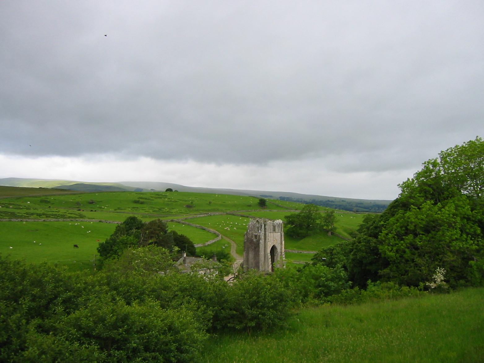
Shap Abbey
I was keenly interested in the weather as dawn brightened this corner of Cumbria on the morning of our third day on the Westmorland Way. I could see bright patches, some blue sky, and also a lot of very menacing black clouds as well. It looked like the sun would make an appearance, however, and so I was reasonably encouraged at breakfast time, 8:30, when Harold and I met the ladies for our usual repast. Our clothes were warm and dry and we dragged our packs downstairs to await the arrival of the Brigantes folk. It was 9:30 or so when we emerged onto the A6 and began our trek.
It was quite fresh outside and the skies continued to be a mixture of warring elements; nevertheless visibility was excellent as we headed north on pavement, stopping at a newsagent to buy our sandwiches and snacks. Tosh then made a second stop for pastry at a shop for walkers. There was no sign of the Knead the Dough bakery any more, but I must say that Shap seemed to have revived a bit after a long period of decline and decay – walkers have a lot to do with this; they ought to build a civic monument to A. Wainwright in many a Lakeland town.
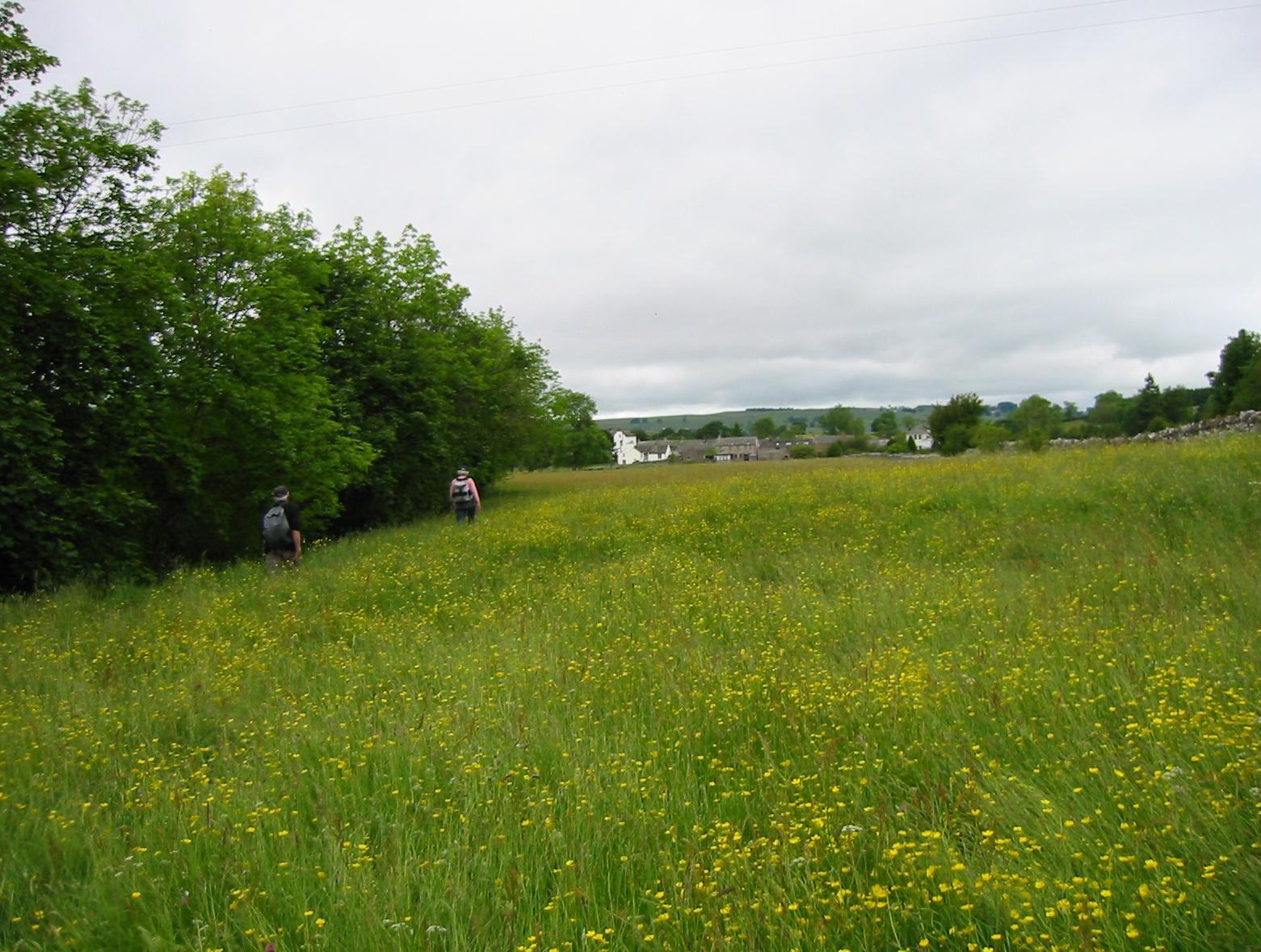
We turned off at the fire station, and, after rounding a quiet corner, entered the first of a long series of buttercup-strewn meadows (there isn’t much depth to the village of Shap, only length). There were a number of stiles to scramble over and gates to push and soon we were at the ancient Goggleby Stone, where I had my picture taken. Our route paralleled a road and once we had to debouch into this for a brief period because of obstructions on our path. Two large trees also proved to be useful landmarks and we eventually found a wall stile that put us onto the lane, just as it completed its descent to the village of Keld.
This proved to be a delightful spot and we walked down into it to see its 16th Century chapel and its flower-bedecked cottages. Then we backtracked to continue in a northwesterly direction along a plateau above the young River Lowther. We passed to the right of a house that had once been a barn and followed stone walls. Hannon suggests that the next stile is “easily missed” and so it was – as we discovered when we ended up in a cul-de-sac of walls. Retracing our steps we discovered a set of steps embedded in a wall and used these. I was keeping an eye on the skies but the black clouds seemed to be moving away – and our views of the High Street range were improving with every step.
Soon our view also included the tower of Shap Abbey, below us on the left. I found a way down a grassy hillside so that we could visit this setting – which also seemed to have improved its appearance in the twenty years since we had visited the site while completing the first third of the Coast-to-Coast Path. This time we sat down on a bench amid the ruins and Tosh had a snack. There were a number of other walkers about, the first of a veritable army we would encounter over the next few days.
After our rest we climbed the access road and turned left at a house, entering for the first time on this trip the confines of the Lake District National Park. Hannon suggests the use of a gate here – though an approaching American was mounting a tall stile in the field to our right (another rerouting perhaps). His wife, however, was glad to follow us in the use of the gate we had just opened for her. Several more gates followed as our mostly level route crossed several pastures in a delightful countryside, with the Lowther making its watery presence known below us. A stile permitted access to the lane at the hamlet of Rosgill.
Our visit here was short, with another stile across the road inviting us to continue on our northwesterly line. The route then took a half left downhill, with telegraph poles serving as waymarks, and putting us on the access road for the farmstead of Hegdale. Four dogs rushed out to greet us here and the farmer emerged to quiet them down. Three were sheep dogs but Jack, the most boisterous, was a Springer Spaniel. A farmer now warned us of some unpleasant stretches ahead, spots that had been washed out in the January rains and which he hadn’t had time to fix yet. His dentist hadn’t had the time (or the opportunity) to fix this chap’s teeth either.
Approaching Bampton Grange
More riverside pastures followed and after crossing a small stream we could see the first of the buildings of Bampton Grange. Our path lead through a giant field of buttercups and directly into the churchyard. Having used Dorothy’s mobile phone last night I knew there was no chance of a pint at the Crown and Mitre across the street – it too didn’t open its doors at noon. This was shame, since it would have been nice to have visited a spot where we had twice spent the night on earlier adventures.
It was 12:45, lunchtime, but there were no benches in the churchyard and I wasn’t comfortable commandeering the pub’s outdoor tables. In the event we sat down on a low stone wall after crossing the bridge, and had our lunch here. There wasn’t too much traffic and the sun was definitely winning its battle overhead.
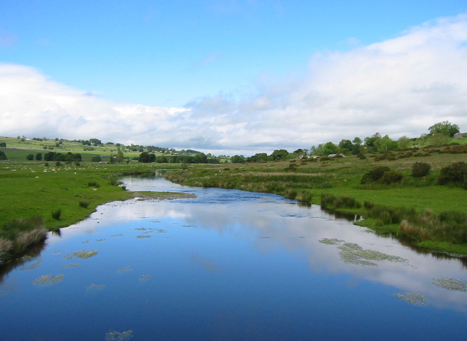
A suspension bridge takes the walker over the River Lowther north of Bampton Grange.
We had a bit of road walking on the west side of the river when we started up again, not even reaching Bampton itself before being directed back to the riverbank for easy progress along the Lowther. A suspension bridge had been erected for walkers and after a mile we used it to return to the east bank, climbing uphill toward a red telephone kiosk at Knipe Junction.
The sun was quite warm as we began a lengthy stretch on tarmac, much of it uphill, and I made the mistake of telling Tosh that we were looking for a track off to the right – this lead to quite a few premature nominations. Eventually we were directed over a stile and down a very large sheep field dotted with hanks of fallen wool. Tosh picked some of these up in case Margie wanted to use them to knit a sweater – but I don’t think anything came of this project.
At the bottom there was a stone slab footbridge and a scramble up to some houses in the hamlet of Whale. Here we actually walked uphill for a bit before turning left to enter the wooded confines of the Lowther Estate. Above us we could see the rocks of the Burtree Scar but the castle itself was hidden in the trees. We were offered a well-shaded delightful track (many pauses for private peeing) and continued to make excellent progress. The river disappeared into a ravine and we climbed up into another patch of forest. We didn’t encounter an advertised cattle grid and our turn off didn’t quite meet specifications either – Harold could find no “grassy avenue” and had to settle for an earthen one with grass growing by its borders. This delightful and level path brought us out to the bridge over the Lowther at Askham, and we headed steeply uphill on tarmac in search of our nighttime pub and its accommodation.
We didn’t find it (there are two pubs in Askham) but we did find the Punchbowl Inn and, as it was just 3:30, we decided to sit down for refreshments. The pub was full of ancient photos of the local hunt (now facing an uncertain future) and here we heard that the local shop was closing down as well. Still, the village, on either side of a multi-staged green, had a prosperous air to it. We were delighted with today’s ten-mile journey (and the fair weather) and after almost an hour we continued up to the main road – where the Queen’s Head was at last located. It was now 4:30.
Our packs were in the vestibule and here we each had our own room again (The Lees ended up in the Lowther Suite, which had a four poster bed and a sagging mattress.) I couldn’t get a signal on Dorothy’s phone so I used the call box across the street to phone home for news of the painting of the sitting room – which was going slowly. We met for drinks at 7:00 and then entered the walker-choked dining room where I had the cod and chips. Harold wanted the pork, was encouraged by his wife to try the lamb instead, and ended up with something he really didn’t want. Again we all had an early night.
To continue with the next stage of our walk you need: