
June 19, 2006: Troutbeck to Underbarrow
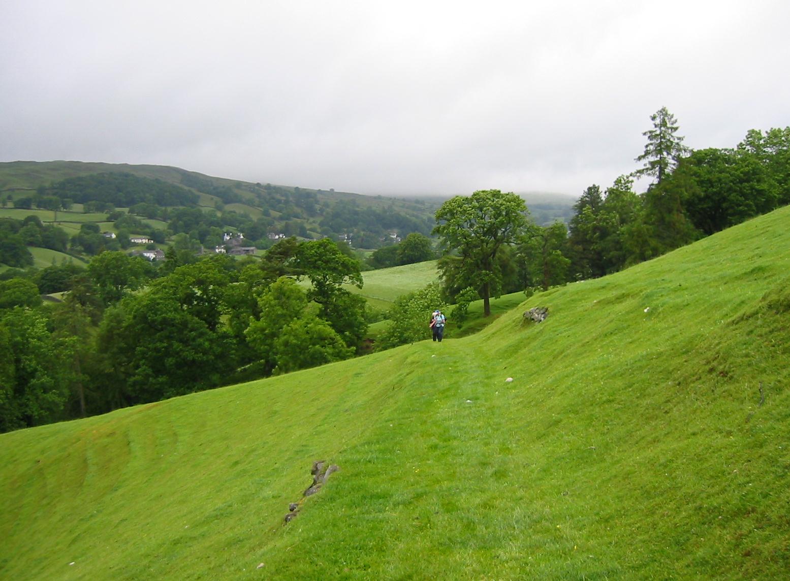
Approaching Far Orrest
Every time I had a chance, I peered out of my bedroom window on Monday morning in order to see if there had been any improvement in the weather. It was still raining every time I did so. We met at 8:30 for breakfast and then waited around for our sandwiches as Tosh paid the quite substantial bill. This time it was necessary for us to put our big packs in order and to bring them down at 9:30 – for once again I had arranged for the Brigantes company to transport them on each of the three remaining stages of our trip. We left them in the lobby, zipped up our rain gear (this time I wore neither sweatshirt nor cap) and headed off in a fine drizzle at 9:45.
Technically speaking, only yesterday’s route belonged to the heart of Lakeland and now we were heading out of this sacred region again and into the Cumbrian margins that had provided us with so many wonderful and picturesque walking itineraries. The route to Underbarrow combines lots of farmland with remote rural outposts and open fell country and I knew it would be a complex undertaking. This meant close attention to Hannon’s text – which I had again secreted in my map case.
We travelled south on Troutbeck’s high street and soon reached the post office again. This time it was open and the others trooped inside for snacks and newspapers. Many villagers were likewise arriving in their cars and we chatted briefly with them about the grim weather. Then we rejoined the Westmorland Way and continued on to Town End, where the National Trust maintains an attractive property and its burgeoning gardens. Our turnoff from tarmac, on a side road down the hill, was almost missed because a woman had just backed her car into our trackway – which also served as the route to her garage. Nevertheless we waited her out and began a descent on an enclosed track that brought us down to a crossing of Trout Beck itself. Wooden bridges lead us onto a tiny island here and off it as well after a few steps. At the bottom of a grassy field we began a steep but short haul up to the roadway above, the A592 that unites Windermere and Patterdale.
We had a brief rest here and then turned south on the road, grateful that someone had provided a tarmac footpath – though when a line of trees separated it from the roadway I began to worry that we wouldn’t see our next turn off across the street. Not to worry, the stile in question was still in view and we climbed up onto a grassy ledge with good views of Lake Windermere on our right. At the end of this stretch we climbed between two houses, stopped in our tracks by a hand-lettered sign affixed to the fence in front of one of these. The message was a quintessentially English entreaty, which I repeat in toto: “Post Please put letters for Frank in porch. Blue tits nesting in mail box! Thanks.” It should be noted at this point that the early morning rain had now stopped and that the sun was trying to make an appearance.
We continued forward on a tarmac road and made our way to the confines of Far Orrest Farm. Here I had some difficulty in following Hannon’s original text and in reading the clues provided by a variety of footpath arrows on the ground. Hannon’s maps, which suggest a flanking movement around the northern margins of the farm, proved more useful and soon we had bypassed this property and located the required exit gate. The latter was surmounted, however, by a slow moving snail and we paused to observe its movements as I took a picture of Tosh, peering down at the creature.
Our way forward led us through a number of fields, with walls to give us our orientation and stiles our entry into each field’s successor. Our goal was Near Orrest, but as we neared this farm it was obvious that building was taking place on the slope facing us and that we would have to detour around the site. We climbed up the hill in the bright sunlight and, fortunately, found stiles that permitted our exit onto a rural lane. Here we turned east and soon reached a crossroads where we again had a bit of a standing rest.
Then we took a second tarmac road to the south, passing not only the expected Common Farm but quite a small community of private houses as well. After a mile of road walking we reached the A591, the main Kendal-Windermere highway, where our crossing was held up until a space appeared in the whizzing traffic. On the other side we headed uphill in a westerly direction, soon leaving the cars behind us for a passage through several fields. I wasn’t entirely confident that Hannon’s directions still applied to a somewhat altered landscape, but we persevered through some overgrown sections and were rewarded with a sighting of our goal – the railway line to Windermere (which we ourselves had travelled over two days earlier).
I must say that I was quite relieved to discover that stiles permitted pedestrian access to the railway line; after the closure of such a crossing on the main line two years ago, one that necessitated quite a Dales Way detour, I had been afraid of encountering a sequel on this trip – and we still had two such crossings to negotiate. Now we pitched up at a delightful house with a pond and well-tended gardens called Sheila’s Cottage, according to the guidebook. A right turn here put us into the precincts of the Droomer Estate on Windemere’s outskirts, though I suspected that the street layout today might be slightly different from Hannon’s version of yesteryear. We persisted in turning south, however, and before long we were ready to enter a field at the bottom of School Knott.
We had been staring at this rugged hilltop for some time but now, with the urgings of hunger pushing us on, it was time to give it a go. There wasn’t much of a path, though Hannon’s instruction to aim for the highest point was sufficient. (Harold, I later noted, reached mile 2500 in his walking career on this ascent.) The others, who tend to precede me on steep ascents, chose the rocky outcrop on the northern end to head for and were somewhat nonplussed when I passed them by and headed for still higher ground to the south. At only 760 feet in elevation, this conquest of School Knott was not going to go on for too long in any event and soon we were on top – with a wonderful panoramic view available.
We searched about for a place to eat our packed lunches, a hawk hovering just below us. Once settled on a rocky ledge with some shelter from the strong winds, we tucked in (Harold didn’t like his cheese sandwich after all). The rest of us enjoyed our ham versions (though a piece of lettuce or tomato would not have gone amiss) and there was a packet of crisps, a bottle of water and a pseudo-Twix in the bag as well. To our surprise, however, the appearance of four strangers seemed to act as a magnet on the curious sheep who dotted the fell below us. Pretty soon the whole flock was running uphill to have a better look, stopping just before our knees, with a couple coming round behind us to stare down at us with their weird rectangular irises. We were well amused.
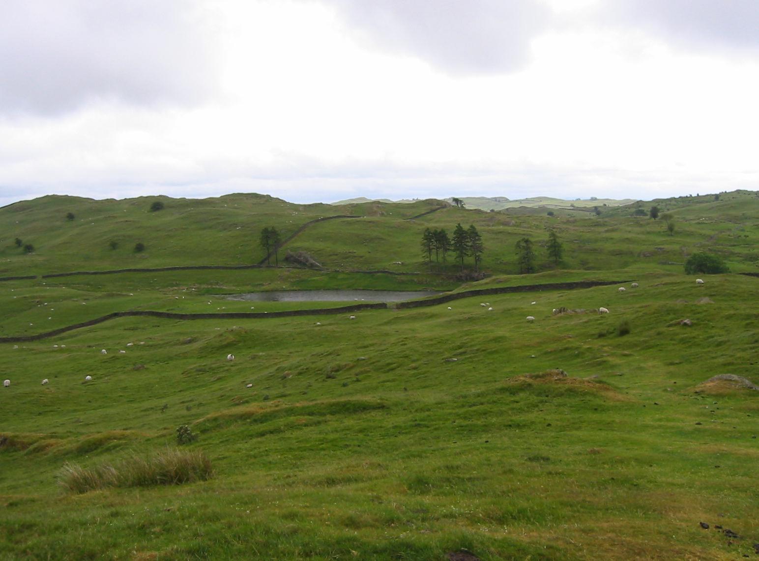
School Knott Tarn
After half an hour or so, we began to walk down the grassy hillside toward School Knott Tarn. When we reached the side of this small body of water we turned right to follow its outflow, crossed the beck and arrived at a corner of fences where, just two days earlier, we had descended during our last walk on the Dales Way. We now rejoined our old friend for a mile or so – though today we were walking uphill and in the opposite direction. It took me a while to figure out how we had come downhill but at last I found a direction post at the head of a fairly flat piece of fell just above Hagg End farm. No one was eager to revisit this spooky place but we persevered and climbed down among the junk to find that, today, the place was empty.
We had a brief bit of tarmac as we passed Outrun Nook farm and then climbed up to a bluff that separated this tidy farmstead from its more rugged southerly neighbor, Crag House. Here was our new turnoff for we were to continue to the south, while the DW went east. Our goal was the infant River Gilpin, here just a beck in rather rough ground. Our path, such as it was, climbed above the stream and continued south using stiles to reach improved footing as we neared the B5284. Near the end of this section we could see the buildings of Crook over on our right and I now proposed a short detour (having made a critical inquiry about opening hours the night before) to the Wild Boar Hotel (or the Famous Wild Boar as they liked to call themselves), an upmarket hostelry only a couple of hundred yards to the right. It was 3:00.
We sat outside for a bit (though the furniture was still wet and we had too close a proximity to the passing traffic), and then we went inside with our drinks. I had a pint of lager. The barperson was a girl from South Africa – which made a change from the usual Eastern Europeans encountered elsewhere in such roles in the Lake District. We didn’t linger for long and after half an hour or so we returned to our turnoff on the B5284, and continued on a tarmac track toward Brow Head on the Crosthwaite-Crook road. The sun was still shining brightly and the views of distant Kendal on our left were quite cheering.
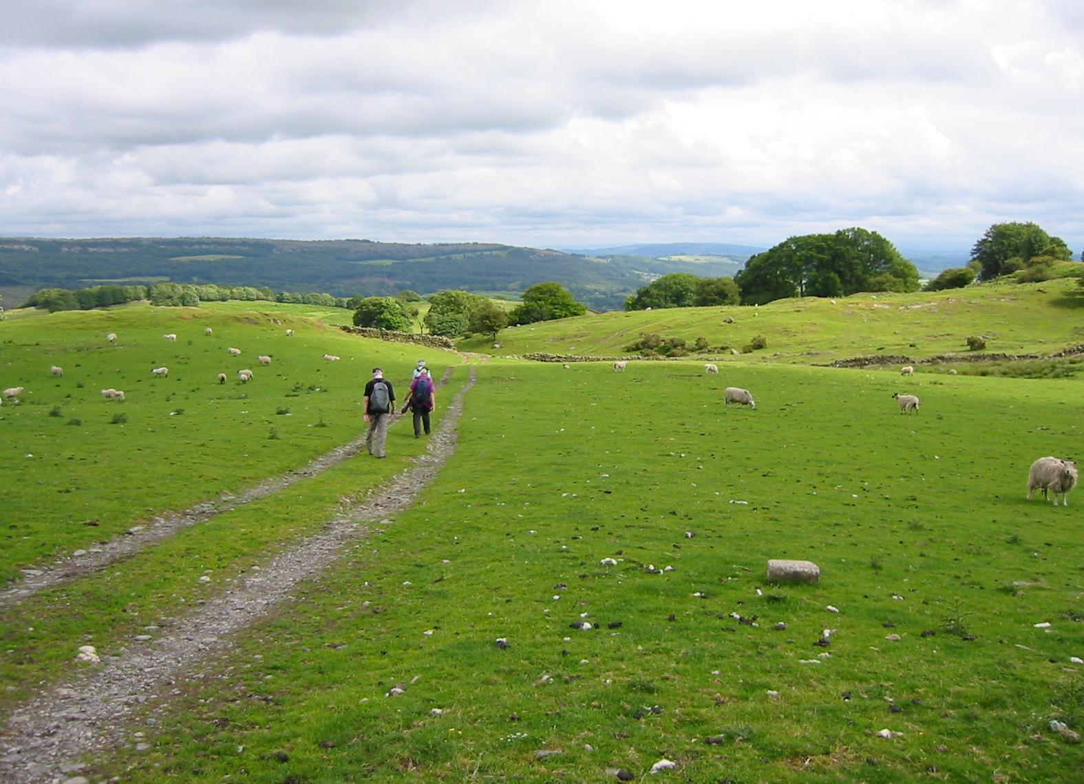
Beyond Low Fold Farm
We turned left on the road, then departed it for a track on our right. Now we had a steep bit of uphill to a crossing track and here we climbed a stile into a field for a protracted bit of cross-country walking. We had several stiles to climb (others seem to have disappeared in this section) before reaching Low Fold Farm. We used its access road to escape the farm but soon thereafter we entered a mostly empty bit of fellside, with not much to help us guide our steps. I tried to keep us going in a large open field, utilizing a stone wall as my guidepost but some of the hints in Hannon no longer made sense and we were soon making our way forward between woodland on our left and the stone wall on our right. I persevered, since I knew, with the help of my compass, that we were heading in the right direction, but soon we encountered a nasty almost pathless descent in thick bracken – and I also knew that no one would want to re-climb this hill if this should prove to have been a wrong move.
It wasn’t, and at the bottom we found an escape onto an enclosed road. We turned to the right here and, after a short distance, went through a gate to begin a wooded section leading down to a road on the outskirts of our long sought-after destination village, Underbarrow. After a short left-hand dogleg on this lane we were back in fields to cross several more obstacles and to emerge at last on a road adjacent to the Underbarrow Church. I took a picture here while the others waited, and then we set off on what I expected to be the last stage of the journey.
Again, however, I think that some changes had taken place on the lane we were meant to use. Seduced by footpath signs we used the first left fork, as suggested, but I think now that we should have been further along than this. Our route led us behind houses, through gardens and over walls – with none of this corresponding to Hannon. So I called a halt, pulled the old South East Sheet of the English Lakes series from my knapsack, and called a retreat. I couldn’t see exactly where we were but I knew that if we returned to the church that I could then use roads to get us to the part of Underbarrow we wanted. This we did, heading first south on the Chapel Bridge-Underbarrow road, and then taking an eastern turnoff toward Fallen Yew. This was mostly undistinguished suburbia, but the reward was a sighting of our terminus across the street, the Punchbowl Inn. (The Punchbowl Inn of Underbarrow is not to be confused with the Punchbowl Inn at Crosthwaite, where Gavan and I had stayed while walking the Furness Way – only a few miles away.)
It was 5:45 and we had walked 11.5 miles, including an extra half-mile I had added following our recent misadventure. I knew (again from a much earlier phone call) that the pub didn’t open for another fifteen minutes, but the others wanted me to summon a taxi now, rather than to wait for a comfortable spot inside. My mobile phone was pulled out and the first number I called, Atlas Taxis, responded – with the driver saying he would be with us in fifteen minutes. We sat on a low wall in the Punchbowl’s parking lot, glad that the weather was now so pleasant. I would have preferred an overnight stay nearby but the landlady of Tullythwaite House had informed me that she and all but one of the five b&b ladies of the village had gotten too old for bed and breakfast and hung up their pinnies. (The one still in business was somewhat off route and didn’t have enough beds anyway.)
We were now headed for Kendal, which meant a dizzying ride at great speed over a flank of Scout Scar and then a descent into a town revered in the walker’s pantheon as the home of A. Wainwright – who served as borough treasurer here. Our hotel, the Highgate, stood centrally on the main street, and here we arrived at 6:15. We made arrangements for a 9:15 pickup with our driver, after a brief conference with our landlady about her breakfast hour. At the Highgate Hotel we already had three en suite rooms booked – and our bags were waiting for us as well.
We had a nice cleanup and then, following the advice of both the cabbie and our landlady, we headed out the back door to the Green Room restaurant in the adjacent Brewery Arts Centre. We had drinks from the bar as Harold introduced Margie to Macallan whiskey; these were brought to our table, where I again had the fish and Tosh denounced the baby corn and the mange tout – not the Green Room’s baby corn and mange tout but all baby corn and mange tout. After a leisurely meal we strolled out into the twilit streets for a stroll up to the town hall and back. Our rooms were perched above the traffic but shutters had been installed and the noise was not a problem. I called Dorothy to report on our progress and again had an early night.
To continue with the next stage of our walk you need: