
August 23, 2015: Wooler to Fenwick
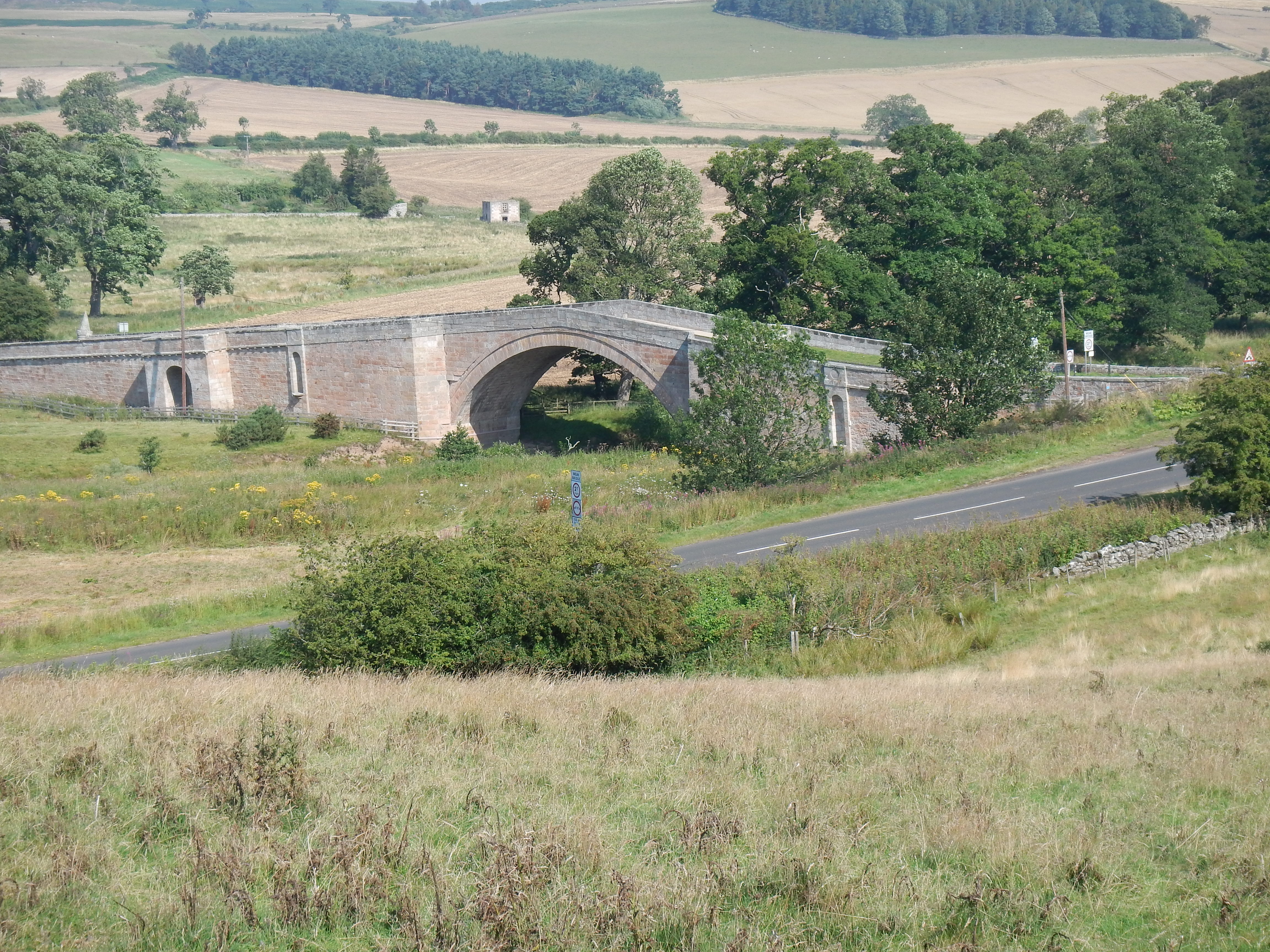
At the end of a dicey descent, Weetwell Bridge.
The sun was shining brightly as Gavan and I completed preparations for our next-to-last day on St Cuthbert’s Way. These included restoration of the sunblocker to the daypack. Indeed, we now lathered up before setting forth at 9:00. We wanted an early start because this would again be a lengthy day – with eleven and half miles ahead of us.
Wooler seemed all but deserted on this Sunday morning, just a few dog walkers and one or two people heading for services at St. Mary’s Church (“No Dogs”), in front of which I stood while Gavan stocked up at the Co-op at the bottom of the market place. We crossed an iron bridge over Wooler Water and turned right to pass a bowling green and on to Brewery Road. Here we turned left to pass a middle school – still welcoming its pupils with stone lions made by Italian prisoners of war. (And what an irony to have memories of the prisoner of war experience on either side of Wooler.)
The road headed in an easterly direction but at a junction there was a bit of a surprise – for here we were joined briefly by the Broussine family, who had spent the night at a nearby farmhouse. Soon they were far ahead of us as the road climbed steeply; we knew that there would be no major summits to conquer today but this stretch was strenuous enough. When the road made a turn to the right we were directed to a track and soon we were marching along the face of Weetwood Bank, with interesting retrospective views of Wooler and the territory we had used to reach it. (This would be an appropriate time to remark that the SCW was well way-marked throughout.)
Our footpath through the bracken and the wildflowers was not easy on the feet, overgrown and rocky in places, and the closer we got to the end of this section it also became ever muddier. A clearer track took us now across Weetwood Moor, again moving us in an easterly direction – with a number of plantations helping us with our orientation. Fences and stiles were also clues as we turned left in preparation for a descent into the Till Valley. Almost from the outset we could see our objective in the valley below, the humpbacked Weetwood Bridge. But getting down to it was a perilous undertaking, the path extremely slippery and muddy and overgrown. As we cleared the last overhanging rowan I again had occasion to celebrate the utility of my walking stick.
Gavan, well ahead of me here, had taken a seat on the abutment of the bridge itself and I soon joined him for a rest and a drink of water. I had one other task – I needed to replace my Explorer map with its earlier cousin, the one-inch-to-the-mile Berwick-upon-Tweed sheet 75, which I had retained from my days on the Northumberland Coast Path.
A good deal of road walking was now on the agenda as we crossed the bridge and climbed up to pass Weetwood Hall, heading in a northeasterly direction through an agricultural landscape. There wasn’t too much traffic but the road rose and fell and in the warm sun and it was a bit of a struggle for me. I remember that on the uphill sections I was happy to wait for my next pause until the shade provided by overhanging trees provided some relief from the sun. Here too I would take my cap off and let the strong breeze do its job of cooling my head. Whenever I caught up with Gavan I was sure to reach for the canteen and by noon I was already dipping into the needed liquid provided by an extra Diet Coke.
We seem to have agreed not to stop for lunch until we had reached St Cuthbert’s Cave, but this was still some distance away – progress as measured on the smaller scale map made it seem even more so.
Eventually we reached the farmsteads of East and West Horton, turning left on another road but not before we had a brief rest on a stone wall while a curious horse stared at us from across the roadway. Our new route evidently made use of the roadbed of the Devil’s Causeway, a Roman road, but we were soon directed onto a track on our right. We passed a giant construction of tires and even a pillbox as we gradually twisted down to Hetton Burn, which we crossed on a footbridge. Another rest was called for as we climbed a steep road on the other side. It looked like a gypsy encampment across the burn.
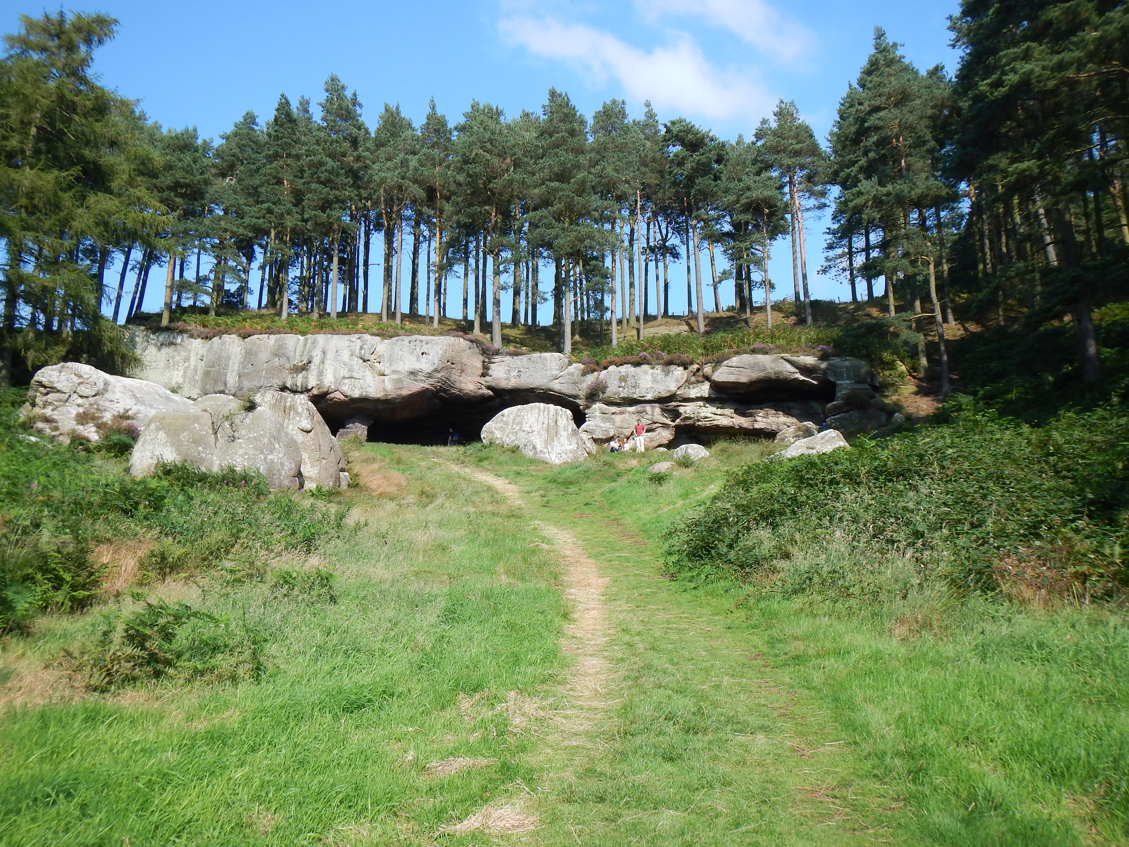
St. Cuthbert’s Cave.
The former Hazelrigg School was our next landmark as we continued forward on tarmac, following a more level section for a while. This was abandoned after a while for a return to footpath as we headed north, the wooded escarpment that contained our cave now a clear objective before us. More bovine characters had to be circumvented as we headed for a wooded track that climbed up to this greenery. Just before entering the woods we turned left and, to my surprise, we could soon see the cave itself at the top of a grassy ride on our right. It was 2:40.
Gavan did some exploration of the cave, in which Cuthbert’s devotees had secreted the saint’s body, and he reported a lot of graffiti, ancient and modern, as I tucked into my salmon sandwich. I must say that this dramatic site was a bit spoiled for us by a tribe of trippers and their children and dogs and by a phalanx of thoughtless cyclists who parked their bikes against the main pillars of the cave – thus forestalling anybody else’s photo opportunity. Little kids climbed over all the exterior rocks while anxious parents called them down. I dropped a corner of my sandwich – “Well, the birds can have that,” I said, but a minute later it was slurped up by a visiting Labrador.
After our lunch Gavan felt that he could find the continuation of our route above the cave and so we did some climbing, hopped a fence on our left and soon reconnected with St Cuthbert’s Way. We passed through a saddle between Greensheen Hill and Cockenheugh, a spot that supposedly offers the first distant view of Holy Island itself – I saw nothing. I saw nothing because I was trying to figure out just how Gavan knew where to go in agricultural fields (more bovines) in what appeared to be pathless territory. And I saw nothing because as we crossed Middleton Burn and headed for some cliffs we were about to experience a melancholy rendezvous; once again, as we reached a union with the Northumberland Coast Path, I would be walking in my own footsteps – but this time those steps would also include those of my long-time walking companion and work colleague, Tosh Lee – who had died in November, 2013, at the age of 80.
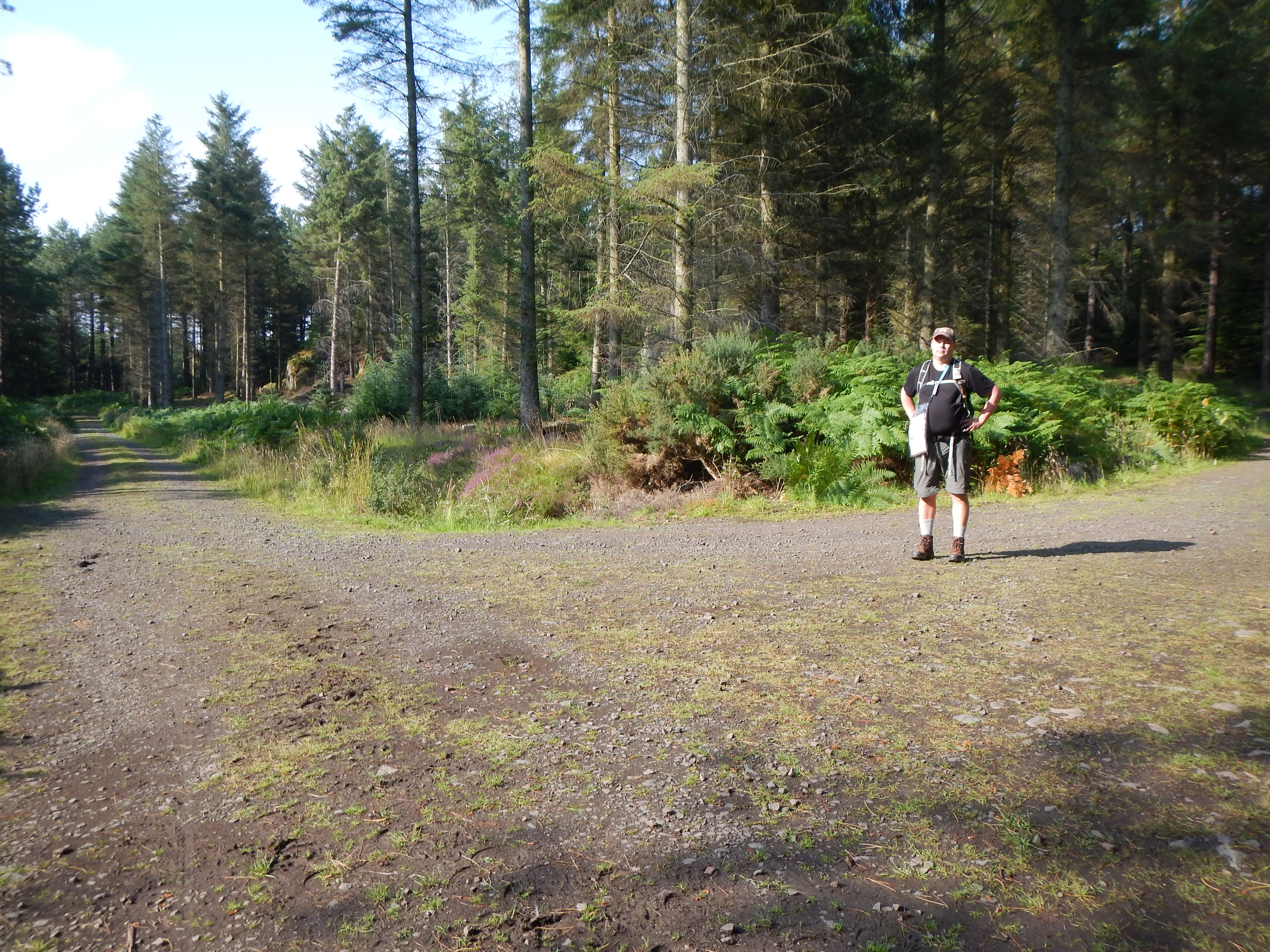
Gavan at the fork in the woods south of Fenwick.
Gavan had known Tosh well and he could understand my emotions as we now followed the conjoined routes in a mostly northerly direction. Two interesting signs were encountered; one noted that there was an escape stile on the left if you were feeling uneasy about the local bull and the other boasted of the arrival of another landscape-destroying wind turbine installation. Now we were about to enter woodland and, as the track split, we took the right fork to walk through a delightful mature forest on comfortable trackways.
All this was to change – so close to the end – for as we began to edge along the eastern margin of the wood on a track called Dolly Gibson’s Lonnen the surfaces deteriorated into a muddy morass. It became increasingly difficult to find secure footing amid the scattered rocks and boards and often I just had to wade through mucky pools. And every time you thought you had cleared the worst of this the gloop returned. Gavan was very frustrated by this section but I tried to cheer him up – “All we need to do is find a path leading off to the left and we will have reached the road to Fenwick.”
Two other thoughts occurred as a consequence of this struggle. I had walked this same route only four years earlier and I was shocked at how much it had deteriorated in this time (you’ve got some work to do, Northumberland County Council). I was also both surprised and gratified that in spite of all this walking in the wet my boots were still dry inside – let’s hear it for Timberland!
At last we did find a path that edged around the top of the wood, passing through several harvested fields and finding at last the tarmac that could take us speedily to Fenwick – already in view. We marched in a final northerly spurt, turning left at a crossroads to find our b&b, a splendid house on the western end of the hamlet. Of course I had spent one unforgettable night in Fenwick in 2011, and I had insisted to our trip organizers that they were not to put us back in this same accommodation again. They had assured me that the old b&b had been sold but that we would be housed elsewhere anyway. (For those who need a reminder of this chapter I can only refer you to the next-to-last day of my walk on the Northumberland Coast Path, elsewhere on this website.)
Now our landlady welcomed us at 5:50 and not surprisingly she added the request that we first store our sticks and then remove our footwear. This was not easy to accomplish without a place to sit down and so I used a perch on the central staircase, managing to dislodge a good deal of mud on the carpet as I did so. I was told not to worry about this and indeed the mess was cleaned up quickly. But when we had climbed to our first floor room I noticed that my walking trousers were leaking mud as well and I had to take them off gingerly in the shower. Gavan had escaped a minor crisis as well. He had evidently forgotten his toilet bag (containing his passport) at our Wooler b&b but our landlady there had spotted this and strapped the object to his carryall.
Our present landlady now tried to make a reservation for us with the local pub but at best we were promised only an outdoor table for 7:00. Our landlord drove us to the Lindisfarne Inn in Beale shortly before this hour but Gavan charmed them here into letting us have an indoor table after all. I barely recognized the crowded place – where Tosh and I had dined four years earlier.
I had a bacon-topped burger and chips and the beer was again very welcome. Some of the Broussine family were here as well but I did note that other large groups were turned away. After dessert we called our landlord and he had soon retrieved us. Needless to say we were pretty tired after a strenuous day and we were soon in our welcome beds.
To continue with the next stage of our walk you need: