
July 31, 2018: High Paradise Farm to Osmotherley
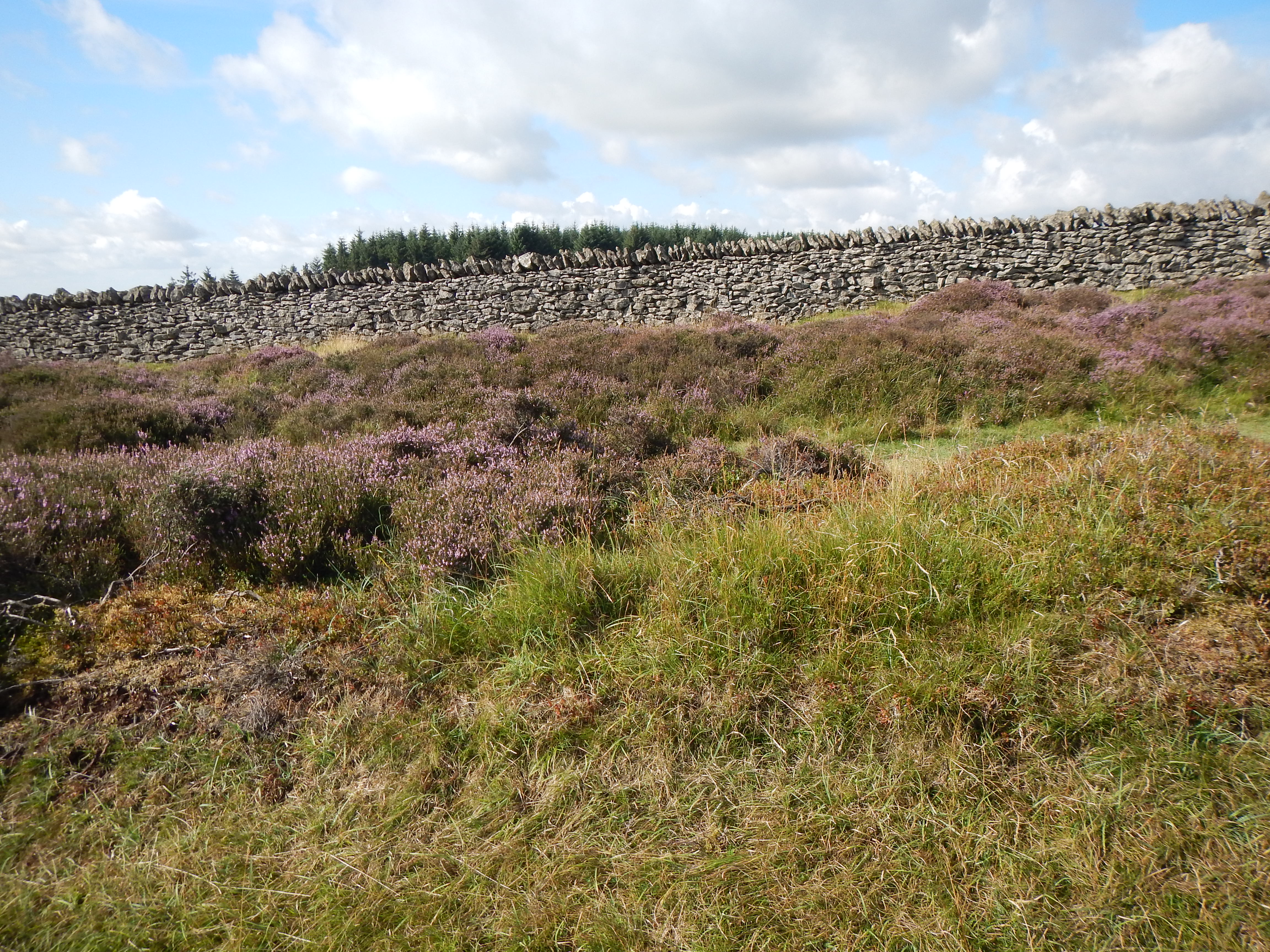
Along the Drove Road – with heather and dry stone wall.
A sliver of dawn from the skylight in Wild Goose Nest, an aperture whose shade Gavan could never quite get into position, served to get us started on the third day of our Cleveland Way adventure. As we slowly made our preparations I discovered the missing loaf of bread on our doorstep and Gavan set to work quite efficiently in preparing our cooked breakfasts. We had our packs ready at about 8:15 and, fifteen minutes early, I could see the Sherpa Van, one that would transport these objects to Osmotherley, already parked out front. The driver explained that yesterday there had been road closures so he had made an early start today.
There was no one else about and this was not entirely encouraging since there was also no sign of the packed lunches we had ordered. We were all ready to go and this was a mystery. Another guest, here to watch his son play cricket at nearby Ampleforth, suggested that Ginny’s car was still here but there was no sign of the lady herself. Eventually Gavan did reach her on his iPhone; she had forgotten our lunches and was off on some other business but there was a remedy – we had made our own breakfast and now we could make our own lunches! She advised Gavan on how we were to penetrate the inner sanctum of the tearoom kitchen and he was soon at work searching about for appropriate materials for sandwich making. There were cakes, crisps and liquids available and we were soon well provisioned. I know it sounds as though chaos reigned at High Paradise Farm but, in fact, we had enjoyed a very pleasant stay.
It was now 9:10 and time to undertake the eight-mile trek to Osmotherley. Just a few steps above the farm we joined the wide track that had served in the movement of farm stock in centuries past, the Drovers’ Road. It was again a beautiful day with sun and cloud and endless rolling fields of heather on our right and, often, the engineering marvel of a magnificent dry stone wall on our left. We walked inside a margin of Boltby Forest for a while as well, emerging at the site of Steeple Cross, where we paused for liquid.
I must say that I was more than a little pleased to be making such useful progress, especially since both my knees, particularly the right one, had been giving me problems in the past month or so. (These days I do nothing in the way of pre-walk conditioning; I don’t seem to need it.) I carried a knee brace in my backpack but I never needed to employ it as we marched steadily forward. I did obtain a new injury, however. In attempting to sit down for a bit of a rest, my back against the stone wall, I slipped and scraped the skin of my left arm. Finding places to sit down while walking British footpaths remains one of the greatest of challenges in such ventures and we never let a bench go by without sitting on it.
One of the reasons I had been looking forward to today’s stretch was that I expected very little in the way of up and down. Of course the route did have its dips and rises – the latter evident as we took a long loop to the left to reach the upper elevations of Black Hambleton. While I was nursing my arm Gavan went off route a bit to sit among some grouse butts in the heather. He said it smelled like a locker room out there.
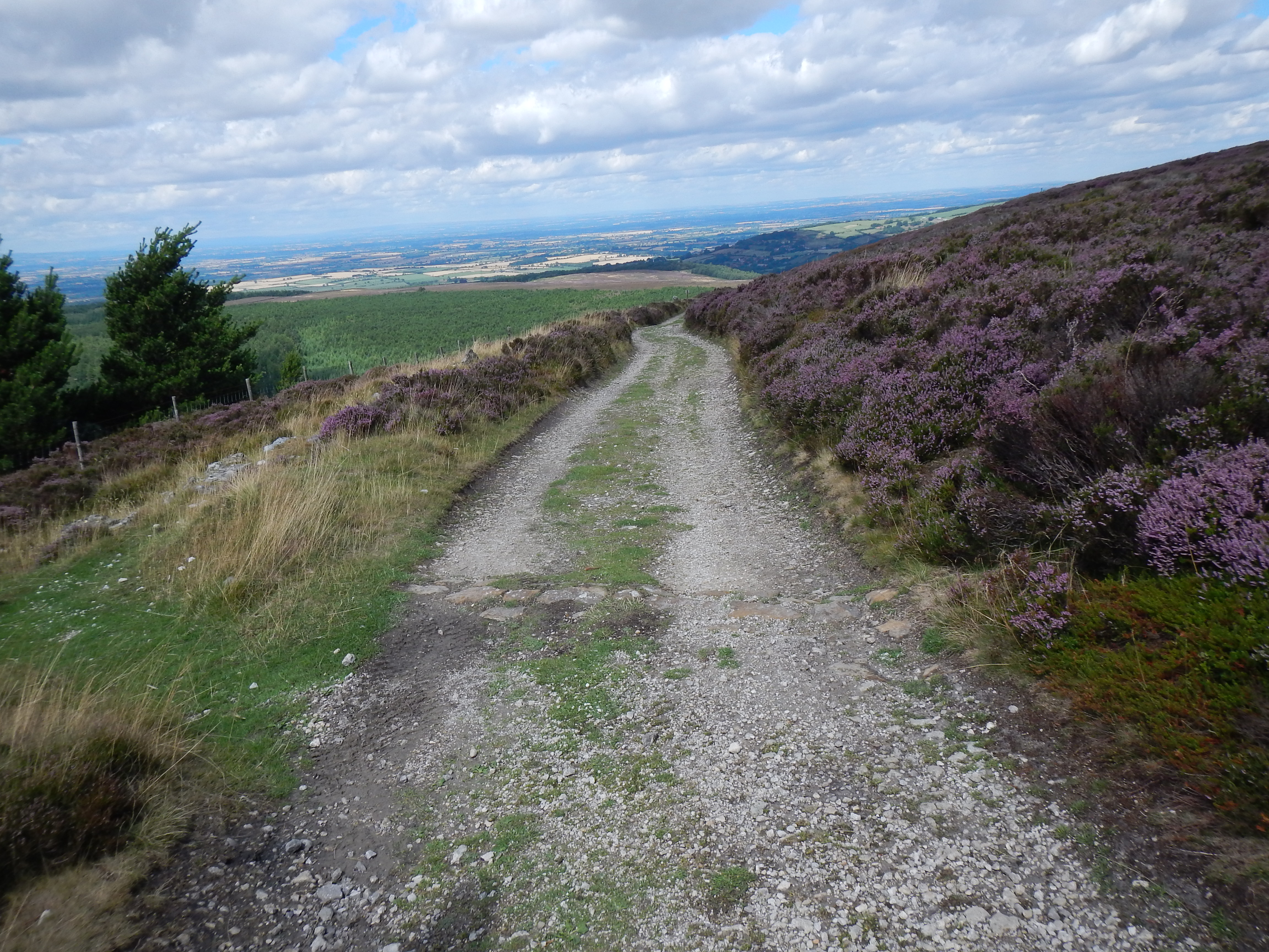
The Drove Road approaches Square Corner.
As lunchtime neared I suggested that we look for a shady spot within the edges of the next stretch of forestry on our left – but the forest had been harvested! This meant that we were already within sight of a bend in the Osmotherley-Hawnby Road (Square Corner) before Gavan found a slit in the green ridge on our left, one that permitted a place for the legs as we sat down to open our do-it-yourself lunches.
We had now exhausted our progress along the Drover’s Road but as we turned to the west at the aforementioned corner I could anticipate an easy descent to our village to wind things up for the day. I was greatly mistaken for the descent brought us our first experience, of many, with a steep staircase of embedded flagstones – where any misstep could be a disaster. (Imagine these stones wet with rain.) I was using my trusty walking stick to steady myself but progress was painfully slow and uncomfortable. The trail planners hereabouts need to check out how to build a contoured footpath, with switchbacks – like the ones constructed by the Civilian Conservation Corps in my native California in the Thirties. This more direct assault on every ascent and declivity is a dangerous strain and profoundly ageist.
At last I made it to the bottom, consuming a lot of liquid before we followed paths along the margins of Oak Dale Reservoir. Some of this was fairly level and some wasn’t but at last we emerged onto a track leading to the Osmotherley-Hawnby road itself. Gavan was being interrogated here by an elderly resident – this was always happening to us as people wanted to know what accent they detected in our speech and bring us up to date on their entire life history. Up behind me came two walkers who wanted to know what crop was growing in a field on our left. I had a look – “Surely that cannot be bamboo,” I said, but they added that they had come up with the same surmise.
I noticed that they took to the road for their final mile into Osmotherley and I wish we had done the same. The official route moved us cross-country and, after we had passed a farmhouse, it dropped us down to a footbridge over Cod Beck – where, this close to the end, we were required to follow a steep path uphill in woodland. Atop at last we followed more level paths, entering Osmotherley by some narrow passages between houses. Complicating progress was the counterflow of locals with their kids and dogs. One of the latter set up an hysterical outcry at our presence. “Don’t worry,” his owner said, “he won’t bite – but I suppose they all say that.”
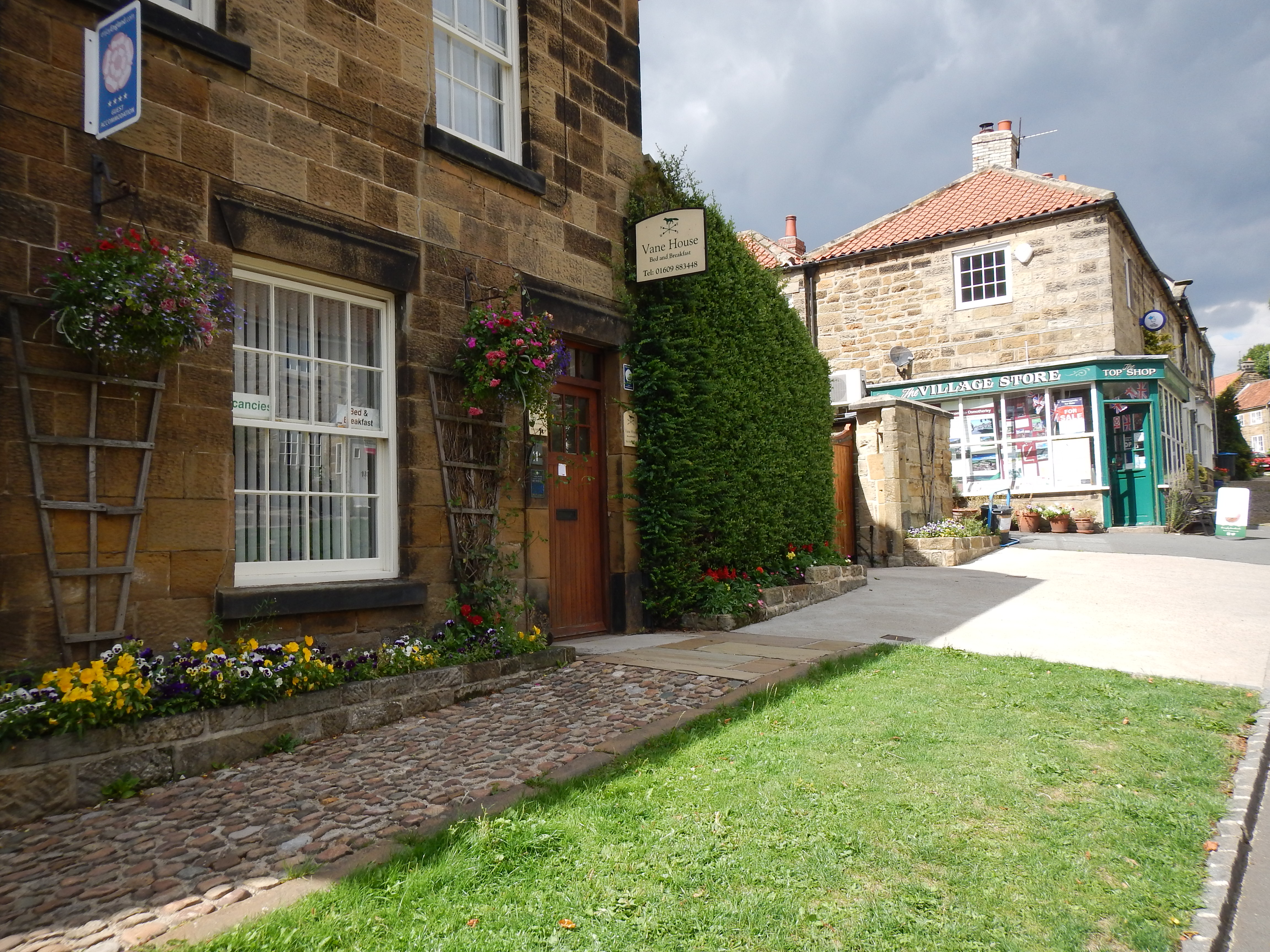
Our b&b and the village store in Osmotherley.
We emerged onto a main street at 2:30, after our eight-mile walk, and already I could see our b&b, Vane House, above us on the right. I knew its location because, believe it or not, I had stayed here in 2000 with Tosh and Harold Lee as we walked Wainwright’s Coast-to-Coast Path. Indeed, when I had told Gavan that he could read all abut our next stage on my website account he did so – and discovered for the first time the name of the Sherpa Van Company which, all these years later, was still thriving.
We did not head for Vane House right away but made our way into the Queen Catherine pub for a welcome pint. Here we also made dinner reservations (on the recommendation of Ken at Sutton Bank) before turning left at the t-junction corner housing a memorial to John Wesley. Gavan darted off to visit some local conveniences, where he learned that this toilet was twinned with one in Burundi! Then we visited a local market where I bought a Bounty bar and some more energy drinks.
Vane House had the same proprietor, Allan, as in 2000 and I even remembered that I was in the room with the skylight. I asked him about the village crone, Miss Thompson, who had presided over her own shop in what appeared to be a cave. He said she was gone now but that Morrisons had bought the site. Then we went to our comfortable room, had showers and a nice rest before returning to the pub for dinner. This was quite an indifferent meal – sorry Ken. Another early night followed.
To continue with this account your need:
Day 4: Osmotherly to Carlton Bank
To read an account the covers the section between Carlton Bank and Clay Bank Top you need to see how this was done on the Coast-to-Coast Path in 2000.