
June 28, 2019: Wood Advent Farm to Luxborough & Heath Poult Cross to Wheddon Cross
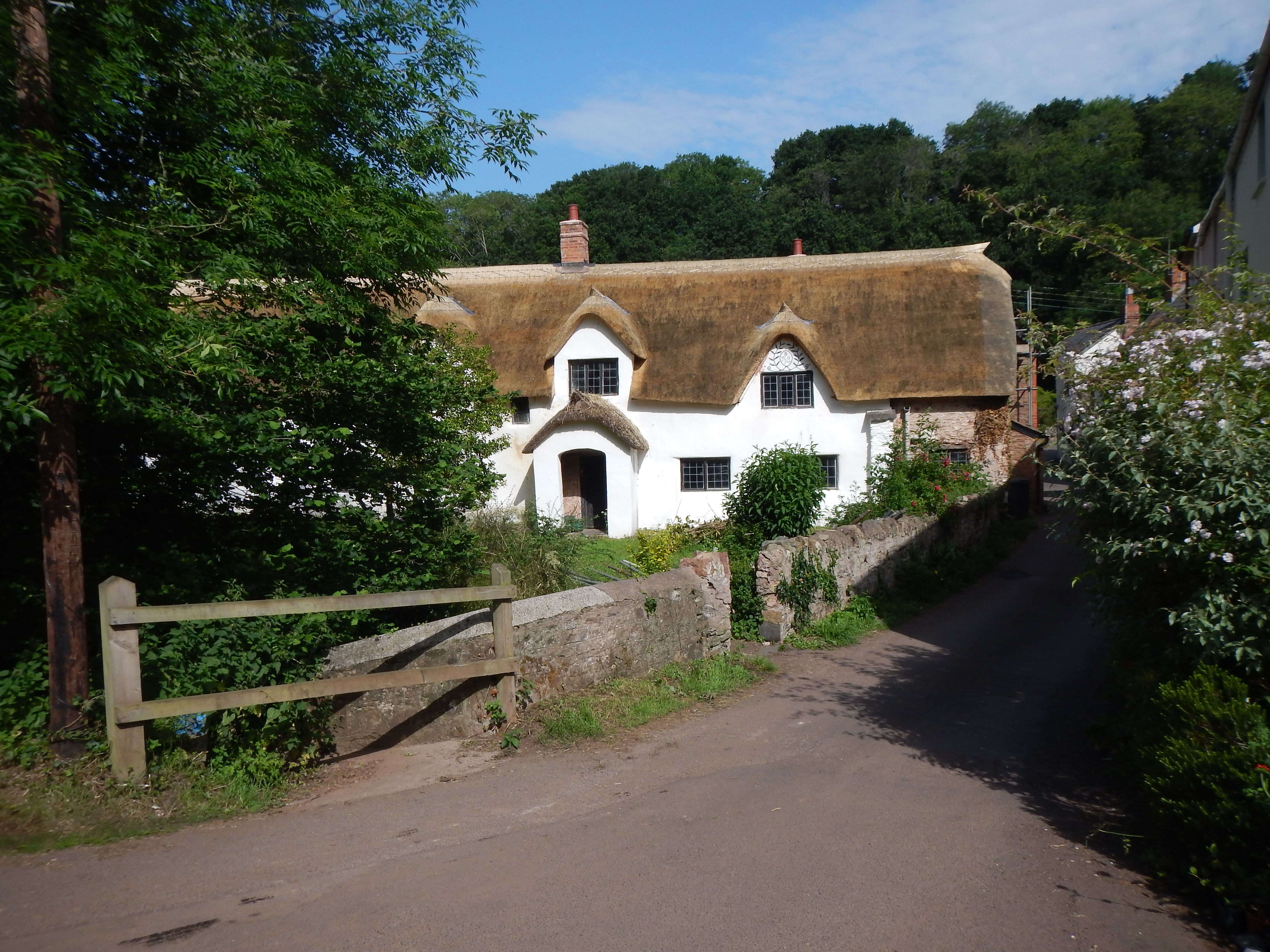
Thatched cottages in Roadwater.
As we completed our breakfast at Wood Advent Farm our hostess, Diana – perhaps sensing our frazzled arrival at her establishment – suggested that to get to the half-way point in today’s stage we could abandon the more challenging Coleridge Way route and use the highway running from Riverwater to Luxborough instead. This was a suggestion endorsed by all of us and at 9:05 we began the day’s march.
To reach Roadwater village itself we used a rising northerly track, suitable for vehicles, to climb to a spot where a wonderful view to the west was available at the margins of a field with a crop whose identity was not immediately evident to these city folk. After a mile or so the track descended to the flowery cottages of Roadwater and we soon discovered the desired tarmac link. We paused to take some pictures at the Valiant Soldier pub and soon we began a long westerly trek.
I must say that this alternative was a delight and a highlight was its proximity to the Washford River. The roadway was well shaded and level throughout our journey and traffic was not too intrusive, though an occasional timber lorry passed by. At one point we came across a sort of gypsy wagon, a house built on a lorry flatbed – with its own stained glass window. We had one rest in a journey of a little over three miles from Roadwater and just outside of Luxborough we met some people who said the pub was only five minutes away.
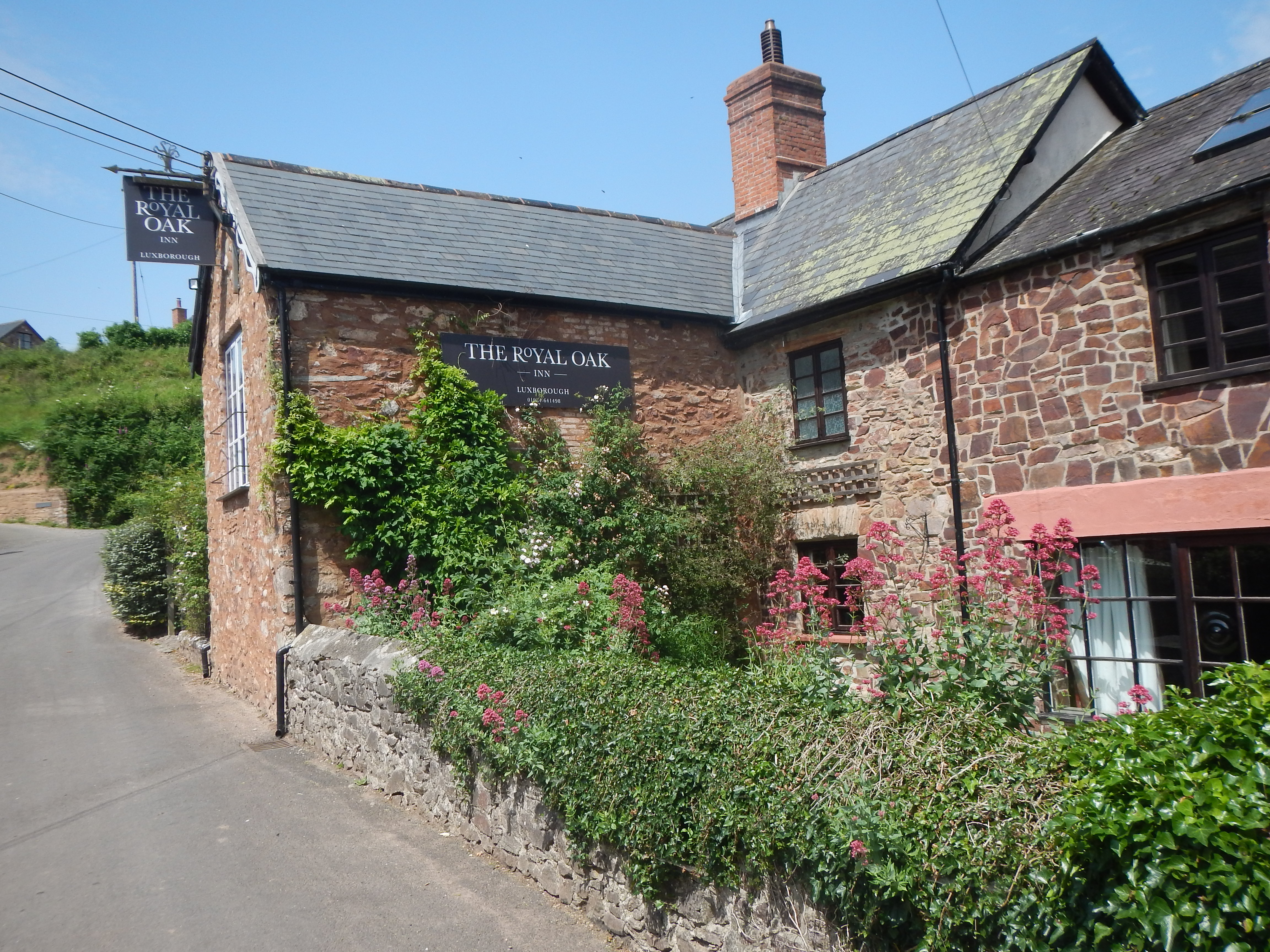
The Royal Oak in Luxborough.
The pub was The Royal Oak. We arrived at 11:55 and waited in the hot sun for only five minutes before this establishment opened its doors. I drank a pint of lager and the staff prepared some nice sandwiches for us. Then it was time to debate the oft-asked question, “Where do we go from here?” A stiff climb in the hot sun seemed an uninviting prospect and, not wanting to have to summon a taxi from some unlikely venue, we determined that we would use a cab to get up to the heights now. The pub staff were very helpful in finding a number for us to call and a car was promised in twenty minute or so. Part of this time was spent wandering around on the sunny village streets.
We had determined that a good place for the driver to let us off was a road crossing at Heath Poult – we had by this time said goodbye to the Quantocks and were walking in the Brendon Hills, with Exmoor not far away. Our driver knew the spot we were aiming for; he, too, kept up a non-stop commentary on the passing scene as he sped up the hillside. We are able to resume our walk at 1:30, heading northeast on a well-used track for just five minutes or so before encountering a gate that once again bore the livery of The Coleridge Way.
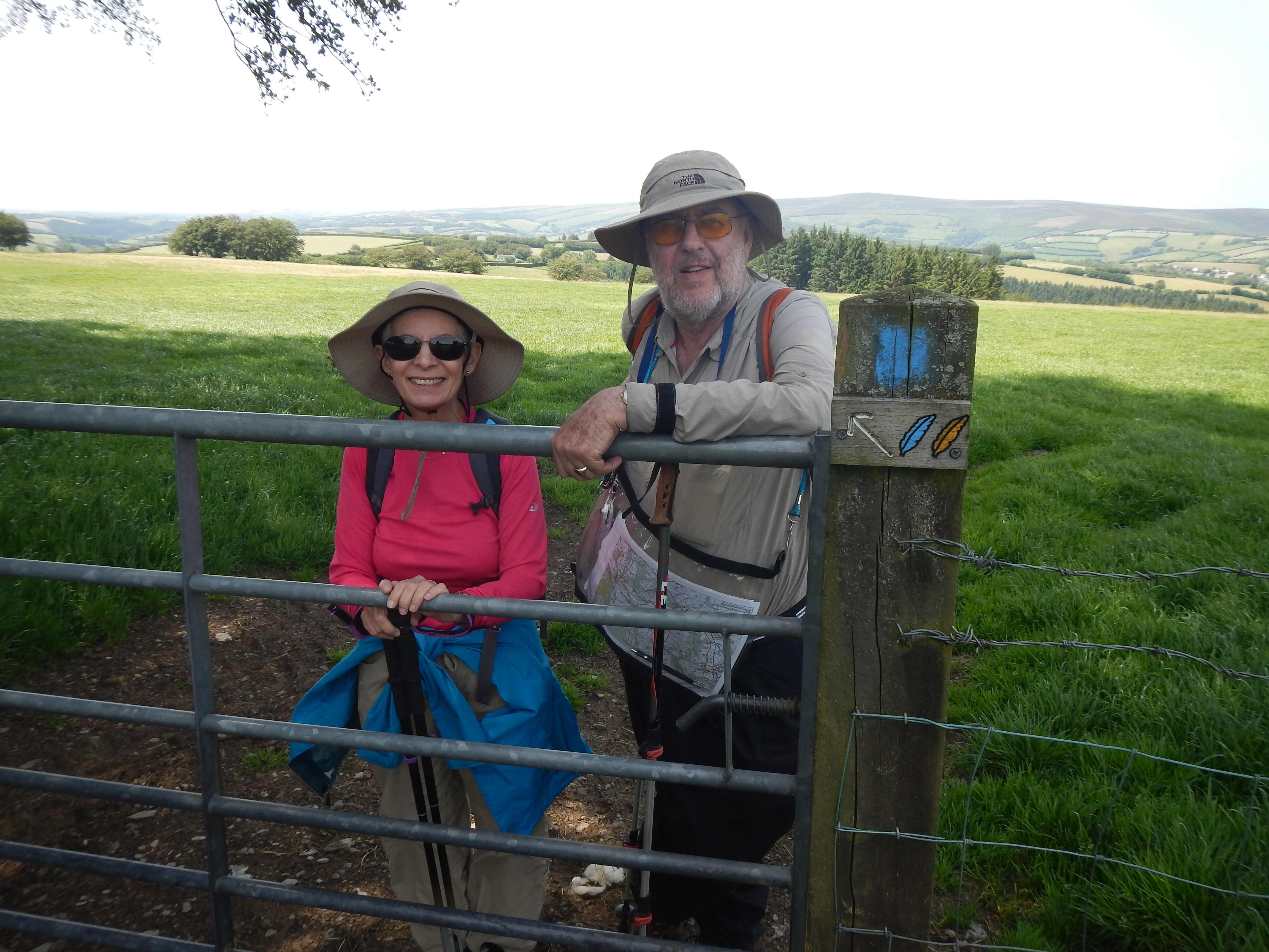
Naomi and Adrian shelter from the sun before we head downhill to Wheddon Cross
We could now have considerable confidence that our own legs could take us to our night’s accommodation and that we would have downward slopes for most of the way. I used my compass to get us moving in the direction of a stand of trees in the far left-hand corner of a field and we were able to follow a thin trod in the grass to do this. It was quite warm on the exposed hillside and we remained some time in the shade of these trees – where a large flock of sheep invited photography.
We passed through a series of gates on our descent to Symm’s Combe – where signs of civilization became more evident in the hamlet of Pitleigh. We were now heading north, past a kennels, and along green lanes that we knew must intersect with a road leading directly to our village. Confusingly we soon encountered a paved road heading in the right direction that was not mentioned in the guide nor evident on the OS map – and Adrian stopped the driver of a small lorry to ask him how this could be true. The driver said that this roadway was a fairly recent addition – since his farmer boss has found earlier access points to his property too narrow for his farm vehicles.
We now had to continue in a northerly direction over a notorious stretch hemmed in by hedges on either side – with warning signs on the ground and in the guide. Here the surface was bedrock, often covered with a slimy covering of mud – a slippery surface that required tiny footsteps in its descent. I had my stick with me, the in-laws their poles, but in spite of all this I fell suddenly on my back – my stick whistling away into a hedge. Fortunately my backpack cushioned much of my fall and though my left wrist was a bit sore I was otherwise unhurt. Warning signs on the ground and in the guide – even the Wikipedia entry on The Coleridge Way mentions this dangerous stretch. So how about another approach – actually fixing this section?
When we started off again, edging our way down even more gingerly, there was a new menace. A farmer, driving an ancient tractor behind us, was using the wheels of his vehicle to trim the hedges and we needed to get out of the way as soon as possible. Our needed village lane was now available for us but while I waited on Popery Lane (so designated on the OS map but not on the ground) the in-laws engaged the farmer in a conversation about the tractor. The farmer said he had owned it for sixty years but he had bought it second-hand.
We now had only a short walk to the west to reach our village, Wheddon Cross, and we arrived at 3:10, just as the C. of E. school across the street was disgorging its kiddies into the waiting arms of parents who had arrived to collect the uniformed youngsters. Our task was to find our accommodation – once again a pub had been selected – but this one had a most unusual name, Rest and Be Thankful. It was nearby and we had soon been admitted and shown to our rooms. We had walked some seven miles today.
I had a nice rest and a shower and joined the others in the pub’s dining room for a very nice evening meal. We did ask the proprietor, Eric, if he could recommend a taxi firm that could get us started in the morning with a ride to Brockwell – having decided that another full day in the sun would not be a very pleasant experience. Eric had no hesitation in replying, “You’ll never get one out here. I’ll take you.” Reassured by this kindly gesture we headed for another early night.
To continue you need: