
June 30, 2019: A39 to Brendon
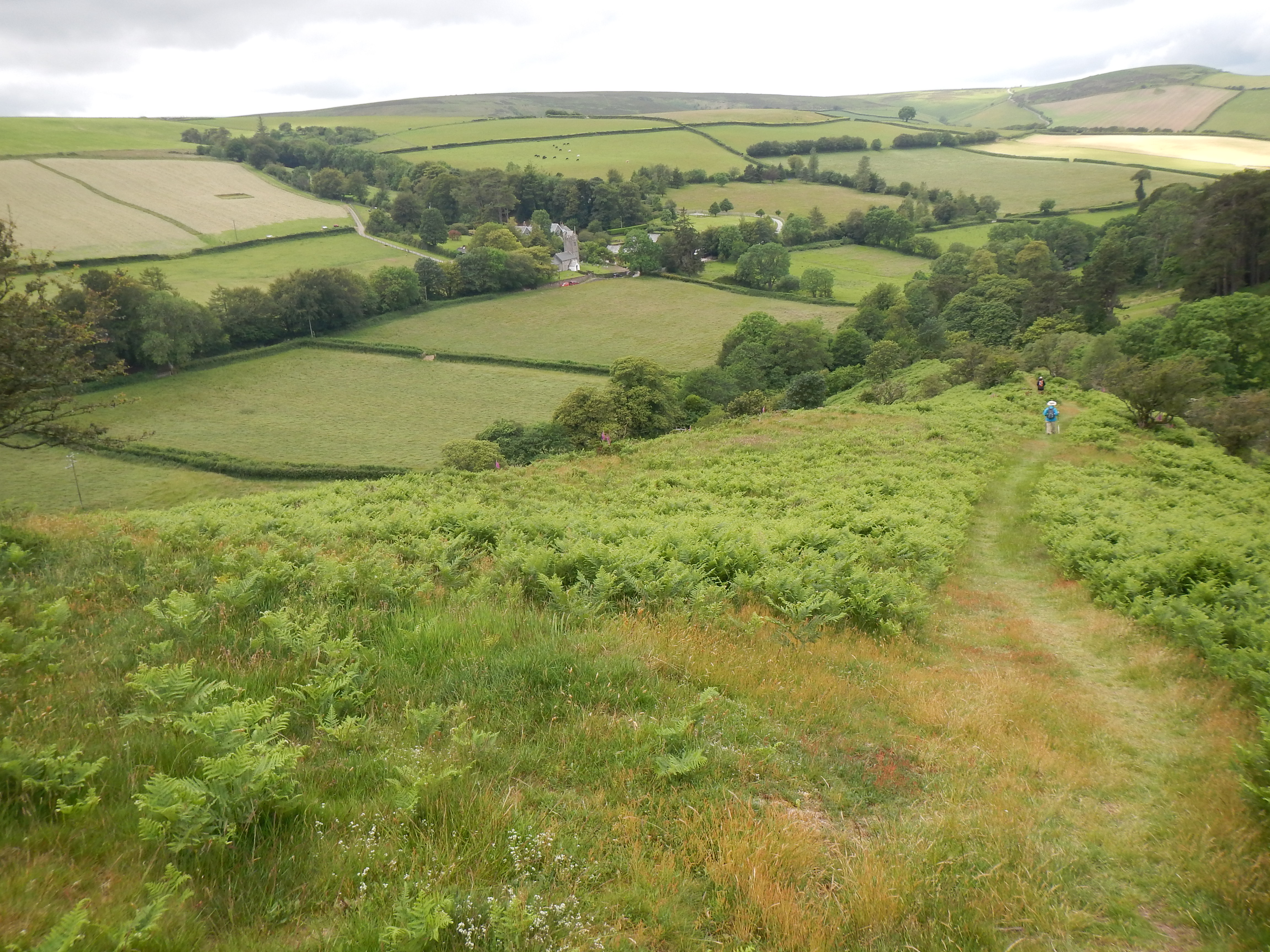
Distant view of Oare.
Long before today’s session on the Coleridge Way we had come to a decision. Celtic Trails had been (over-optimistically) labeling all of the sections we had covered so far as “easy” or “moderate” but the route that climbed from Porlock had at last earned the forthright designation “strenuous” – as it climbed in and out of deep coastal combes. The mileage was longer than any other stage as well and, especially since I had covered nearby territory while walking the South West Way many years ago, we had determined to seek again a shortened version of the day’s march. That is why I had made a second phone-call while we were at dinner last night. I had called William, the local taxi driver who would ferry our bags forward for us today, to ask him if he would pick up some additional freight – us.
I only bumped my head on the ceiling once this morning. We had agreed on a 10:00 departure and William arrived on time, loading our bags and ourselves aboard, before heading west along the A39. It seemed that we rose and rose and we were well satisfied that we had made the right decision.
William said he knew the exact spot where the Coleridge Way climbs up from Broomstreet Farm and crosses the highway and at 10:35 he had located this spot. We paid him, said goodbye to our bags and, facing south, climbed a stile next to the private drive to Lilycombe. It was a gray day but there was no threat of rain and temperatures were perfect for walking. We took a number of photos and then set off to reach the end of the field before us, soon turning right to follow a hedge in the direction of a small conifer plantation. West would be our dominant direction again and the view before us of field and fell was thrilling.
As we cleared the plantation we found a bench and had a little rest here, then continued of footpath as we began to make an increasingly steep descent into the valley on our left. On our right was Deddy Combe and here I spotted the only extensive patch of heather in bloom witnessed on this trip. There were many wonderful wildflowers at our feet and just a few blooming heather bushes here as well. The path pulled away from an accompanying hedge and plunged forward – with baby steps required for safety at a number of places. Views of the village of Oare improved during this descent and at last we reached level ground again, turning right along a streambed to approach a bridge. This we crossed, using the adjacent road to climb up to the church.
We were entering territory sacred to the memory of R.D. Blackmore’s Lorna Doone – an 1869 novel we were still asked to read when I was in junior high school. The church in question figures prominently in the story but to Adrian’s (feigned) chagrin it was actually being used for a sacred service (this was Sunday) and we did not penetrate its interior – though we did eat our sandwiches while sitting on a convenient bench. Meanwhile I had noticed a sign promising a PC (public convenience) and a PH (public house) in the next village, Malmsmead, and Adrian proposed that we just use the road at our feet to reach this spot.
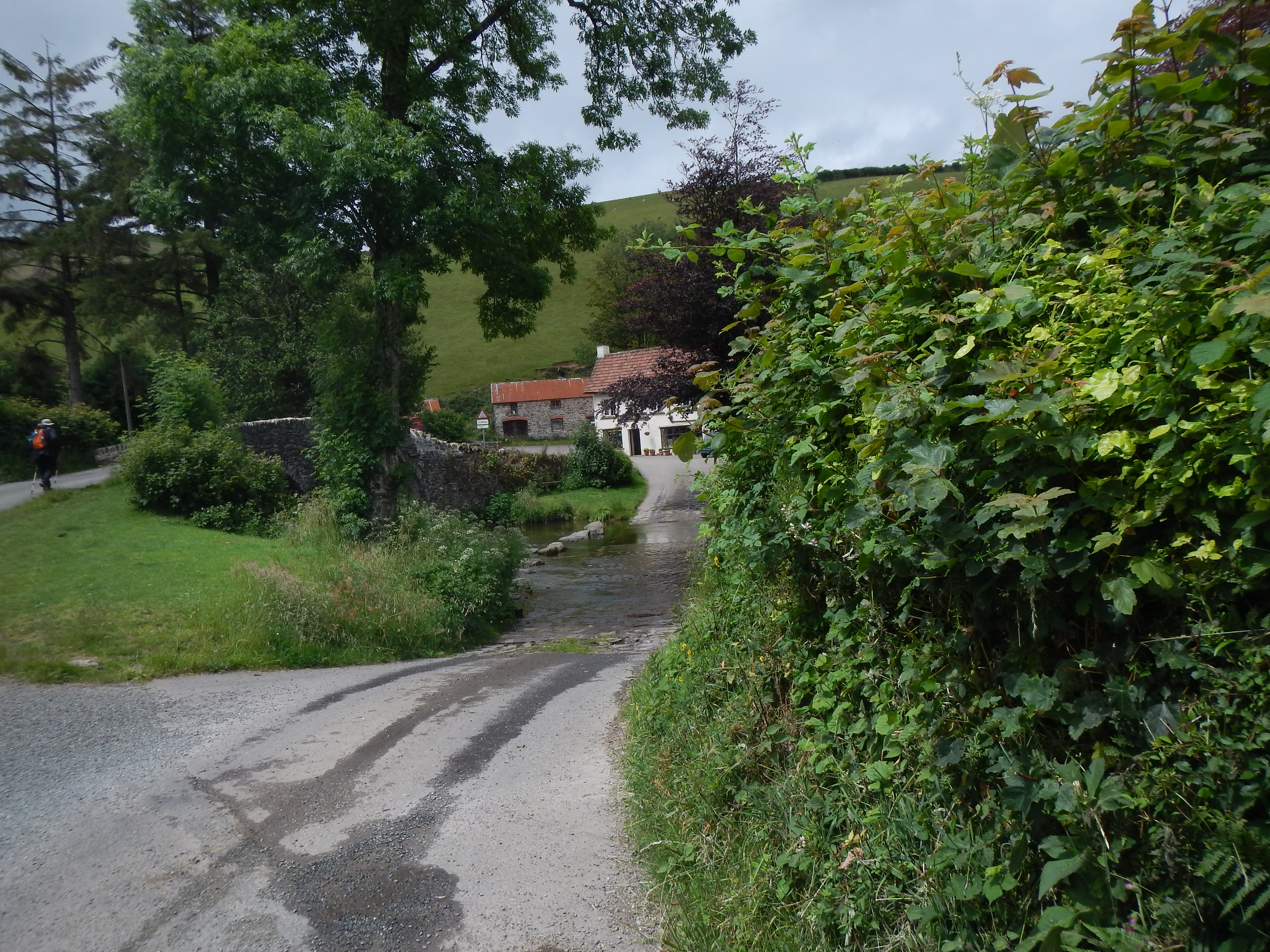
On to Malmsmead – leaving Somerset and entering Devon.
Once again we would be forsaking the parallel Coleridge Way footpath but by this time there was no problem for us in such a desertion. There was a good deal of traffic to dodge for this is campsite country and after passing the turnoff to Lorna Doone Farm we reached both a water-splash and a bridge over the local stream, the Oare Water, in order to enter Malmsmead itself. We had been on the road for almost a mile and by reaching Malmsmead we had passed from Somerset into Devon. The pub was soon located – it too bore Lorna’s name – and, penetrating its interior, I had the rare mid-walk luxury of drinking half a pint while seated in a leather armchair. The barmaid was having a lot of trouble with her pumps and I ended up with a Cornish lager this time. There were lots of people about.
After our rest we made an attempt to find a roadway that would take us onward toward our evening’s accommodation. Fortunately there was a sign to reassure us that we had made the right choice – I would have sworn that we were heading in the wrong direction, but we weren’t. The Coleridge Way evidently makes for the heights hereabouts so that made it easy for us to keep the river-level roadway all the way to Brendon instead. This was very pleasant and easy walking – with little traffic to worry about, though signs did warn users to keep an eye out for four-wheeled dirt bikes and we could see one on the horizon.
Sheep in profusion filled a field in the center of a very delightful village, where Naomi encountered her first monkey-puzzle tree. We passed Brendon’s pub, the Staghunters Inn, and at 3:00 we reached the large grounds of our b&b, Millslade Country House. We had walked six miles today.
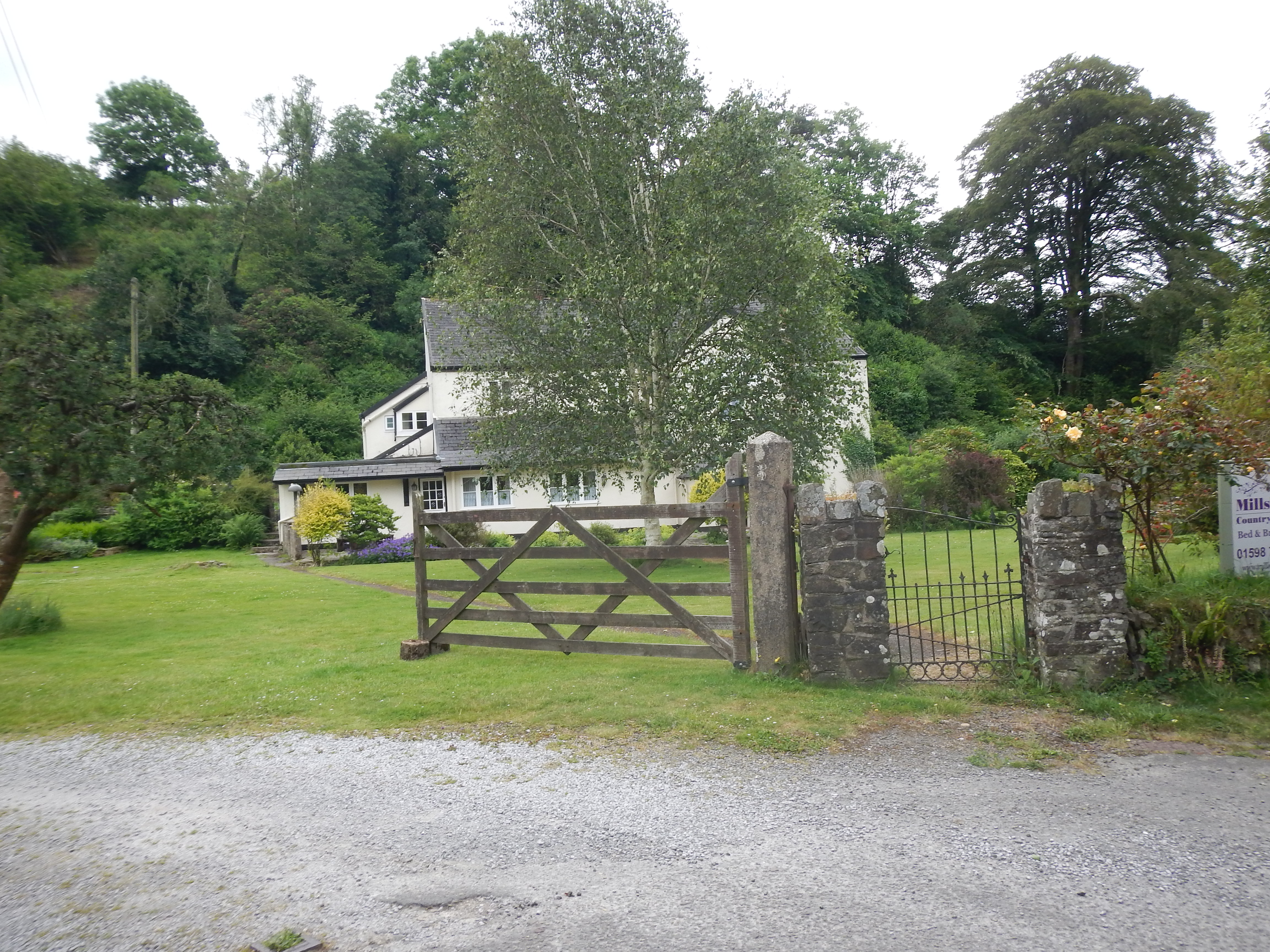
Our B&B in Brendon, the Millslade Country House.
We were welcomed by Anna and Simon and shown to our rooms. Naomi and Adrian went out to explore the village (witnessing the near-death of a free-range chicken) while I had a nice rest. The pub was nearby and sure-enough there was a chalkboard on a table with “Anthony@7:00” waiting for us. I drank a pint of lager and indulged myself in a nice steak with all the trimmings. There was always plenty of light in the sky when we returned to our accommodation on this trip but that did not prevent another early night.
To continue you need: