
June 5, 2016: Moelfre to Llaneilian
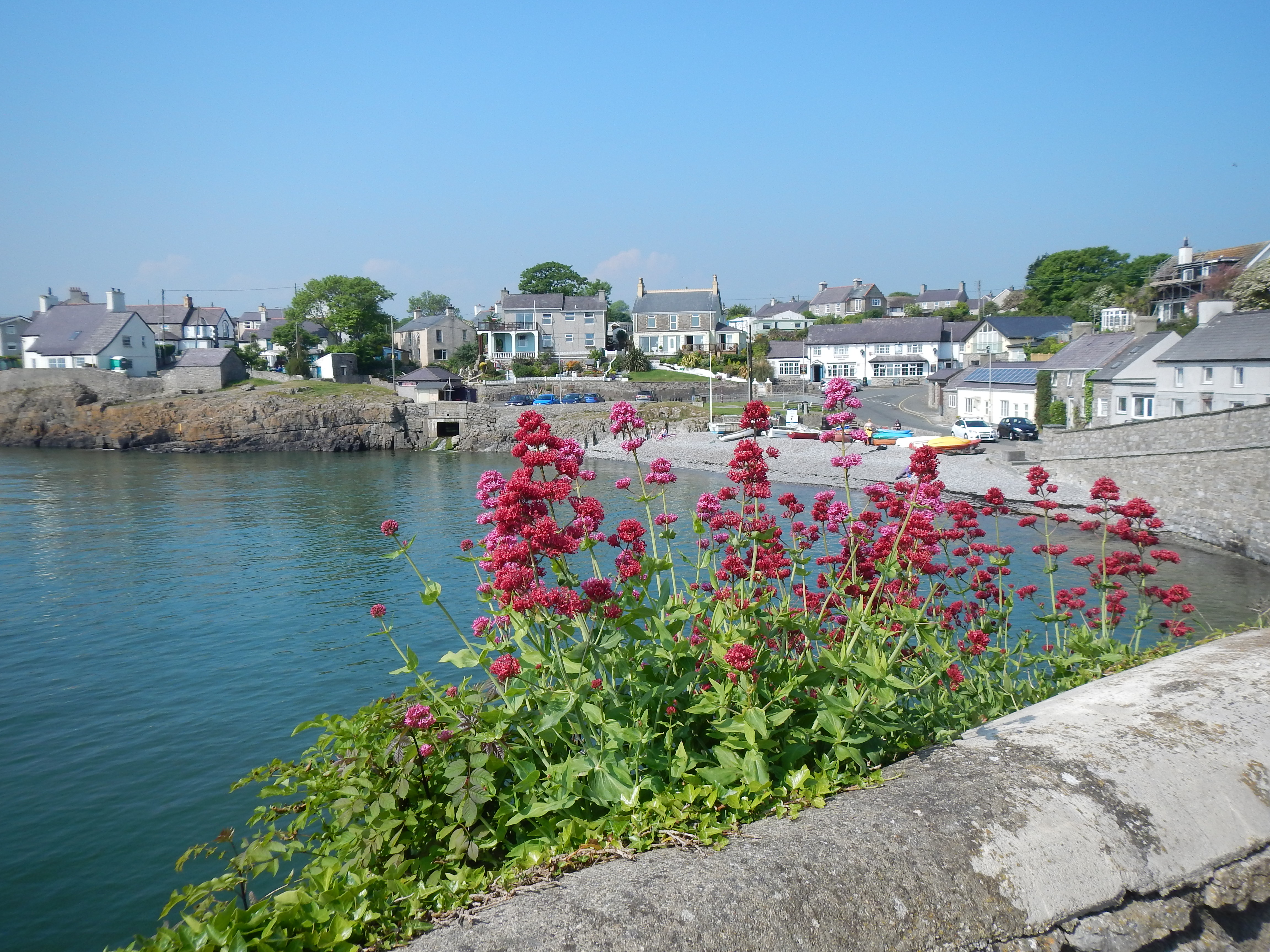
Moelfre harbor.
On Saturday, June 4, my in-laws, Naomi and Adrian, joined me for a third expedition on the Welsh island of Anglesey. This would be our attempt to complete the final third of the coastal path – with two previous ventures on this route having brought us from Holyhead on the west coast to Moelfre on the north.
In fact we were still rather tired from an eight-day holiday around another island, Sicily, as we made our preparations for this five-day trek in Wales. His Auntie Linda still had custody of my young Schnauzer, Otto, so we were able to pack without causing too much canine anxiety and at 1:00 a cab arrived to whisk us to Euston Station. We had time to find a lunch spot (and some rare seating) in the balcony overlooking the vast concourse and here we spent half an hour or so before a march to the most distant of tracks for the 2:15 to Holyhead. I have to admit that I has pretty-well baggage-free, Adrian lugging my case, since both of my shoulders were bothering me – the lingering result of my famous falls two years ago while walking in Ireland.
I had purchased seat reservations for our party and we were soon comfortably ensconced at out own little table. Across the aisle a family with two identical blonde twins were parceling out the last of the cherries. The girls, six or so I would say, never stopped their mischievous chatter – but how rewarding to see that their chief activity was producing handwritten word lists. This was obviously their return journey from Disney World in Paris and our view of the Welsh seacoast was often obscured by a large inflated head of Minnie Mouse.
Our train arrived at Bangor at about 5:15 and here we were met by the first of a number of taxi drivers enlisted by Celtic Trails, the firm that had organized all of our accommodation, our baggage transfer and, indeed, our own movement when not on foot. It was a bright and warm afternoon and lovely to be back in a familiar rural scene. We would be staying for our first night in a new (for us) establishment in Moelfre, where we had concluded last year’s walk. Ty Dderw was, in fact, a hotel – far above the village itself and, after being shown to our rooms (the key to mine was broken), we returned to its bar for some pre-dinner drinks. Adrian once again began his doughty quest for local beers and ciders but the young girls who seemed to be running the place said they had none. (Later this was disproved.)
I had the fish and chips and slipped outside to take a photo against the setting sun. Sleep was not easy to come by. The hotel seemed to be a favorite port of call for senior bikers and they kept their machines revving night and morn. My room seemed to be perched above the bar scene and every now and then there would be a manic interruption. Still, it was nice to be in position for another go on the Anglesey Coastal Path.
It is bright so early at this time of year and I had trouble extending my sleep. Adrian had his heart set on purchasing a mug he had seen last year at the RNLI shop in the harbor and, since we had only nine or so miles to go and the shop, we believed, would not open until 10:30, there seemed plenty of time for us to have a leisurely breakfast and complete our pre-walk preparations. In my case this meant lathering my arms, neck and face with sun-block. We knew it would be a warm day and I was able to wear only a t-shirt – indeed this costume never varied throughout our trip.
At about 10:00 or so we began our descent to the village of Moelfre, stopping at a shop for some additional liquid, passing our old b&b and Anne’s Pantry and the Kinmel pub as we made our way along tarmac paths. Valerian in all three shades was abundant out here as I paused to take a retrospective view of the harbor. The RNLI shop came next and while Adrian made his purchase I waited at the statue of helmsman Richard Evans, soon finding the need for some cooler temperatures in the shadows of the lifeboat station itself. We paralleled a small shingle beach, with the isle of Ynys Moelfre on our right.
The route was a busy one this morning, with lots of families celebrating the sunny Sunday in the company of kids and dogs. As we reached Porth Heleath it was becoming obvious that the coast path here was not the tame avenue we had grown accustomed to on earlier trips but a bit of a roller coaster, with lots of up and down. This and the heat made for slow-going, though we didn’t dawdle – Adrian was always out front, Naomi next and yours truly in the rear. I used my faithful walking stick and I was very glad to have it; my in-laws sometimes used two poles. In this fashion we finally reached the beach at Porth Lligwy.
Of course the indented coastline was very beautiful and wildflowers blossomed everywhere. We passed the cove at Porth y Mor and then a second cove at Traeth y Ora. What we were looking for was an escape from coastal headlands and a turn inland as we neared the estuary of the Afon Goch. The guidebook by Carl Rogers noted a turnoff at a spot signaled by a kissing gate, a bench and a waymark post and more than once we were seduced into a belief that we had reached just such a spot. (I insisted that two out of three was not enough.) I had again re-typed the text since it would be easier to read in a larger font and against more useful backgrounds than that provided by the publisher and Adrian and I each carried a copy of the pages I had printed in our map cases.
In fact I often paid no attention to the text, content to follow Adrian – who began a steep climb in a south-westerly direction as we attempted to rejoin the highway above us. It took a long time and there were many twists and turns, sometimes on footpath, sometime on farm tracks (as at Penrhyn Farm) and sometimes in open fields. At last things leveled off and we could detect signs of activity as we neared the Pilot Boat Inn. Believe it or not there was a time when I feared we would arrive at this spot too early for lunch! Now, I noted ruefully, it was already 2:00 and we had not yet covered half of our assigned distance for the day.
I ordered a pint and a prawn in Marie Rose sandwich (all three of us did so) and went outside to take a picture of the busy place – whose attractions included a redundant double decker bus for the kids to play in. Over lunch we conducted crisis talks. Although we would not have anyone waiting for us at the end of today’s stage it had been suggested that our cab company would be expecting to hear from us between 4:00 and 5:00 and we could clearly see that this was an impossible goal. I told the others that the only way we could arrive at Llaneilian village at a respectable hour must entail some abandonment of the coast path itself and the use of road surfaces heading in the same direction. They had to agree.
We did not linger for long and shortly before 3:00 we were off again. A small bit of road walking led us back to the wide swath of the estuary, which we crossed on a bridge – heading back for the coast on riverside surfaces that were often muddy. There were also some paths in the grass, though they made for a very uneven surface and I was not altogether disappointed when we at last reached tarmac again and started our climb uphill toward the village of Dulas. A chap working on his garden asked if we needed our water bottles re-filled and invited us to rest on some benches in his back yard. He seemed to be quite knowledgeable about both the footpath and the road variation we were now undertaking and approved of our strategy. He wanted to know if we had seen any member of the local tribe of red squirrels.
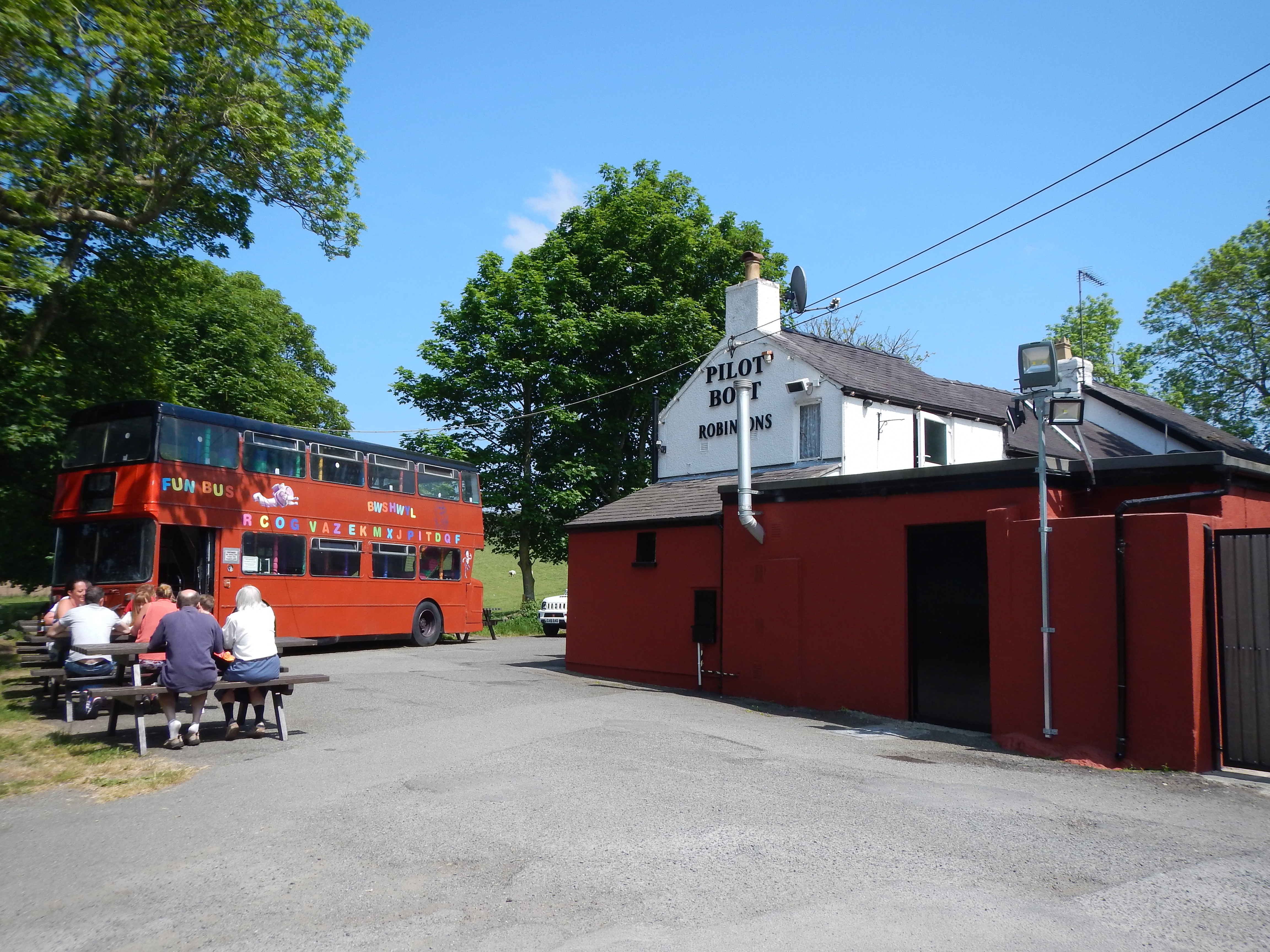
A late lunch at the Pilot Boat Inn.
After our rest we persisted, climbing steeply uphill, passing the Llanewnllwyfo church, then celebrating a Sunday service, and cutting a field corner between two lanes. In a short seaward distance we reached a junction and here we left the coast path for some faster progress on tarmac. I was able to follow our progress on the large scale East Anglesey Explorer map and, though I would not describe our route as level, I could see that it would avoid many of the steep ups and downs of the coast path.
There are purists who decry both road walking and any deviation from the official route but I am not one of these. In fact I often enjoy such a variation, which broadens one’s perception of the countryside. Here all was quite beautiful – with the fields and hedgerows rich with a springtime lushness. There was very little traffic up here and we were at last able to make some decent progress. Still, it was almost 6:00 before our northerly road made a westerly turn and brought us back to settlements high above Porth Eilian.
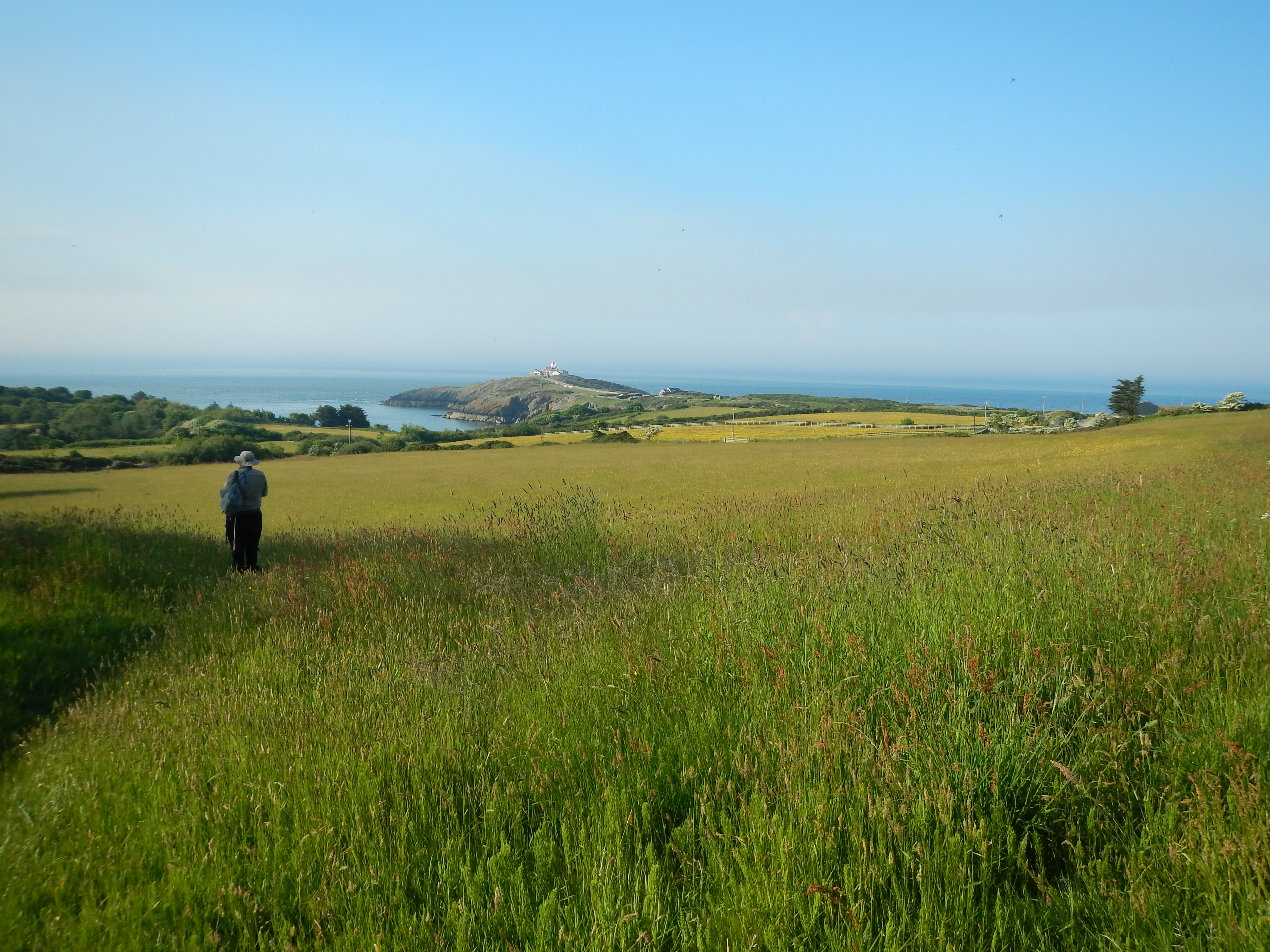
After a very long day Adrian begins the final descent into Llaneilian.
A footpath route down to Llaneilian was clearly indicated on my OS map and, in fact, it was well marked on the ground and we had no difficulty making an often steep descent on it – the Point Lynas lighthouse soon appearing on our right. It had been an exhausting day and I was most relieved to put a foot onto the tarmac road that joined the beach below with the village above. We had to climb uphill again, soon discovering that the spot from which we were to summon our cab had no mobile phone signal. A local chap suggested that the only reliable place was up at the church and Naomi and Adrian trudged up to make the critical call.
I slumped down on a cement block at the entrance to a parking lot, adopting a posture so melancholy that the chap who had proposed the church as a good calling point asked me if I was okay. I was, but I had certainly found the walk to be a very taxing one. It was now 7:10 and time to consider just how far we had walked. Naomi’s Fit-Bit and the app on my iPhone both offered information on this topic and they more or less agreed. So did our local source who argued that the distance between Moelfre and Llaneilian was not 9.0 or 9.5 miles but 13.5!
The others were gone for some time and I reasoned that they must have asked the chap from Copper Cabs to pick them up first; this was indeed what happened and at last I was picked up as well. As we had been ferried forward to Moelfre on the ninth day of our walk so now we were on our way to Bull Bay, which we were scheduled to walk by tomorrow. Our driver offered recommendations on where we might have our evening meal in this place and then we were deposited at the Rhianfa b&b and shown to our rooms. By now it was nearing 8:00 and so, without even pausing for a shower, we headed off for the Bull Bay Hotel; already I was dreading having to walk steeply uphill again at the conclusion of our meal.
I needn’t have worried since we would not be eating at the Bull Bay Hotel. The jolly and talkative barman informed us that not only had the kitchen closed but he had closed the bar too. This was a matter of deep disappointment for me since I was parched after a day in the sun. (I noted that, unusually, I had not paused for a single trailside pee on today’s stage – my body needed to retain every drop of moisture.) The barman made a call on our behalf, soon discovering that the Trescastell Hotel, which we had passed on our way into town, had also closed its kitchen. Next he suggested we eat at the curry restaurant in Amlwch and an allied cab company was summoned to transport us to this spot.
Rozi’s proved to be a kind of oasis under such circumstances and I had soon downed two g&t’s. The food wasn’t a great success and my Amlwch Special turned out to be tandooried chicken drowned in an indifferent curry sauce. A young waiter, just back from a visit to the States, wanted to share every moment of his holiday with us and I found this to be very intrusive. (Naomi and Adrian wanted him to open a Balti house in Philadelphia.) Still we would not go to hungry after a day with more than one challenge and, darkness now having descended, a cab took us back to our b&b and that long-delayed shower.
To continue with the coastal route you need: