
March 15, 2005: Hatton Cross to Uxbridge
Only an hour to go now: a pub stop at the General Eliott first.
Taking seriously Harold’s admonition to walk without him – if a good day came up while he was in the States – I had been studying the weather forecasts diligently ever since our last walk on February 8. However the persistence of very cold weather meant that not a single opportunity for a walk in temperatures at least as high as 10 (50 F) offered itself – until, that is, today -– when the Lees, now reunited, agreed to resume our walk on the London Outer Orbital Path with an attempt to bridge a gap, in the western section of the route, by returning to Hatton Cross.
We had been here on a very uncomfortable day last spring when I was suffering from leg problems while walking a stretch that ended in confusion when the route along the River Crane mysteriously evaporated – casting us into a no-man’s land of suburban pavements. I had never quite figured out what went wrong, but at least this time I had studied out an alternative way of making a northerly progress should the Crane again prove a problem.
As usual, the Lees needed to end the walk in a timely fashion – as they had a play to attend (Schiller’s Don Carlos) with a 7:30 curtain. We agreed, therefore, to forego the rights attendant on possession of our freedom passes and to enter the underground system well before the 9:00 watershed. Indeed I left the house (and a very suspicious dog) at about 7:35 to make my way to the Maida Vale tube stop, paying £3.80 for the privilege of passage to Hatton Cross, via Piccadilly Circus. I read a copy of the day’s Metro and then one of my Rambler’s magazines and had good luck with the system – arriving at the last stop before Heathrow at 8:50, ten minutes early. A lot of people were getting off here because you needed a shuttle bus to get to terminal four these days and among the departing passengers were the Lees themselves. They had enjoyed a much shorter journey and were eager for the march – well Tosh had to search for her ticket and Harold had to buy a candy bar -– and by 8:55 we were ready to begin the eleven and a half mile journey to Uxbridge.
It was a gloomy gray day outside and there was a bit of a breeze. I was walking in my leather jacket, wool scarf, gloves and black bobble hat (minus the bobble) and the Lees were similarly protected. We crossed a busy intersection and headed east along the busy A30. On our right planes were landing at Heathrow, beginning with a Lufthansa jet. On our left there were a number of modern and characterless office buildings and B.A. structures as well. There was a pavement for pedestrians but as we switched to an adjacent slip road we encountered workmen with signs redirecting us around barriers and one of these actually tumbled over as Tosh passed by. Ahead I could see the bridge over the River Crane and, crossing this, I was much relieved to see a walkway beginning at a barrier. We could make normal northerly progress after all.
There were a number of signs identifying sights to be seen in the Crane Bank Water Meadows – local insects, oxbows in the river, water voles. I did see a mysterious black and white tail disappearing into the underbrush. Harold and I both paused for a pee and we passed several other barriers, keeping close to the river in woodland and grassland until our gravel path swung to the right and deposited us on a puzzling patch of greensward with quite a few paths to choose from. I made the right choice, relying on the direction in the OS map, and this put us out into a depressing corner of Cranford, where we continued north on the pavements of Waye Avenue, passing tacky stuccoed semis before debouching on the busy A4 Bath Road.
Tosh here entered a newsagent where she hoped to pick up a copy of the morning’s Herald Tribune. None of the Asian shopkeepers here seemed to have heard of this publication, even though I discovered a copy among their proffered publications. Our next instruction was to use an underpass, but this was closed due to flooding and we had to cross the A4 at some traffic signals, heading west over the Cranford Bridge (still bearing the symbols of the long-disappeared county of Middlesex). Then we turned right into a grassy strip, Berkeley Meadows, with a children’s playground – and continued northward with the Crane still on our right.
After a brief jog right on a paved road we re-entered woodland and used some plank footbridges to reach the riverside again. There seemed to be a lot of water in the Crane today – though we haven’t had much rain lately – and stretches of the river where the litterbugs had not been active were quite lovely. The open grassland of Cranford Park was on our left and I had two landmarks to look for, a church on our left and a footbridge on our right – with the latter serving as the tipoff that it was time to turn in a northwesterly fashion to cross the grass in pursuit of the former. Tosh walked as close to the Crane as possible searching for the bridge but I had spotted the church before long and had begun a march across the grass.
St. Dunstan’s was bordered by a children’s playground (closed because of vandalism) and an excellent example of an ancient ha-ha. We reached the churchyard (signs warning us not to use drugs here) and passed through the archway in a stable block. None of us knew it at the time, but Harold, by reaching this spot, has just completed his mile 2300.
The archway invited entry into a tunnel under the roaring M4. At the end we turned right to follow a woodland path and then a grassy strip northward. I think we stayed a bit too long on the gravel of our path (the LOOP sticking a bit closer to the river) but we ended up exactly where I wanted to go, the Crane pub on the A 312. Tosh, hankering after a cup of coffee, entered the premises of this well-lighted establishment (I thought it a bad sign that their post was still lying on the doormat) – only to be told that they weren’t open yet.
So we crossed the A 312 and turned right, spotting a tantalizing coffee truck in the queue waiting to enter the roundabout, where we turned left to head uphill – buffeted by the racket of a dual carriageway. At the top of a bridge over the Grand Union Canal we could see the Nestle’s factory, another coffee symbol, wafting a plume of cappuccino foam from its smoke stack. As soon as we had crossed the canal we took a multi-staged ramp down to the waterside, where (detouring) we headed left for a few paces in order to see the whitewashed facade of the Bull’s Bridge, where a branch of the canal headed off for Paddington, thirteen and a half miles away.
Then we retraced our steps and headed west-northwest along the canal towpath, dispiriting views of litter on our right – indeed Harold suggested that even Tosh would be daunted by the cleanup opportunities here. Industrial sites, both active and derelict, crowded both sides of the canal here and the only visual interest was provided by the long canal boats chugging by – we exchanged greetings with their pilots. We walked under a railway bridge serving the Hayes and Harlington station and at the next road bridge I suggested that Tosh could try her luck at the Old Crown pub. She ascended to street level while Harold and I waited at canal side but she was rebuffed here too. “It makes me mad, the staff is just sitting around waiting to open at 11:00,” Tosh reported, “why not open now?”
We returned to our towpath in some disgruntlement but at least we now had, for the first time today, the accompaniment of some LOOP waymarkers. These made a desultory appearance, often defaced and often missing just when you could have used one. For instance, after passing under a few more bridges I began to search for a reedy inlet on our right – the sign to leave the canal behind for a while and head inland. Here, at a critical turnoff, there was no sign at all but I persevered and soon I could see the modern business park with its landscaped grounds and cascades and fountains –signaling our arrival in Stockley Park.
Built on an old brickfield site Stockley Park is a totally manmade environment – with artificial hills and a golf course dominating the scene ahead. Our guidebook noted that they had even imported half a million worms to help with the absence of any native soil and, more cogently at this moment, that the clubhouse had a cafeteria and bar open to the public. Encouraged by some LOOP signs we made our way uphill toward this edifice, shaped like a race course grandstand, and tried our luck on the first floor – where the long function room, though containing men in suits, was locked to all comers. We stood disconsolately on the balcony, enjoying the advertised view (okay if you like golf) and then we went downstairs and discovered the bar sharing quarters with the pro shop. They were open.
It was shortly after 11:00 and I must say that this was an unusual pit stop for us. The man behind the counter was helpful, though important bits of catering equipment were missing. Nevertheless he managed to make coffee for Tosh and cappuccinos for me and Harold. We sat around a coffee table while golfers had the full English at little tables adjacent. On the telly there was a program on home decorating and I must say this seemed out of character with such a macho environment. Who wants to hear about organza curtains while selecting a brand new space age putter from the pro shop? The loos were also unique in our experience. You had to type in a secret code (245) in order to be admitted to a room where the usual toilets facilities were accompanied by low benches and lockers for the golfing fraternity. In all, though, this was a pleasant break for us (and now that Tosh had been inspired by the full English) it was time to continue on for another hour in order to seek a lunchtime pub.
Our route lead us uphill toward a pylon and bridge over a highway separating the two halves of the park. Then it was on to the summit of one of the artificial hills – but LOOP signs were missing here and I think I chose the wrong path (there were many hereabouts) for our descent. By the time we were on level ground again I could see that the floodlit playing field – which should have been on our right – was on our left. We circled back toward this site but I decided to leave the park along a suburban street, assuming I could rejoin our route a little closer to the canal. I was using the OS map in the guidebook but I was never exactly certain which of the streets in Yewsley we were navigating – choosing, on instinct, likely looking candidates for forward progress. At last we arrived at Horton Road, which I knew I wanted, and I could see, only half a block away, a LOOP turnoff onto Horton Bridge Road. We weren’t lost anymore.
The Lees disdained the Brickmakers Arms so we rejoined the towpath and continued on to the bridge into West Drayton. Here we climbed to street level and headed south, over the canal, in search of refreshment. On our left we discovered almost immediately the De Burgh Arms (I wanted to know if they did dehamburghers) and this proved to be a friendly enough establishment where we could settle down in toasty warmth to enjoy a leisurely lunch. It would have been less leisurely if the kitchen had been a little better organized.
The Lees wanted two full Englishes but the manager was out shopping for eggs so Harold ordered fish and chips and Tosh a steak and onion sandwich in a baguette. They had no baguettes, so would a bap do? I ordered scampi, peas and chips – my first non-Atkinsonian meal since January 1. Some chaps behind us were having trouble with their orders too – since the kitchen staff had run out of lettuce. I drank two Diet Pepsis and the Lees ordered their usual end of meal coffee – but the staff couldn’t find the coffee carafes and so this part of the adventure was scrubbed. Jess, the attractive and accommodating barmaid, explained that new management had just taken over kitchen operations yesterday and things were still a bit chaotic. Never mind, we had a good rest anyway, discussing our summer walking plans and even committing to an expedition on Glyndwr’s Way after that. At ten minutes to two we were ready to leave.
We returned to the far bank of the canal and resumed our towpath trod, heading in a northwesterly direction with the unedifying prospect of industrial sites on either side. I was looking, however, for a turnoff at the Cowley Peachy Junction, where the LOOP heads to the west along the Slough arm of the waterway. There were two points of ambiguity here. At the junction of the towpath with a path that lead up to the right and onto the desired bridge the LOOP people had placed a left leaning arrow – which could easily be taken as an instruction to remain on the towpath. Instead it meant take the right-hand path first and then turn left over the bridge. Adding to the confusion was the instruction in Sharp’s book that we needed to have reached a “Braunston 82 Miles” milepost – whereas the one we encountered here said “Braunston 84 Miles.”
This was an interesting instance of when I had to ignore one instruction in a guidebook in order to comply with a second. So we crossed the bridge and headed along the Slough arm, which was far more peaceful and uncluttered and actually took us, as an aqueduct, over the Frays River. At another bridge we doubled back to cross the Slough arm and headed north into woodland. Now we had on our left the River Colne and we were surprised at how swiftly it flowed – it was almost like being back along the Wharfe at points. Scenery, which has been decidedly second rate today, also improved – with a wonderful scene at Little Britain Lakes, where a flotilla of swans headed our way, hoping for a handout.
So we had a very pleasant march along the Colne and I only wished I was not suffering intermittently from post-Atkinsonian gas. We saw no herons today but all the other usual waterside birds were present: swans, mallards in pairs, Canada geese, coots and moorhens. The open spaces of Huntsmoor Park were on our left. After about a mile of lovely progress among the daffodils and the blossoming trees we reached a road, climbed up to it and crossed a bridge over the Colne.
Before we were able to make our continuation along the east bank of the Colne, however, Tosh darted across the road and retrieved, of all objects, an abandoned Ford hubcap! This grime-encrusted object, she proposed, would serve as a planter for her herbs, each species of which could project from one of the eight separate open spaces of the rim – “and keep them from getting mixed up with one another.” A small pot, to complete this picture, could be inserted atop the Ford logo. Harold was extremely doubtful about the utility of this project but the higher his eyebrow was raised the more stubborn his wife became – and so she carried her hubcap with her for the last miles of our journey.
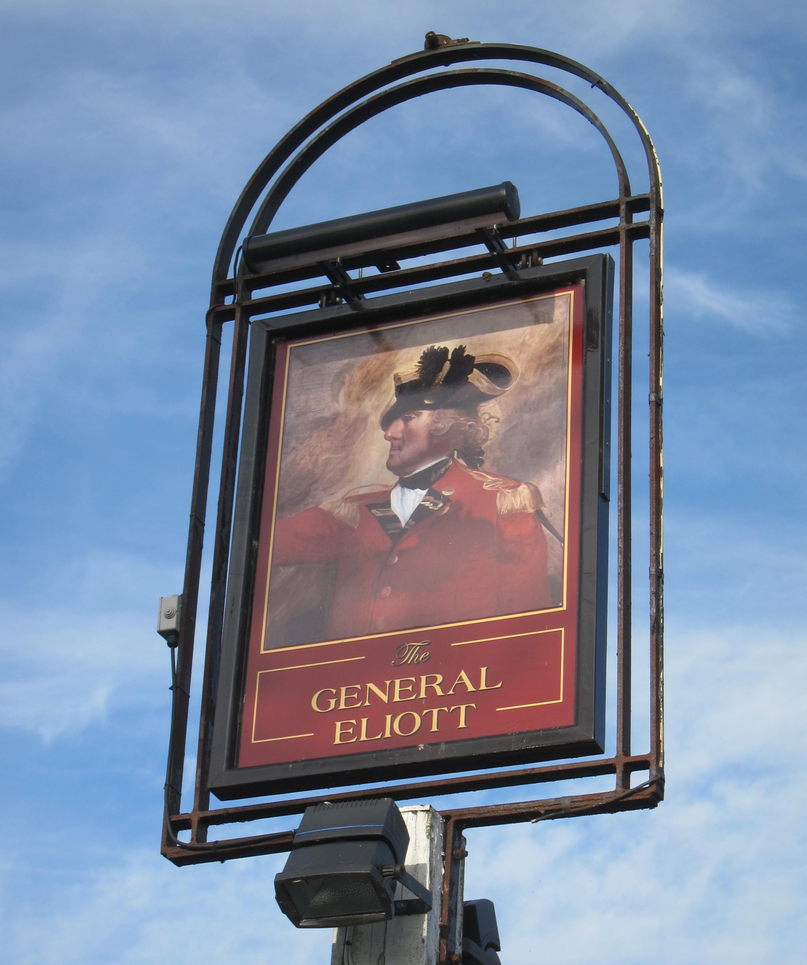
The pathway was a bit rougher than those we had followed so far and one stretch seemed to have been recently ploughed. Eventually we reached a feeder and our path turned right, away from the river, sending us eastward on a lane and then a street that lead back to the Grand Union Canal. A woman had just parked a car here and was being greeted by two cats. Ahead I could see the first of the longboats and as soon as we reached the canal we turned left to reach the General Eliott pub where, we decided, there was time for another coffee.
Tosh parked her hubcap outside and we entered an atmosphere dominated by a TV with the afternoon’s racing at full blast. A young man, who looked too young to be served, was stationed so that his stool impeded access to the tables in the rear – but we were soon seated. The Lees had coffee, lovingly prepared by a chef who quizzed us about our progress. I drank a mineral water and had a completely ineffective visit to the loo.
I now knew that we had less than an hour to go and that we would easily make it to our station by 4:30 – as I had promised. There was one final stretch of towpath walking but when we reached the Swan and Bottle car park we turned away and rose to street level – having made good at last a gap in our LOOP progress. It had been three years since we were last here but I had no problem leading us up to the Uxbridge station – though both of the Lees tried nervously to outguess me.
There wasn’t a long wait for a train and I joined the Lees on the Piccadilly Line, saying goodbye to them at Rayners Lane, where I sat on the platform for a few minutes waiting for a Metropolitan Line train. Now that our walk was over the sun was coming out and I sat hatless on a bench and pretended that I could feel spring in the air. On board my train I munched some peanuts, too tired to read as we made our way to Baker Street, passing the construction zone that was the new Wembley Stadium on the way. I switched to the Bakerloo Line at Baker Street and, after a very successful outing, made my way home at about 5:20.
Our next walk was: