
August 1, 1997: Gravesend to Cooling
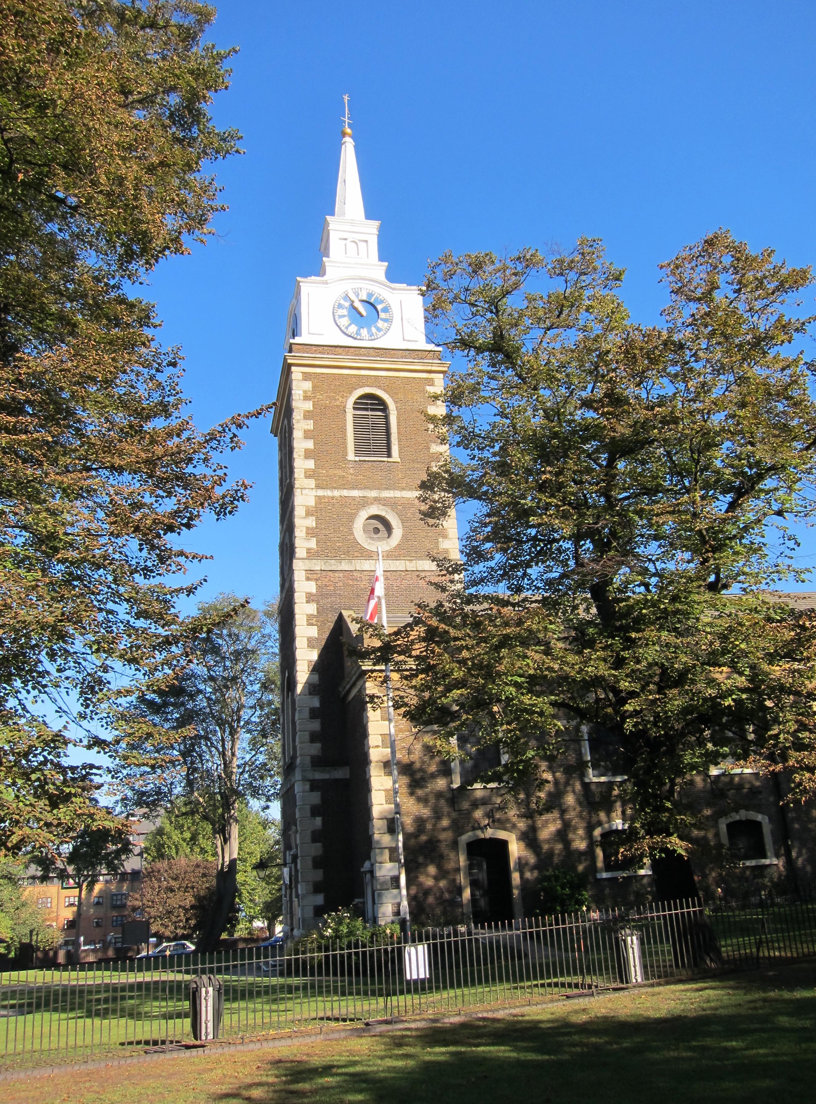
The church at Gravesend
Four weeks after the Lees and I had completed our next-to- last expedition on the South West Way, we began a new London-based walk, the Saxon Shore Way. We needed a new route for day walks – after having completed the Chilterns Hundred and I was especially interested in testing my back, which had given me a lot of problems after my return from Dorset.
We met at 9:30 on a Friday morning at Charing Cross (which, after three quarters of a year, could once again be reached on the Bakerloo line). There was no urgency because there were four trains an hour to Gravesend, our starting point. We took the 9:54, using the extra time to buy sandwiches, liquid and snacks. The journey took an hour, and included many stops. Tosh and I, lacking any fresh school gossip, concentrated our attentions on the riveting topic of grammar instruction – which had been the featured subject in a recent edition of the English Journal.
At Gravesend Harold and I found the gents quickly enough, but Tosh was thwarted – when she tried to get into the ladies – by a sign indicating that because of recent vandalism it would now be necessary to obtain a key from a member of the station staff. Appropriately, she accosted two gents crossing the tracks in orange vests, “Can you please give me the key to the ladies loo?” They stared at her in wonderment – one of them finally replying, “But we work at McDonalds.” Thereafter she used the gents – while Harold stood guard.
Out in front I wrote down the numbers of some local taxis, in case we decided to summon one at the end of our walk. Then, at 11:00, we headed toward the river, passing the aforementioned fast food establishment, and, as one would expect of Americans, we also circled St. George’s church in order to see the statue of Pocahontas. Then we continued down to the ferry pier, pausing to see the mosaic mural depicting the waterman’s riot in 1833. Here we discovered a sign indicating “Start of the Weald Way” – a route we had completed several years earlier. Saxon Shore Way signs and plinths began to appear as well as we made our way eastward among a series of parks and along a number promenades. We were launched.
The Saxon Shore Way is a 160-mile route that follows a long coastal loop around the perimeters of Kent and East Sussex before ending at Hastings. It is not, however, a true coast path, often seeking inland routes and right of ways and only touching the water’s edge on occasion. It is not a national trail, but the work of the Kent and East Sussex County Councils was supported by the Countryside Commission and the Ordnance Survey does publish a recreational path guide, with OS maps inside, written by Bea Cowan. I was using this as well as the Thames Estuary Landranger 178 OS map.
The weather reports had suggested that any lingering moisture would disappear from the area by noon and, indeed, a hot sun had appeared while we were still at the Gravesend train station. But by the time we were at the riverside we were back in grey, with a very low ceiling and restricted views. This made for better walking weather, but I’m sure we missed a great deal, particularly on the opposite shore of the river.
Gordon of Khartoum had been in charge of the fortifications in this area and we passed a number of military structures he had built. For a while we were pushed away from the river by docks, warehouses, piers, and the buildings of HMS Customs – which has its local headquarters here. Naturally Tosh, the keen student of non-residential architecture, was fascinated by many of the sites we passed this day.
I had some trouble figuring out where to go after leaving Gordon Promenade. The guidebook calls for a crossing of the lock gate used to get smaller vessels into an adjacent canal, but we were on a road bridge now. References were also made in the guidebook to actual street names, but none of the alleys and byways here had signage. So we floundered about a bit amid the loading and unloading of warehouse activity before continuing straight ahead from our road bridge through an industrial site. The advice that we look for a turnoff after 100 yards was not too helpful – “100 yards after what?” is always the question; in this case our turn off, onto a constricted path between wire fences, came well after 100 yards of anything.
We reached Wharf Road and continued eastward past scrap yards and warehouses. A poor apple tree was struggling to produce fruit up against the side of a pile of pallets. There was a Saxon Shore Way sign (and the famous plinth with the helmet motif) at our turn off to Denton Wharf. Here we were happy to be the first customers at the Ship and Lobster, a friendly pub that was already open at 11:40. We each had a half pint of lager and took a peek at the pub’s many interesting photos, each highlighting local maritime history.
Tosh forgot her sun glasses in the pub and had to go back, but shortly after noon we were able to continue east, gaining access to the top of a concrete sea wall and then to a high grass dike that took us past locked piers and under power lines. A herd of black and white horses was grazing contentedly in the meadows on our right. It was getting darker instead of lighter and views were shutting down in all directions. This made for an eerie passage, with large ships suddenly looming up on our left as we headed toward another Gordon project, Shornmead Fort. Tosh had been agitating for lunch so I suggested we head for this ruin. Curiously, Harold and I arrived here five minutes before the hungry lady, who was compulsively collecting everything today: dried weeds, old rope, pieces of broken tile (which she dignified by calling them potsherds), and rocks. By the time she had arrived Harold and I had located a fairly sheltered spot at the east end of the wall of the fort.
We tucked into our sandwiches, but within five minutes a fine drizzle had overtaken us. (Never trust Michael Fish.) I had brought my rain jacket with me and I put this on, but we decided it was too uncomfortable to sit still and so, after only a ten-minute rest and a hurried swallow or two, we packed up and moved forward once again. I walked on the top of the high grass dike as we passed a red painted beacon on the shoreline, but Tosh often walked instead in the valley to the right of this eminence, convincing herself that the rain couldn’t get to her there. At a very high metal ladder stile Harold paused to put on his rain pants.
I pressed forward to the end of the dike, where our paths split. I waited here because I wanted to make sure the others could see me following the shore around Higham Saltings. Tosh was again well behind and we lost her again as Harold and I continued forward on a garbage strewn dike to Cliffe Fort, at the head of a promontory. My stomach was a bit upset and I was damp on my left side but I persevered, trying to keep us on target to reach a pub in Cliffe before closing time. The weather was improving as we rounded the fort, which also seemed to be engulfed in quarry activity. While we were waiting for the missing lady Harold took his rain pants off; we were never bothered by moisture again.
We walked under a conveyer belt and headed toward Cliffe Creek, where we turned our back on the Thames. It was much warmer and humid, with no breezes to cool us down, as we rounded the head of the creek and searched out a continuation to the southeast on a narrow strip of land between lagoons. Route finding was a bit problematic here, and the OS map was more useful than Cowan’s text. There was a long, uninteresting (well, Harold liked it) straightaway among hawthorns for nearly a mile. At the end we turned left and headed for Allen’s Hill but here, a bit too soon, I began my ascent around the flank of this low level rise, ending up at a crossroads I hadn’t expected at all. However a man in a truck, who was looking for water leaks, was just turning around and I asked him the best way to reach Cliffe village. It was directly ahead us on one of the adjacent roads, and we soon entered it at 2:50, though a bit farther south than the official route calls for. The first pub we encountered had closed at 2:30, but we took the main road south and in five minutes reached the Evening Star, which had only opened at 2:00.
We entered and each of us had a pint; this liquid was most refreshing after such a humid march. The place was full of rather louche youth, many playing pool, but, behind the bar, the pretty teenager in a long blue dress was congenial enough. As we relaxed it was time to consider our next move. We had walked seven and a half miles. It would be two miles of road walking to the Higham train station – but another of my ideas was to call a cab from Strood and have it meet us in Cooling, a mile and a half further along on the Way itself. Tosh said she’d get them to turn down the jukebox so I could make my call. There was a number for a Strood cab company above the pay phone and after two attempts I succeeded in getting them to send us a taxi for 4:10 at the St. James Church in Cooling.
We drained the last of our glasses and returned to the center of a village that seemed to be enjoying a building boom – hunting about a bit before finding our continuation to the east of town. I lead us across empty fields on the bare earth and, as we approached Rye Street Farm, down a road past a commercial raspberry operation. Tosh was again well behind and I stationed Harold to look out for her at several turnoffs as we entered rough pasture, crossed a footbridge, threaded our way through a field of linseed and reached the Cooling road. Cooling Castle, on our left, was very impressive; there was a wedding reception in an ancient barn as we passed by.
This walk had been unusual in a number of ways, one of them being that I had lead at every stage from first to last; that doesn’t happen very often (a stage victory, they would call this in the Tour de France – had this been a race). Another surprise was in store at the very end of the walk. The Cooling Church is, of course, the one depicted in Great Expectations as the spot where Magwitch pounces on Pip.
I arrived here at 4:00 exactly, ten minutes before taxi time, and was soon followed by Harold. But this time Tosh had disappeared altogether. Harold assured me that he had seen her on the road behind us, but as he retraced his steps, the lady could not be found anywhere. Meanwhile the Strood taxi arrived, so the first order of the day was to drive around in search of the missing walker. We took the turnoff to Cooling Court and after several hundred yards we encountered our somewhat embarrassed companion who, having seen no church ahead, had turned off to the right to improve her chances of finding one to the south.
She now insisted that we had to return to the church in question so that she could have a look – although I reminded her that we would start here next time. So the bemused Asian driver turned around and we returned to Cooling. Then he headed off for Strood, which we reached at 4:30. The ride, including tip, had cost £10, but it was well worth it.
Tosh bought us tickets for Gravesend and we found a bench on platform two while we waited for the 4:59 to Cannons Street. I drank a box of Ribena strawberry juice. There were plenty of seats on a journey that followed a slightly different line back to London, with fewer stops on the way – though we did have to change at London Bridge in order to get back to Waterloo. It was 6:15 and we had enjoyed a pleasant day. My back had held up well over the nine-mile route and we were already discussing our next outing. I got home by 6:45, just two hours before our summer visitors, Howard and Jennifer, returned from York.
To continue with the next stage of our walk you need: