
June 11, 2000: Etchinghill to Hamstreet
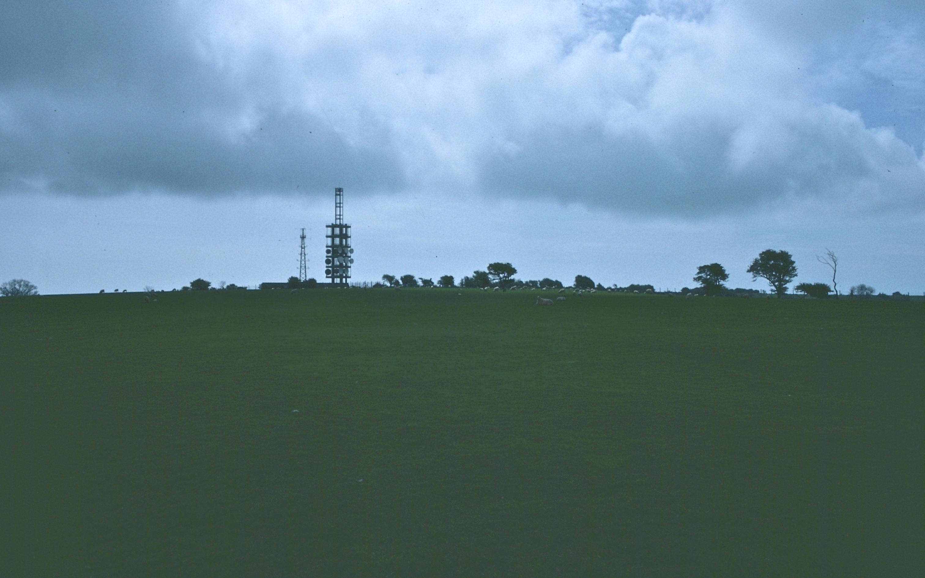
The telecom masts at Etchinghill
Less than two weeks after our wet afternoon in Dover, the Lees and I foregathered in Charing Cross Station for the next, and certainly the most strenuous, stage of the Saxon Shore Way. I wanted to get this walk in while there was still a lot of daylight, for fifteen and a half miles, so far from London, requires the endless sunshine of a late afternoon in June. We busied ourselves getting in enough food for the long day (I bought two baguettes) and had time for coffee and pastry as well. It was approaching train time, 8:30, and not a single kiosk was open at which one might purchase so humble an object as a candy bar!
Our connection required us to change at Ashford, where there was time for us to complete our food purchases on the platform. As we passed through once familiar territory near Sandling I pointed out the Telecom tower that we would soon be visiting on foot. I had asked the conductor which of the two Folkestone stations might have taxis nearby and he had recommended Folkestone Central – so here we alighted at 10:17. The first cab went to some other customers but we were soon aboard a taxi heading north to Etchinghill. Indeed, we were swept around a bend and deposited near the church before I could get the driver to stop. The expedition cost only £6.60, but we were now positioned, as we walked back to the spot where the NDW and the Saxon Shore Way descend from the top, to resume our walk. I reminded the Lees that we had already walked the Aycliff-Etchinghill section of this route in our conquest of the NDW – which is why we were not repeating the Dover-Etchinghill section of the SSW now. It was about 10:40 when we got underway.
The uphill gradients were pretty gentle. I knew that today’s route would be full of complexities so I carried the guidebook in my map case from the outset. The weather alternated between sunny periods and cloudy ones, but all threat of rain seemed to have passed in the morning mist, and I was able to spend the entire day in a gray t-shirt.
We emerged from the foliage onto the windy telecomm summit and approached the fence of the tower, noting that the NDW was carrying on its business as a national trail and as part of a European Grand Randonee route as well. Our more humble Saxon Shore Way was now heading south on a level saddle, the dramatic Brockman’s Bushes on our left. It passed a trig point and began a descent on a rutted farm track. Views of the distant sea were everywhere today, but we never approached the shore itself.
At the bottom of the hill we encountered our first muddy lane – there were many of these today since a lot of rain had fallen and trees in full leaf make it hard for the surfaces to dry out. A harder surface greeted us at Bluehouse Cottage. The guidebook promised a more direct short cut across a field on our left but when we tried this we discovered that the path was overgrown and the footing juicy – so we retreated to the lane and continued south to the A20; there were Saxon Shore Way signs on this corner too.
We turned left, crossed the highway and paused at a war memorial before using a footbridge over the roaring M20. We seemed to be in a building site here and I was worried about losing some vital landmarks, but the route seemed unaffected and we were soon heading west on a metaled track. The path then climbed a hillside briefly and began an undulating progress in a southwesterly direction. I wasn’t able to confirm every one of the guidebook instructions on the ground, but the route was well marked and quite pleasant, with woodland and wildflowers predominant. We crossed the Sandling Road and climbed a hillside back into woodland. Most of the morning’s ascents were easy enough and not protracted in any case. Our passage through Chesterfield Wood ended when we entered more open territory, crossing a juicy field to aim for a chapel at Pedinge. Cows and sheep were everywhere today.
We crossed the A261 and the outskirts of Oxenden Farm, but again we were more reliant on signs than on the text. We followed a broad path through cultivated fields but, much to our surprise, it disappeared altogether and we were faced with vast expanses of oilseed rape – which had been planted over the path. A few hardy souls had attempted to penetrate this resistant foliage and so there was nothing for us to do but follow suit. But this was a very wearying section on the legs. I could see the nose of Folks Wood, which we aimed for, but the plants continued to tug at our knees until we had at last reached a stile that put us out on the B2067.
Here some road walking began, and another bit of uphill, but I don’t think anyone resented the solid footing. Every now and then we paused to let cars by. We passed the Shepway Cross but did not go left with the SSW because I had decided to lead us directly to the pub in Lympne. I had been predicting a 1:00 arrival and we did arrive at 1:05; we would have made our deadline if we hadn’t been raped.
The County Members Inn was a very nice establishment with an efficient staff. We did not go into the restaurant but settled in at the bar, where we each had a pint of lager and an egg and cress sandwich. I ordered a bowl of chips, which everyone enjoyed. We were served almost immediately (what a contrast to our last lunch on this route). Tosh asked the waitress how to pronounce the name of this village – “Lim” was the response. This, I said, seems to set the record for the number of silent letters in a six character word – since the “p,” the “n” and the “e” all seem to be redundant. We used the loos and washed our hands and at 1:45 we were ready to roll again.
We headed back to the Saxon Shore Way on a little side road and I suggested we double back a bit to have a look at St. Stephen’s Church and Lympne Castle. Then we headed west again, following a narrow wooded path at the cliff edge, our first view of the Royal Military Canal below. Our route led us back to the road briefly and then it was time to take a track steeply down the scarp. I have had a number of unusual animal sightings in my journeys as a walker but I suppose the sight of six elephants, lounging in the field next door, must come at the top of the list. We were walking along one side of Lympne Zoo here and in a few minutes we had distant views of bison and antelope as well.
The afternoon was somewhat sultry and I wasn’t feeling that chipper, my lunch sitting heavily and the Lees sprinting ahead of me. When we reached the embankment of the canal they were soon out of sight in the twists and turns of the uneven surface through woods. I caught up with them as we reached a muddy road at Aldergate Bridge and here I suggested we climb up to the parapet for our only close-hand view of the canal itself. Then we had a long level slog dodging puddles as we made our way westward – Harold now bringing up the rear and a muttering Tosh testing the ooze as she looked for the best place to put her feet.
At Honeypot Cottage we were directed inland again; there wasn’t much of a path but the guidebook directions were straightforward and we had soon climbed up a bit in order to sit down for a rest and some liquid. The prospect of having to regain all that altitude lost in our descent to the canal was not an enjoyable one but I decided to have a go while the others rested. Again there was no path but I had a ruined chapel in sight to guide my steps. Curiously, I began to feel better after these exertions and it took the Lees a long time to catch up with me. By this time I had followed two posts below the cliff edge and headed west on an overgrown track.
There was an attractive modern building at Fostum’s, but we were well below it (in some place called Dunk’s Ruff) as we made our way along field edges and around woodland. I must say this section was proving far more strenuous than I had imagined. We descended again and then had to regain the lost elevation. The approaches to stiles were overgrown and the only evidence that we were on a long distance footpath was the occasional Saxon Shore Way helmet nailed to a stile. The OS map was very useful in confirming directions, but we were knee deep in grass as we fought our way into the Curtis Wood. We emerged from this below the dramatic hillock of Aldington Knoll, where we had another rest. I was trying to figure out if we could make the 7:02 from Hamstreet, but this was now looking less and less likely.
After our rest we climbed a stile into the road and walked east for a few meters before heading up on a thin path next to an overgrown field. At the top we could see the Aldington church and a cleared path, for once, lead us through the grain to the next road. We had come 5.5 miles since lunch and we still had 4.75 miles to go.
I was having trouble with my shoelaces (this often happens when the feet have to fight through the foliage) and Tosh said she wasn’t taking another step until I retied them. I needed a spot where I could elevate my foot and this was found at a gate that ushered the route off the road – at the start of a series of gates and stiles in farmland. Text descriptions were important here because there was no evidence of a path downhill between power lines. We crossed a little bridge and climbed uphill, with Blackthorn Woods on our left. The clouds had thinned by this time in the late afternoon and we had bright sunshine whenever this was not obscured by woods.
When we reached a road we were not too far away from a pub in Aldington Corner but now there really wasn’t time for such a diversion. Tosh was beginning to fret about the arrival of our former colleague, Don Jesse, in Acton (though she had told him not to expect his hosts before 10:00) and she was charging forward as though the 7:02 were still a possibility. It wasn’t.
After a short distance on the road we turned right on a metaled track, then circled the gardens of Hungry Hall. I had to pause to tie my other boot. The way forward was not at all easy to follow as crops, derelict stiles, nettles and fences each had a go at slowing the walker down. As we neared civilization Tosh balked altogether at a stile, a ditch and a barbed wire fence that conspired to make progress past a kennel a true hazard. I wish I had taken a look at this spot myself – I might not have been so daunted, but I could see an easy escape down a drive to the road we would be using soon anyway – so we gave up on the struggle and took to tarmac for a few minutes.
We continued west to walk through a portion of Park Wood. It was muddy on such stretches and here I discovered that Tosh was suffering from a new phobia – fear of the dark. The contrast between the sun in the eyes in open places and the obscurity of the forest was great, but when I suggested she should follow rather than lead in such circumstances she said it wouldn’t help. We crossed a stream in the middle of the woods and climbed back toward the light soon thereafter. We emerged onto a track that lead out to Priory Road. The domestic block of Bilsington Priory itself was to the south now and when we reached a road we turned toward it. I was well behind here but I caught up when Tosh stopped to talk to a deaf old man, standing in the road. He estimated that it was still an hour and a half’s walk to Hamstreet and I think this finally convinced Tosh that the 7:02 was not a possibility.
A long woodland section through Priory Woods followed. At one point the path split and I fished out my compass to make sure that we were taking the northwest branch rather than the due north one. Once again sunlight beckoned as we used a track to reach a paved road. But the way forward on the other side was not at all congenial. As instructed we headed diagonally left past a farm pond to make for the next SSW marker at a stile. But the suggestion that we now double back in the direction of two metal gates was not possible because grain had filled in all of the field. I tried circling it, but this was desperate since there was no real path and the surfaces were uneven and one risked a sprained ankle at every footfall. “Take baby steps,” I advised.
When we reached the metal gates our reward was a path into more darkened woodland, Dyne’s Wood. A succession of open spaces and trees followed and every time I thought I could put my sunglasses away for the day I was proven wrong. We were heading southwest now and, with a mile or so to go, it was already 7:02. Another stretch of road walking followed, with a turnoff at Horton Green and a path to Gill Farm. As we neared our next section of woodland I told Tosh that the bad news was that we were about to enter woods again, but that this would be our last stretch for the day– for it was Ham Street Woods.
In fact the route, along tracks, was often open to the heavens –so we made good progress here, emerging at last at a parking area north of the village. I knew of a shortcut to the train station (the last few meters of the Greensand Way, curiously) and we used it to arrive at our platform at 7:45. I phoned Dorothy on the mobile. A few minutes were spent scraping mud off our boots and at 8:02 we had a short ride to Ashford. A train was waiting here, with a schizophrenic in shorts sharing our compartment for one stop, and we were back at Charing Cross at 9:45. We spent part of our train time eating our sandwiches (I never got to the second baguette) and part of the time snoozing. There was still a tiny glint of light in the sky as I inched home wearily but contentedly at 10:15.
To continue with the next stage of our walk you need: