
June 1, 2012: Ringstead to Hunstanton
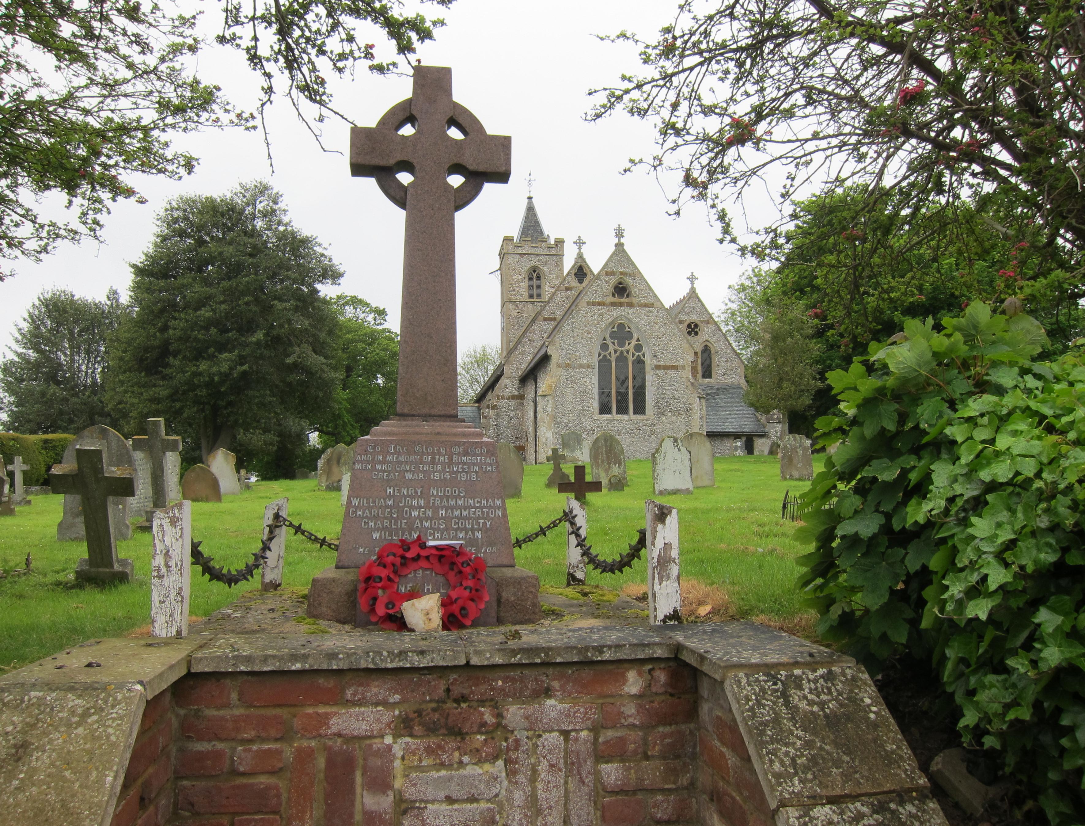
Ringstead church and war memorial
I didn’t have to worry too much about sun streaming through my windows this morning because, once again, skies were gray when I got up for the last day of our expedition on the Peddars Way. Some of the pavements were wet as well and I determined to start the day in raingear… this is always more comfortable than putting it on during the walk itself.
We had breakfast at 8:30 and we very much regretted causing such looks of disappointment on the face of our hostess by ordering such simple fare. (You know you are in gourmet heaven when there are a dozen different types of bread on offer on the menu.) We had been given permission to leave our luggage at the guest house – where we would pick it up and await our second taxi at the end of the walk at noon. We brought everything downstairs now, however, and laced on our boots as a new driver from Ben’s Taxis waited for us at 9:30.
We were soon back in Ringstead and Tosh was buying her newspaper at the General Store. We were able to get underway at about 9:50 and, though it remained gray throughout the morning, it did not rain and I was able to utilize my camera once again.
One of my first shots came as we used pavement to head north to reach the village church and war memorial. There were a number of interesting cottages and farmsteads here and there was much debate over the names of flowers blossoming in front years. After five minutes we turned right, still on pavement, then left (north again) to pass by a large windmill. This structure was surrounded by scaffolding and workers were in the process of restoring it as we walked by.
Tosh missed our next turnoff and I had to call her back so that we could leave tarmac for a while and head west on a field path. Now, at last, we could see the ocean itself on the horizon. We turned north and passed along a lengthy section of hedgerow-protected footpath – so reminiscent of earlier sections further south.
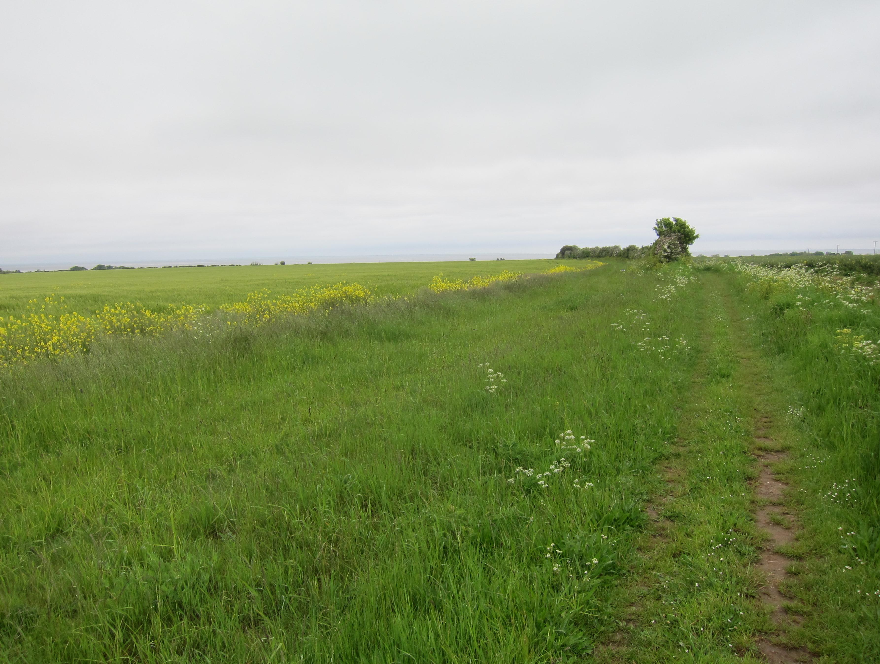
From Ringstead to the sea
It was during this stretch that we encountered one of the unique features of the Peddars Way – deployment of a large sculptural standing stone, part of a Norfolk Songlines project, here designed by Tom Perkins, with text by Hugh Lupton: “All the past that has lead to your moment in time is held like a great secret in the landscape that surrounds you.” We had passed another stone like this at the outset of our walk but nature had already made it difficult to decipher the text – this one was much easier to read. (Now that we have our national trail sculptures in place, how about the occasional bench for us old timers?)
Eventually we reached the A149, on the outskirts of Holme-next-the sea. Here the Prince of Wales had presided over opening ceremonies for the National Trail in 1986.
Our way forward was along Beach Road and this was not very comfortable – as there were many cars about. The road gradually swung to the left and I suppose one could say that this long homage to an ancient Roman route, the Peddars Way, now came to an end with the presence of coastal scenery: all of the signs we encountered from this point on bore only the designation Norfolk Coast Path. The latter route begins in Hunstanton and we would now have some two and a half miles along it to get back to the Bays Guest House. (In character and itinerary the Peddars Way and the Norfolk Coast path are so different from one another that their conjunction seems to be almost arbitrary – though combining them surely makes for a more suitably-sized guidebook.)
We now passed over a canal and dodged traffic locked into position by a huge lorry – approaching a golf course where it took a while before Margie spotted a finger post out on the sand dunes. We then began a desperate plod along the top of the ridge at the back of the beach, our feet sinking into the sand. Others had tried to find firmer footing on the left of this trough and we tried this out ourselves but the impromptu footpath was twisting and overgrown. I wonder if better progress could not have been made on the beach itself and Tosh wanted to drop down to the inland side of the ridge, where there seemed to be a far more level route up against the golf course fence – and this is what we did, eventually.
Earlier I had toyed with the idea of trying to get back to Hunstanton in time to make the 12:55 train from King’s Lynn. But the slow sandy progress on this section had put paid to this idea. We now walked by a series of beach chalets and past the impressive clubhouse and, with still more sand to sift, up to the lifeboat house. There were loos here and the girls used these while I sat on a bench and watched a number of trippers and their dogs make their way forward.
When we resumed our climb up to a line of pine trees more sandy surfaces led to a further defection on Tosh’s part – she was sure she could find a more convenient surface if she dived into the trees. I knew that just a few more steps would get up to the clifftop esplanade so I persevered and so did Margie – we had to wait for Tosh, who had gotten lost.
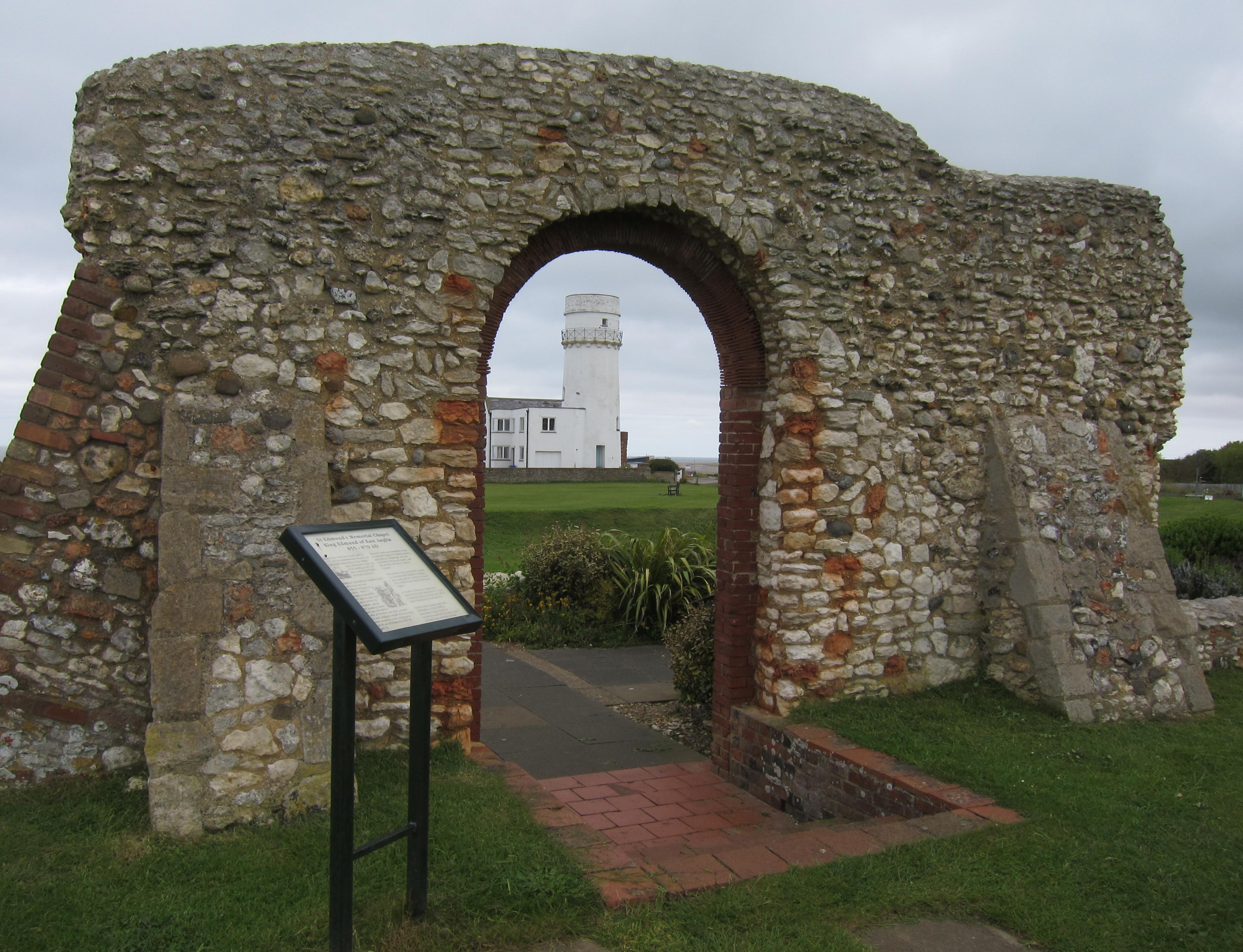
The ruins of St. Edmund’s Chapel and the lighthouse at Hunstanton
On level and solid ground (first a parking lot) we pressed forward, often on grass now, soon reaching the Hunstanton lighthouse and the ruins of St. Edmund’s Chapel. (I later figured out that by reaching this spot Margie has now walked 800 miles on British footpaths). That lady used the loos at a clifftop café (so did I) while Tosh ordered an ice cream cone for herself. Then we continued on, in a southerly direction through the ornamental seaside gardens – with a number of Jubilee-inspired plantings) and at last drew level with the Golden Lion Hotel, where we had enjoyed our drinks the night before. It was 12:45.
Tosh got lost once again as we made our way back to our b&b and, after we had phoned the taxi company, she disappeared in search of a cup of coffee. Our bags were retrieved from the Bays Guest House and I sat on a bench out front and took my raingear off and collapsed my trusty walking stick. Our cab was soon here and we loaded up for a fifteen mile drive to King’s Lynn – passing Sandringham on our left. Progress through King’s Lynn itself was painfully slow – for a while we followed the progress of two gay guys who were holding hands as they walked along the pavement.
We reached the train station with about fifteen minutes to spare and used the loos and made some purchases in the café. Aboard the train (a direct one back to King’s Cross) we snoozed, read, and snacked. I finally drank the can of Diet Coke I had been carrying in my pack for days. Marge and I could hear Tosh half a car away, phoning the ticket office in Notting Hill with her booking requests – this meant that she could head for home when we arrived back in town shortly after 3:30. I congratulated my walking partners on a job well done – the geriatric warriors had triumphed once again. I then got in a very short taxi queue and was soon heading for home and, tired after five days of exertion, very glad to get there indeed.
Many walkers will want to continue with the Norfolk Coast Path. If this is true for you then you need:
Day 1: Hunstanton to Brancaster
Footpath Index:
England: A Chilterns Hundred | The Chiltern Way | The Cleveland Way | The Coast-to-Coast Path | The Coleridge Way | The Cotswold Way | The Cumberland Way | The Cumbria Way | The Dales Way | The Furness Way | The Green London Way | The Greensand Way | The Isle of Wight Coast Path | The London Countryway | The London Outer Orbital Path | The Norfolk Coast Path | The North Downs Way | The Northumberland Coast Path | The Peddars Way | The Pennine Way | The Ridgeway Path | The Roman Way | The Saxon Shore Way | The South Downs Way | The South West Coast Path | The Thames Path | The Two Moors Way | The Vanguard Way | The Wealdway | The Westmorland Way | The White Peak Way | The Yorkshire Wolds Way
Ireland: The Dingle Way | The Wicklow Way
Scotland: The Great Glen Way | The Rob Roy Way | The Speyside Way | The West Highland Way
Wales: Glyndwr’s Way | Offa’s Dyke Path
Channel Islands: The Guernsey Coastal Walk | The Jersey Coastal Walk