
June 21, 2006: Crooklands to Arnside
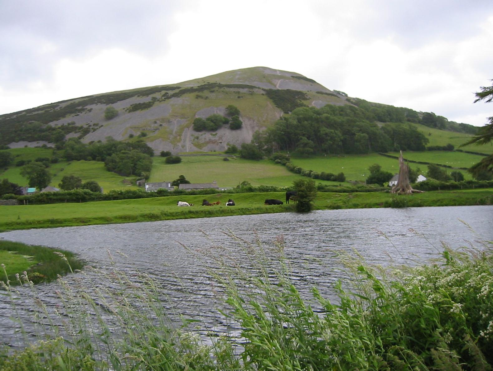
Opposite Farleton Knott
It had rained most of the night and it still seemed stormy outside – but skies were far brighter on this day and the sun was trying to come out. Most of my wet things had dried well enough; I used the hand-held hairdryer to finish toasting the cuffs of my green sweatshirt. I did note that the little toe of my right foot was quite sore so I put some tape on it. We had breakfast at 8:30 and returned to our room to prepare, for the last time, our backpacks for the Brigantes carrier. Just as we were stowing them in the reception office our burgeoning bimbo of the previous evening arrived. There was even more flesh on display today – she had somehow managed to arrive for work in an outfit that provided an inch of cleavage, fore and aft. It was 9:35 when we made our departure.
The first thing that hit us was the wind, a very strong breeze that soon had us clutching our caps in exposed locations. The sun had triumphed, though it provided no warmth – altogether a chilly morning for the summer solstice. We dodged the traffic to cross the street and then our bridge over the canal – soon finding steps down to the towpath. I told the others that today we had an even longer stint along the canal than yesterday and that we would meet twelve bridges before leaving its side. If it hadn’t been for the wind pushing us back this would have been an easy stretch indeed. The towpath was again just a soft grass verge in most places, easy on the feet and still fairly well drained. The Lancaster Canal, long ago closed and subdivided by highway construction, carried no boats or any other signs of human intrusion; it had been left as a watery sanctuary for the local wildlife and it was quite lovely. We encountered quite a few people out exercising their dogs. One young woman had a sheepdog with a missing front foot and a Jack Russell named Chauncey.
At the first of our bridges, Millness Bridge, the canal ended briefly because of its first encounter with the M6 motorway – though we were able to use an access road beneath the latter to reach the other side and resume canalside walking. I kept careful track of which bridge we had reached so as to know how far we had come – none of them were signed and quite a few of them had no names anyway. After two more bridges a concrete tunnel had been provided for us to use in our passage forward. Ahead of us was the commanding height of Farleton Knott, providing a very dramatic contour in an otherwise flat landscape. We had drawn up opposite this eminence by the time we had reached Duke’s Bridge, where Hannon again warns us that our route would be diverted by the M6.
Unfortunately there was no indication of this on the ground and, as the others were well ahead of me here, I assumed that some improvement in the route had been negotiated and I therefore just followed along. Certainly the towpath continued forward for another quarter of a mile and I had high hopes that some sort of passage had been negotiated in the twenty years since my edition of the guidebook had been printed – but the path ended abruptly at the motorway embankment and I discouraged Tosh from trying to bushwack her way forward. There was nothing to do but call a retreat.
This we did, returning after ten minutes to Duke’s Bridge, climbing up some steps to the Milnthorpe Road, walking over the motorway in a cap-clutching moment, and locating a stile that now allowed us to parallel the M6 in a southerly direction – by walking along a fence in a large field. I told the others that I was adding a half-mile to today’s total, making this an eleven-mile day. A gate allowed us to return to the canal and two bridges later we had to leave it briefly to use twin stiles to get over another road. A swan was at home at the northern end of this interruption and, as the southern continuation beckoned, we found its mate and six more cygnets. These chaps were several weeks younger that yesterday’s lot, more white than grey, but they all swam over to have a look at us and there was much snapping of camera shutters.
At Holme Park Bridge, after three morning miles on the canal (not counting an embarrassing half-mile extra) we turned our back on this pleasant scene and used a farm road to enter Holme village itself, a not very distinguished ribbon of cottages presided over by mums with prams. After a southerly dogleg we turned west between buildings and began a crossing of several fields and meadows, carefully following Hannon’s instructions on the subject of gates, stiles and fences. This route led us to the B6384 Milnthorpe-Burton Road and the start of another adventure in railway safety. Again we would be approaching the main line and again I was beginning to wonder if we would be able to get across safely. I was less worried today because I had the right map in my daypack and I knew that the way round such an obstruction would be fairly easy to do on roads. But almost immediately I could see another pedestrian bridge rising above the trackway, and this was good news indeed.
On the other side we moved forward to a fence, switched sides, and ascended with it on our right – soon obtaining a view of Pyes Bridge Farm below. When we reached the track over the bridge in question, however, we had to wait our turn. A huge DHL lorry was attempting to cross the little stone bridge but farm muck was impeding any search for traction and the angle of entry was a twisting one and the driver had to back up twice before being able to inch over the bridge. We four gave him a round of applause as he approached us and he beamed with pleasure over his triumph. He was followed immediately by the farmer in a truck. Of the lorry he said, “They keep making them bigger and bigger.” I noted that after all that, the DHL man was probably carrying nothing more weighty than a camera battery.
Approaching Beetham
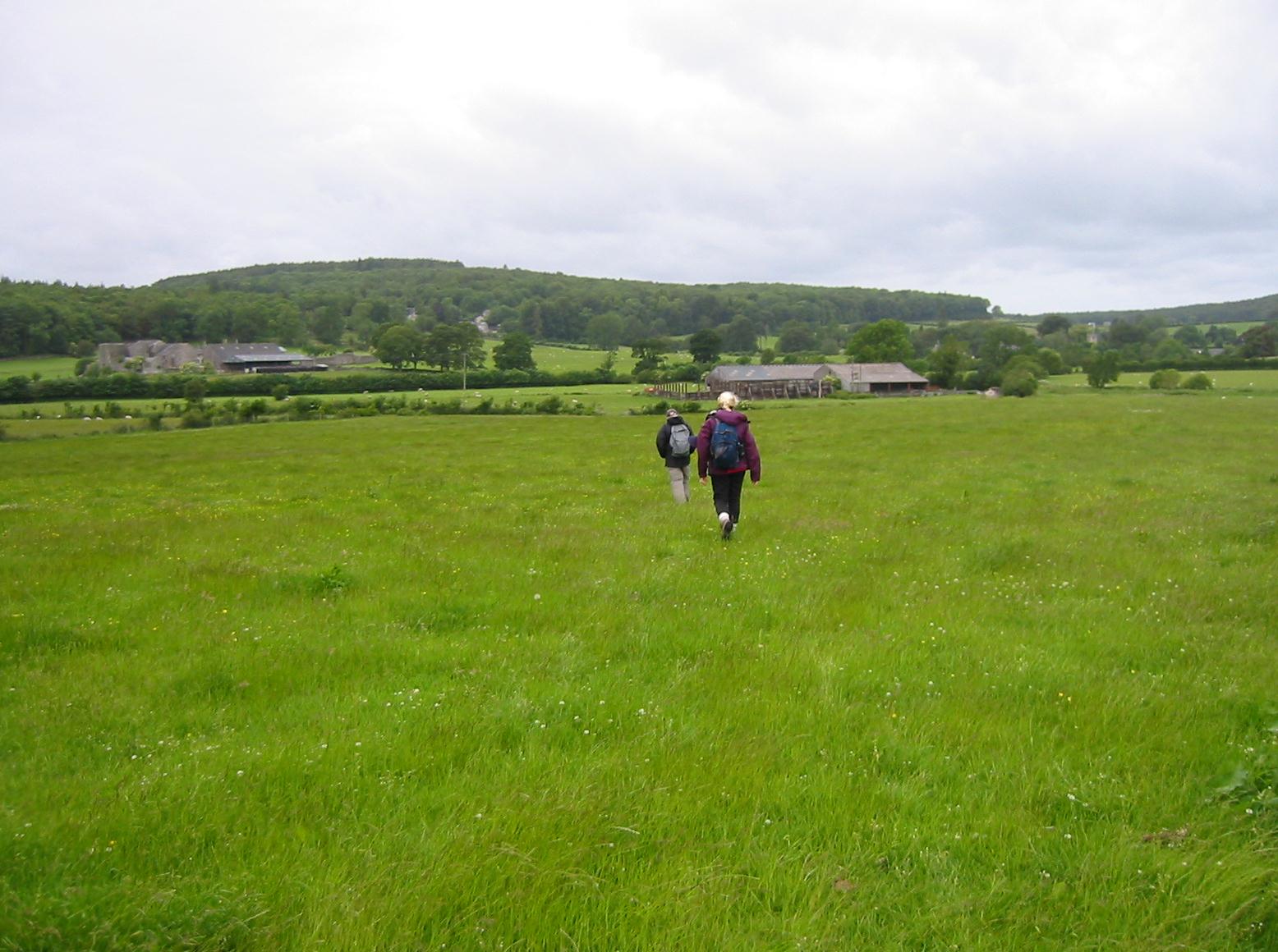
Our next section was again an overland one, without much evidence of path – just an instruction to aim for a group of barns. The others veered too far to the left here (Tosh thinks any gate or stile on the horizon is hers) and I had to pull them over to the right to find a farm track that lead us out to the A6. This we crossed gingerly, utilizing a paved footpath to take the Beetham turnoff and to enter our noontime village. It was recess in the local schoolyard and the children, wearing bright blue-green sweaters, were making the usual racket. Some of the older girls were clutching one another and swaying in the wind, but they did say hello to us. We passed the Heron Theatre next – just one sign of the upmarket nature of the village – which we walked through slowly in search of another of its jewels, the Wheatsheaf. I had been promising the others a pub lunch and, after rounding a corner, we had arrived at the pub’s door. It was 12:30.
We knew we were in posh surroundings when a black-clad waiter asked us if we required a table for four. The other diners seemed to be mostly local gentry and many were known to the staff. Drinks were brought to us from the bar (I was drinking Diet Cokes) and we settled in for an elegant lunch. Upstairs there seemed to be a businessman’s meeting in a function room and this rather retarded the service. Tosh said that the place had an atmosphere and that the waiters seemed to have definite ideas of their place and station. I had the scampi.
In the men’s room there were framed photos of yesteryear with salacious captions (not so in the ladies) and I told Harold that he had to spend some time in here. A dowager with huge eyeglasses sat in one corner and a Miss Marple was trying to ingratiate herself with some people who had the same name as people she had once known in another village. All this was very amusing, but it took a long time. We had only covered half of our distance and it wasn’t until 2:20 that we made our escape from Beetham, walking by the church and finding a stile into a rising field.
At the top we entered woodland, following the advice that we needed to turn left (which seemed to be opposite the direction required) but this path eventually swung around to join a much wider track that continued to rise – first in a westerly direction and then in a southerly one as we emerged at last on the top of a hill. Our goal was a cleft in the cliff below us, the famous Fairy Steps. Tosh couldn’t believe that we were required to penetrate this chasm, one person wide, but so we were and so we did, gingerly, finding places for our feet as we climbed down and squeezing ourselves between the narrow walls. Pictures were taking of Margie as she made her way down. Here we were happy that we weren’t carrying our heavy backpacks and that we didn’t have any rugby players in our entourage.
Two paths lead away from the bottom and I mistakenly took the left-hand version. Almost immediately I realized, with the help of my compass, that this was the wrong way, but I persisted in reaching the woodland ahead of us anyway – for we suddenly needed shelter. It had started to rain. Out came the raingear and we were several minutes in getting ready to face the elements. Fortunately, as we returned to the foot of the Fairy Steps and continued westward and downhill, there were lots of trees about and we were able to walk under cover.
We passed through another version of the steps, one I liked even better as a matter of a fact, and reached level ground where a forestry track lead us out to an open field. Here we returned to bright sunlight, heading west, with the company of a wall on our left, out to the farmstead at Hazelsack. This was beginning to feel like familiar territory to me for Gavan and I had passed through this world when we were in the first hour of our walk on the Furness Way in 1994. I remember passing Hazelsack Tower then and we did so this time, though in the opposite direction – as we entered the grounds of a caravan encampment and headed southwest, searching for a stile. Only a short distance from this spot was a fence where I had rescued a sheep – who had caught its horns in the wire.
Now we undertook an entirely new route, passing though a strip of woodland on a very muddy path (Hannon has us on a parallel route to the east that would have been much dryer). At the end we reached a lane and then moved cross-country to a farm track (also mucky) that headed for a railway line, one that we would ourselves use the next day. I noted that a barn, mentioned in the text and noted on Hannon’s map, had been demolished in the interim. We passed under the railway line and, at a multi-signed junction, turned right to parallel the line past a farmhouse and almost out to the road at Black Dyke. (I remembered at this point how Gavan, in the first charm of political correctness, had joked that the name needed to be African-American Lesbian.)
Our route now called for a stiff climb in woodland behind the gardens of nearby houses. This section ends, Hannon warns, when the path debouches into Spinney Lane, but I was a bit uncertain if we had arrived at the right spot when we reached a suburban lane lined with garages. A gentleman with a tape measure in his hand came out of his garage to advise us that we needed to continue our ascent on tarmac and this we did, reaching the desired point after only a few steps and continuing on to the Arnside-Silverdale Road. Here we turned left and continued to climb while looking for a turnoff onto Arnside Knott itself. It seemed to take forever to reach this spot (though the views ahead and to our left were intriguing) and when we did so there was no gate (we found one inside the woods), only a stile. Now began another steep bit of uphill, our last, as we sought the summit of this hill.

The Kent Estuary from Arnside Knott
We slanted off to the left after a while and found a wall that would provide an escape for us shortly. But the actual summit is reached only after you turn your back on the wall and take a little trail out to a triangulation pillar. Here we had a brief rest and Tosh, who was using a real camera on this trip, changed some film. Then we returned to the wall and breeched it to begin a descent of Red Hills. Views of the Kent Estuary at low tide stretched out before us and we could see trains on the bridge just to the north of Arnside village.
There was no footpath and, as though he were running out of advice, Hannon suggests only that you need to head for a stile onto a lane. This we could see, some distance away, but the route downhill through the bracken had to be improvised. Tosh headed one way and the rest of us a second, but after some minor bushwacking we all reached the stile at about the same time. We now headed, in suburban surroundings, down to the shoreline, utilising a small enclosed path to make the final descent to the sandy shore.
Here we headed north, walking along the sands for a while and, after the lifeguard station, on paths and roads as we rounded a corner and reached Arnisde. We soon passed our place of accommodation, Willowfield House, but I reminded the others that we needed to travel several hundred yards to reach the town pier and the official end of the Westmorland Way. All of us could now claim the completion of this route and, in my case, I had walked all three legs of Hannon’s circumnavigation of the Lakes – with the Westmorland Way following earlier adventures with Gavan on the Furness Way and the Cumberland Way. It was 6:15.
We took some photos and marched past the Albion pub to our hotel, where we reclaimed our bags for the last time, and were shown to our three rooms. Only the Lees had en suite facilities, though Margie had a toilet. I had a basin and I used this to get cleaned up for our 7:00 departure for the pub. The Willowfield Hotel was a typical zany English b&b, with large teddy bears on every bed, breakfast request forms that had to be deposited on the tray held by a mannequin, toilet roll dispensers behind the head of seated users and a shaving mirror angled so that you could easily shave your chest. We could, I suppose, have made it back to London rather than spend the night here, but we would have been exhausted and at least doing it this way meant there had been a place for our backpacks to be deposited by Brigantes.
Vouchers were available for discounts at the Albion, which was having a curry night. I think Tosh did toy with the curried mussels but the rest of us stuck to the traditional menu. I had nachos and the lasagne, neither a great success, and the Lees ended their repast with ice cream sundaes that came pre-packaged straight from the deep freeze. I had started with a double Jack Daniels but again I was ready to switch to Diet Cokes. The tide was racing into the estuary now and this was a very impressive sight out our window in the dining room.
We traipsed back to the hotel and said goodnight and I did fall asleep readily enough, but thereafter I had quite a restless night – my stomach was in rebellion after all this stodgy food and I had to make several journeys to the distant gents. I packed for the last time the next morning and went down to breakfast at 8:30. The Willowfield had a nice breakfast atrium though we were facing the parking lot, a Skoda’s bum in our faces. Tosh made her final payment on behalf of the group (the trip cost me £470, including trainfare) and, as it was raining again, we put on our gear and departed at 9:35.
Tosh streaked ahead, hoping to buy newspapers at the post office, but she was given short shrift here and it wasn’t until we had rounded a corner at the northern end of town that we discovered an authentic newsagent. The Arnside train halt had been tarted up considerably since Gavan and I had used it, and we crossed over its bridge and took refuge in an open glass cubicle while waiting the ten minutes for our train. A dozen Arnside ladies were waiting here too.
We departed at 9:57 (we had seat reservations) and reached Preston at 10:35. Again we didn’t have to change platforms, though with a little more time in hand, Tosh and I went under the tracks to reach a loo on the other side. We left at 10:49 and this time I moved some Chinese kids out of our reserved seats, which were oddly situated: Margie and I had seats facing forward and Tosh and Harold, across the aisle, faced backwards. The journey, in toto, took only three and a half hours, and at 1:26 we arrived in Euston after a most successful outing – the only one during which, with one day on the Dales Way, not one but two walks had been completed. Again we used the loos before heading off. I said I was taking a cab but Tosh, big backpacks and all, now wanted to use two tubes. Harold protested that he couldn’t find his Freedom Pass at the bottom of his backpack and that he would have to buy a ticket. You could tell that Tosh really disapproved of such a waste but he was obviously not going to unpack everything on the Euston concourse – so she had to accede. We said goodbye and I was off.
Footpath Index:
England: A Chilterns Hundred | The Chiltern Way | The Cleveland Way | The Coast-to-Coast Path | The Coleridge Way | The Cotswold Way | The Cumberland Way | The Cumbria Way | The Dales Way | The Furness Way | The Green London Way | The Greensand Way | The Isle of Wight Coast Path | The London Countryway | The London Outer Orbital Path | The Norfolk Coast Path | The North Downs Way | The Northumberland Coast Path | The Peddars Way | The Pennine Way | The Ridgeway Path | The Roman Way | The Saxon Shore Way | The South Downs Way | The South West Coast Path | The Thames Path | The Two Moors Way | The Vanguard Way | The Wealdway | The Westmorland Way | The White Peak Way | The Yorkshire Wolds Way
Ireland: The Dingle Way | The Wicklow Way
Scotland: The Great Glen Way | The Rob Roy Way | The Speyside Way | The West Highland Way
Wales: Glyndwr’s Way | Offa’s Dyke Path
Channel Islands: The Guernsey Coastal Walk | The Jersey Coastal Walk